The Ledge Group Sites
Open for reservations via Recreation.gov. Some dates are first-come, first-served when not reserved. Summer thunderstorms can cause flash flooding; the Ledge E site periodically floods during storms.
Wind Advisory issued October 10 at 9:57PM MDT until October 12 at 12:00AM MDT by NWS Grand Junction CO
* WHAT...South winds 20 to 30 mph with gusts up to 50 mph expected. * WHERE...In Colorado, Four Corners/Upper Dolores River and Paradox Valley/Lower Dolores River. In Utah, Arches/Grand Flat, Canyonlands/Natural Bridges, and Southeast Utah. * WHEN...From 9 AM Sunday to midnight MDT Sunday Night. * IMPACTS...Gusty winds will blow around unsecured objects. Tree limbs could be blown down and a few power outages may result. * ADDITIONAL DETAILS...In addition to strong surface winds expected, stronger thunderstorm potential could result in locally higher wind gusts at times.
Hydrologic Outlook issued October 9 at 10:53AM MDT by NWS Grand Junction CO
ESFGJT A strong low pressure system off the Pacific Coast will begin to draw in tropical moisture associated with Topical Storm Rachel this weekend. This strong southerly fetch will draw anomalously high moisture content across the Desert Southwest and into eastern Utah and western Colorado. The chance for widespread precipitation increases Saturday evening into Sunday. Total precipitation forecasts range from 1 to 3 inches across high terrain, with highest amounts favoring the Uintas, Tavaputs and the Southwest San Juan mountains. Embedded thunderstorms are also possible Sunday afternoon, increasing the threat for flash flooding across vulnerable terrain. While confidence in location and rainfall rates remain low at this time, the potential for rapidly rising rivers, streams, normally dry arroyos and slot canyons are possible Sunday through Monday. Please follow the evolving forecast, especially if your plans including recreating or commuting across eastern Utah and western Colorado Sunday onward. Also, keep in mind weather potential above your location and upstream, particularly for those who reside below sensitive terrain like recent burn scars.
About
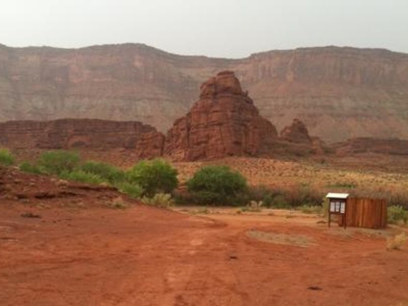
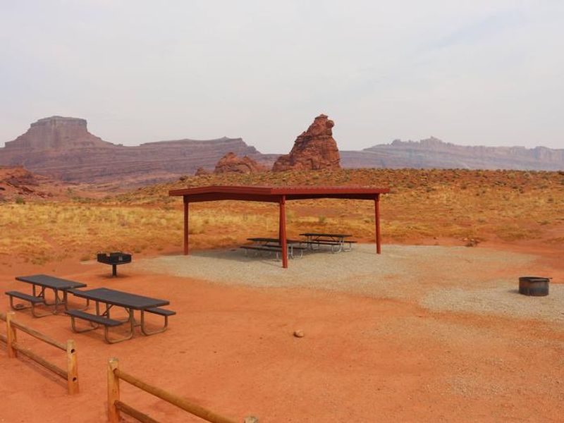
The Ledge Group Sites are a set of three BLM group campsites situated along Kane Creek Road, approximately 10 miles from Moab, Utah. This area is a hub for off-highway vehicle recreation, with direct access to popular routes including Hurrah Pass, Amasa Back, and Kane Creek Canyon. The campground caters to groups traveling with motorcycles, ATVs, and 4WD vehicles looking to explore the challenging backcountry terrain. Access to the campground requires descending a tight, steep switchback and crossing several creek beds on a gravel and dirt road. Vehicles over 22 feet or those towing long trailers are not recommended. The Ledge E Group Site in particular is subject to periodic flooding during thunderstorms where the road crosses Kane Creek drainage. Each group site includes a fire ring with grate and picnic tables. Vault toilets serve the area. There is no potable water, dump station, or electrical hookups. Campers must bring all water and supplies. The exposed desert setting offers little shade, making spring and fall the ideal seasons to visit.
Directions
From Moab, drive 10 miles on Kane Creek Road. The group sites are on the left side of the road. Access involves a tight, steep switchback and several creek crossings on gravel/dirt road. Not recommended for vehicles over 22 feet or those pulling long trailers.
Nearby Campgrounds
Amenities
| Water | No |
| Fires Allowed | Yes |
| Toilets | Yes |
| Dump Station | No |
| Wifi | No |
| Pets Allowed | — |
| Showers | No |
| Electric Hookups | — |
| Water Hookups | — |
| Sewer Hookups | — |
| Camp Store | No |
| Price | $125 |
Vehicle
| Max RV Length | 22ft |
| Max Trailer Length | — |
| Big Rig Friendly | No |
| Pull Through Sites | No |
Contact
| utmbmail@blm.gov | |
| Phone | +1 (435) 259-2100 |
Cell Service
| AT&T | Yes |
| Verizon | None |
| T-Mobile | None |
Availability
Photos

Community Posts
No posts yet. Be the first to share your experience!