Hunter Canyon Group Site
Open for reservations via Recreation.gov. The site has a locked gate; combination provided with reservation confirmation. Best for spring and fall use due to extreme summer heat and minimal shade.
Flash Flood Warning issued July 20 at 9:08PM MDT until July 21 at 12:00AM MDT by NWS Grand Junction CO
FFWGJT The National Weather Service in Grand Junction has issued a * Flash Flood Warning for... The Snyder Burn Scar in... West Central Mesa County in west central Colorado... Eastern Grand County in east central Utah... * Until midnight MDT tonight. * At 908 PM MDT, Doppler radar indicated thunderstorms producing heavy rain over the Snyder Burn Scar. Flash flooding is ongoing or expected to begin shortly. Excessive rainfall over the burn scar will result in debris flows. The debris flow can consist of rock, mud, vegetation and other loose materials. HAZARD...Life threatening flash flooding. Thunderstorms producing flash flooding in and around the Snyder Burn Scar. SOURCE...Radar. IMPACT...Life threatening flash flooding of areas in and around the Snyder Burn Scar. * Some locations that will experience flash flooding include... mainly rural areas of West Central Mesa and Eastern Grand Counties
Hydrologic Outlook issued July 20 at 10:32AM MDT by NWS Grand Junction CO
ESFGJT Anomalous moisture has become established across portions of eastern Utah and western Colorado. Scattered thunderstorms capable of producing heavy rain are expected this afternoon and early evening. Rainfall rates of 1-2 inches per hour will be possible with the stronger storms. These rates could lead to flash flooding and debris flows especially over steep terrain and recent burn scars. Also, rain over the past several days has lead to saturated soils, which increase the chances for excessive runoff. As a reminder: Keep an eye on our forecasts through the end of the week and stay tuned for updated hydrology alerts if visiting or if you reside below vulnerable terrain to flash flooding and/or debris flows. Storms across the west develop quickly, leaving little room for lead time in flashy terrain.
About
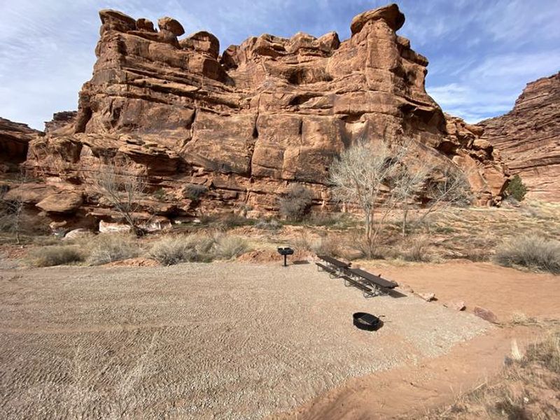
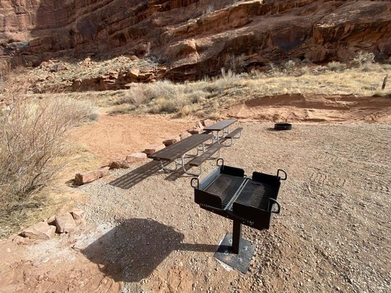
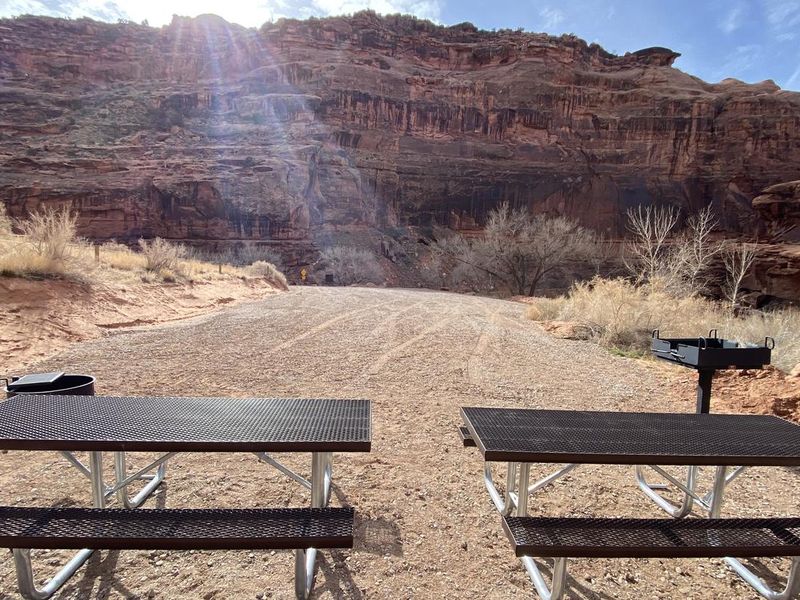
Hunter Canyon Group Site is a primitive BLM group campsite situated along Kane Creek Road, approximately 20 minutes from downtown Moab. The site provides direct access to the Hunter Canyon Trail, an easy 2-mile out-and-back route following a spring-fed creek beneath towering sandstone walls. Popular rock-climbing routes are accessible nearby, and the area offers extensive opportunities for mountain biking, four-wheeling, and ATV riding. The campsite features a vault toilet, fire ring with grate, and picnic tables. There is no potable water, dump station, or electrical hookups. The site is accessed via a tight, steep switchback on a gravel/dirt road and is not suitable for vehicles over 22 feet or those pulling long trailers. A locked gate secures the entrance; the combination is provided with each reservation. The area is best suited for spring and fall camping, as summer temperatures are extreme and shade is minimal. Kane Creek Road can be busy with OHV traffic. Nearby attractions include Hurrah Pass, Moonflower Canyon, Amasa Back, and easy access to Arches and Canyonlands National Parks.
Directions
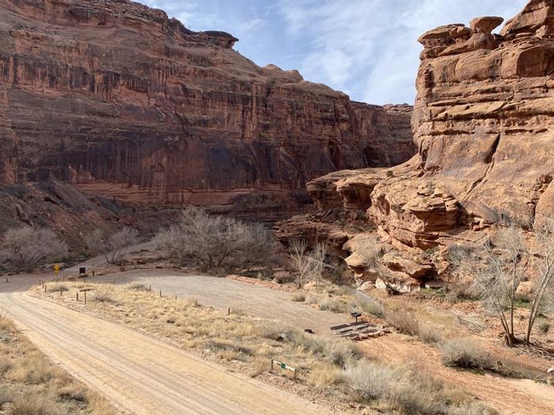
From Moab, drive 8 miles on Kane Creek Road. The group site is on the right side of the road, accessed via a tight, steep switchback on gravel/dirt road.
Nearby Campgrounds
Location
Amenities
| Water | No |
| Fires Allowed | Yes |
| Toilets | Yes |
| Dump Station | No |
| Wifi | No |
| Pets Allowed | — |
| Showers | No |
| Electric Hookups | — |
| Water Hookups | — |
| Sewer Hookups | — |
| Camp Store | No |
| Price | $50 |
Vehicle
| Max RV Length | 22ft |
| Max Trailer Length | — |
| Big Rig Friendly | No |
| Pull Through Sites | No |
Contact
| blm_ut_mb_mail@blm.gov | |
| Phone | +1 (435) 259-2100 |
Cell Service
| AT&T | None |
| Verizon | None |
| T-Mobile | None |
Useful Links
| View on Recreation.gov | |
| BLM Hunter Canyon Group Site |
Availability
Photos
Community Posts
No posts yet. Be the first to share your experience!