The Ledge Campground
Open year-round, first-come first-served. Individual sites are $20/night (cash or check only), 14-night stay limit per 30 days. Seasonal fire restrictions may apply during high fire danger periods.
Flood Warning issued November 3 at 8:20AM MST until November 5 at 5:15PM MST by NWS Salt Lake City UT
* WHAT...Flooding caused by excessive rainfall continues along the San Juan River from near Bluff to the terminus at Lake Powell. * WHERE...Southwestern San Juan County in southeastern Utah... * WHEN...Until 515 PM MST Thursday. * IMPACTS...River levels continue to rise due to excess runoff from Sunday's rainfall. Expect high water levels and the River exceeding its banks, inundating low-lying areas along the San Juan River. A prolonged period of high water is forecast, with a crest near 23.5 ft Thursday morning. It will take several hours for all the water from these storms to work through local drainage systems. * ADDITIONAL DETAILS... - At 813 AM MST, stream gauge reports indicates the observed stage on the San Juan River at Bluff has exceeded flood stage and is at 23.7 feet. Timing of additional crests is subject to change as more details become available. Please continue to monitor the forecast and updated warnings. - Some locations that will experience flooding include... the San Juan River from Bluff to the terminus at Lake Powell. - http://www.weather.gov/safety/flood
Flood Warning issued November 2 at 12:31PM MST until November 5 at 5:15PM MST by NWS Grand Junction CO
* WHAT...Flooding along the San Juan River caused by excessive rainfall is expected. * WHERE...along the San Juan River from the Four Corners through Mexican Hat, UT. This includes Bluff, Montezuma Creek and Aneth. * WHEN...Until 515 PM MST Thursday. * IMPACTS...River levels continue to rise due to excess runoff from Sunday's rainfall. Expect high water levels and the River exceeding its banks, inundating low-lying areas along the San Juan River. A prolonged period of high water is forecast, with a crest near 23.5 ft Thursday morning. It will take several hours for all the water from these storms to work through local drainage systems. * ADDITIONAL DETAILS... - At 1222 PM MST, stream gauge reports upstream and impacts of flooding have been reported along the San Juan River near Farmington, NM. Expect flood waters to reach the Four Corners Wednesday evening and the town of Bluff early Thursday morning. Timing of crest is subject to change as more details become available. Please continue to monitor the forecast and updated warnings. - At 11:30 AM MST Monday the stage was 20.4 feet. - Bankfull stage is 22.0 feet. - Forecast...The river will rise to 22 feet late this evening with a secondary crest near 23.5 feet expected near Bluff early Thursday morning. It will then fall below flood stage Thursday morning. - Flood stage is 23.0 feet. - Http://www.weather.gov/safety/flood - Some locations that will experience flooding include... Mexican Hat, Bluff, Montezuma Creek, and Aneth. - http://www.weather.gov/safety/flood
About
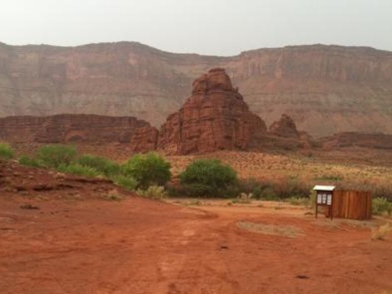
The Ledge Campground encompasses five distinct camping areas (Ledges A through E) with 105 individual sites nestled in a dramatic red rock canyon along Kane Creek Road, approximately 8.5 miles from Moab. The scenic desert valley setting draws ATV, UTV, and 4WD users who come for the exceptional network of nearby trails, including Amasa Back, Hymasa, Hunter Canyon Rim, Pritchett Canyon, Jackson, and Captain Ahab. This is a primitive campground with vault toilets but no potable water or hookups. Sites operate on a first-come, first-served basis at $20 per night, payable by cash or check at the campground. Each site accommodates up to 10 people and two vehicles, with a 14-night stay limit per 30-day period. A reservable group site accommodating 15-30 people is available separately through Recreation.gov. The access road is paved for the first 4 miles from Moab before becoming gravel with two shallow wash crossings and one short, steep switchback. Spring and fall are the ideal seasons; summer brings extreme heat with minimal shade.
Directions
From central Moab (Center St. and Main St.), head south to Kane Creek Road between Burger King and McDonald's. Turn right (west) on Kane Creek Road and continue straight at the stop sign. The road is paved for 4 miles, then becomes gravel with two shallow wash crossings and one short, steep switchback. The campground is approximately 8.5 miles from Highway 191.
Nearby Campgrounds
Amenities
| Water | No |
| Fires Allowed | — |
| Toilets | Yes |
| Dump Station | — |
| Wifi | No |
| Pets Allowed | — |
| Showers | No |
| Electric Hookups | — |
| Water Hookups | — |
| Sewer Hookups | — |
| Camp Store | No |
| Price | $20 |
Vehicle
| Max RV Length | — |
| Max Trailer Length | — |
| Big Rig Friendly | No |
| Pull Through Sites | — |
Contact
| utmbmail@blm.gov | |
| Phone | +1 (435) 259-2100 |
Cell Service
| AT&T | Yes |
| Verizon | None |
| T-Mobile | None |
Photos
Community Posts
No posts yet. Be the first to share your experience!