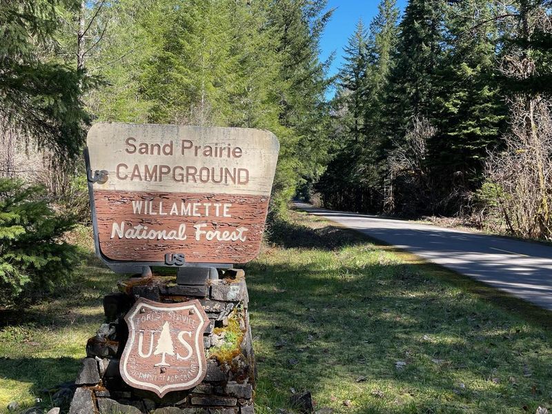
Sand Prairie Campground
Open for the 2026 season, operating May through September. Some sites are reservable via Recreation.gov; others are first-come-first-served. Caution: this area was impacted by the Emigrant Fire, with increased likelihood of landslides, mudslides, flash floods, and debris flows.
Alcohol Prohibitions
This Order describes acts that are prohibited upon lands, roads and trails within the National Forest System administered by the Forest Service Pacific Northwest Region in regards to alcoholic beverages.
Aquatic Invasive Species
This Order prohibits 1) possessing, storing, or transporting any aquatic invasive animal species AND 2) prohibits possessing, storing, or transporting any aquatic or riparian invasive plant species - on National Forest System lands in the Pacific Northwest Region as specified in the Order.
Restrictions on Use of Forage and Mulch Products
This Order prohibits unloading, storing, or using any straw, hay, grain, seed, or other forage or mulch products that are not state-certified weed free on the National Forest System lands, roads or trails in any Closure Area as specific in the Order. Some examples of these include hay bales, hay…
About
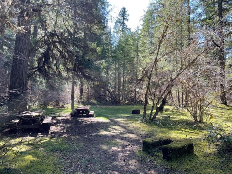
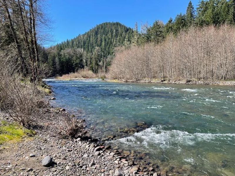
Nestled in a mixed conifer forest of Douglas-fir, Western hemlock, and cedar alongside the Middle Fork Willamette River, Sand Prairie Campground offers 21 sites in the Willamette National Forest. The campground provides easy access to the 27-mile Middle Fork National Recreation Trail, making it popular with hikers, mountain bikers, and equestrians. Hills Creek Reservoir is also nearby, providing opportunities for kayaking, paddleboarding, and fishing. Each site features a picnic table and fire ring. Vault toilets are available, but there is no potable water, so campers must bring their own supply or a filtration system. No hookups are available. Quiet hours are 10 p.m. to 6 a.m., and pets are welcome on leashes no longer than 6 feet. Nearby attractions include trails to Young's Rock, Larrison Rock, Chuckle Springs, and Indigo Springs. The campground operates seasonally from May through September.
Directions
From Oakridge, Oregon: At the intersection of Crestview Street and Oregon State Highway 58 (the only traffic light in Oakridge), head east on Highway 58 for 1.7 miles to Hills Creek Road/Kitson Springs Road. Turn right and travel 0.5 miles to Forest Road 21. Turn right onto Forest Road 21 and travel approximately 11.6 miles; the campground entrance will be on your right.
Amenities
| Water | No |
| Fires Allowed | Yes |
| Toilets | Yes |
| Dump Station | — |
| Wifi | No |
| Pets Allowed | Yes |
| Showers | No |
| Electric Hookups | — |
| Water Hookups | — |
| Sewer Hookups | — |
| Camp Store | No |
| Price | $7 |
Vehicle
| Max RV Length | — |
| Max Trailer Length | — |
| Big Rig Friendly | — |
| Pull Through Sites | No |
Contact
| Phone | +1 (541) 782-2283 |
Cell Service
| AT&T | None |
| Verizon | None |
| T-Mobile | None |
Availability
Photos

Community Posts
No posts yet. Be the first to share your experience!