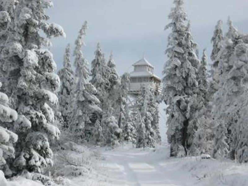
Warner Mountain Lookout
Open for the winter season through May. Reservations required via Recreation.gov. Access requires 2-10 miles of ski, snowshoe, or snowmobile travel. Conditions change rapidly with possible high winds and sudden storms.
Alcohol Prohibitions
This Order describes acts that are prohibited upon lands, roads and trails within the National Forest System administered by the Forest Service Pacific Northwest Region in regards to alcoholic beverages.
Aquatic Invasive Species
This Order prohibits 1) possessing, storing, or transporting any aquatic invasive animal species AND 2) prohibits possessing, storing, or transporting any aquatic or riparian invasive plant species - on National Forest System lands in the Pacific Northwest Region as specified in the Order.
Restrictions on Use of Forage and Mulch Products
This Order prohibits unloading, storing, or using any straw, hay, grain, seed, or other forage or mulch products that are not state-certified weed free on the National Forest System lands, roads or trails in any Closure Area as specific in the Order. Some examples of these include hay bales, hay…
About
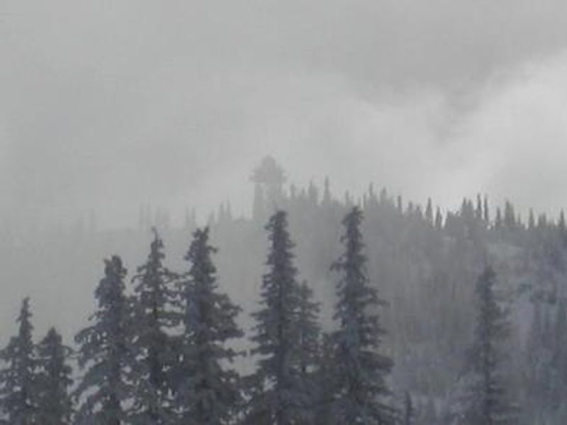
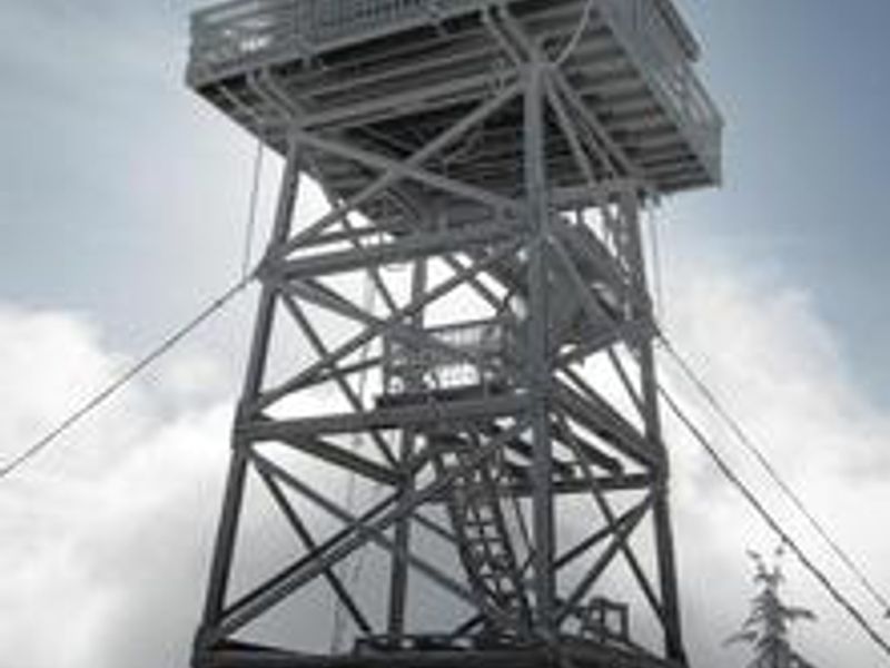
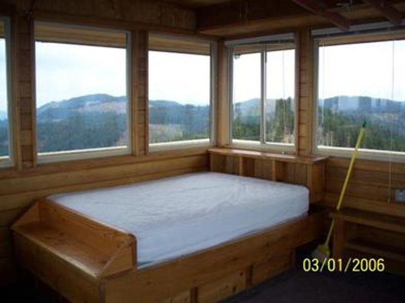
Warner Mountain Lookout offers a unique backcountry winter experience approximately 75 miles southeast of Eugene, Oregon. This replica of an old cupola-style fire lookout towers over a forest of noble fir, mountain hemlock, and silver fir at the crest of Warner Mountain. The 14x14-foot cabin is surrounded by a catwalk and accessed via steep, narrow metal stairs. Guests enjoy panoramic views of pristine snow-covered terrain and starry skies on clear nights. The cabin accommodates up to 4 people and is furnished with one double bed, table and chairs, propane stoves for heating and cooking, cookware, dishes, a broom, and a two-way radio for emergency use. Propane is provided. No potable water is available; guests typically melt snow for drinking, cooking, and washing. A vault toilet is located nearby. Guests must pack out all trash. This is a remote, challenging destination. The road is not plowed or maintained for winter travel, requiring 2-10 miles of skiing, snowshoeing, or snowmobiling to reach the lookout depending on snow conditions. Conditions change rapidly with sudden storms and high winds possible. Cross-country skiing or snowshoe experience is highly recommended. Guests are responsible for their own travel arrangements, safety, and towing if their vehicle becomes stuck.
Directions
From Oakridge, continue on Highway 58 about 1 to 1.5 miles east. Turn right towards Hills Creek Reservoir on Kitson Springs Road and proceed 0.2 mile to Forest Service Road 21. Turn right and follow FSR 21 south and southeast for approximately 18 miles. Turn left on gravel FSR 2129. Proceed 8 miles to Spur 439 (you may encounter snow before reaching 439). Turn right and follow for 4 miles to the 342 spur on the left, which leads to the lookout. Orange poles mark the final route through a meadow. Park facing downhill before reaching the snow zone if a storm is predicted.
Amenities
| Water | No |
| Fires Allowed | No |
| Toilets | Yes |
| Dump Station | No |
| Wifi | No |
| Pets Allowed | No |
| Showers | No |
| Electric Hookups | — |
| Water Hookups | — |
| Sewer Hookups | — |
| Camp Store | No |
| Price | $85 |
Vehicle
| Max RV Length | — |
| Max Trailer Length | — |
| Big Rig Friendly | No |
| Pull Through Sites | No |
Contact
| Phone | +1 (541) 782-2283 |
Cell Service
| AT&T | Yes |
| Verizon | None |
| T-Mobile | None |
Availability
Photos

Community Posts
No posts yet. Be the first to share your experience!