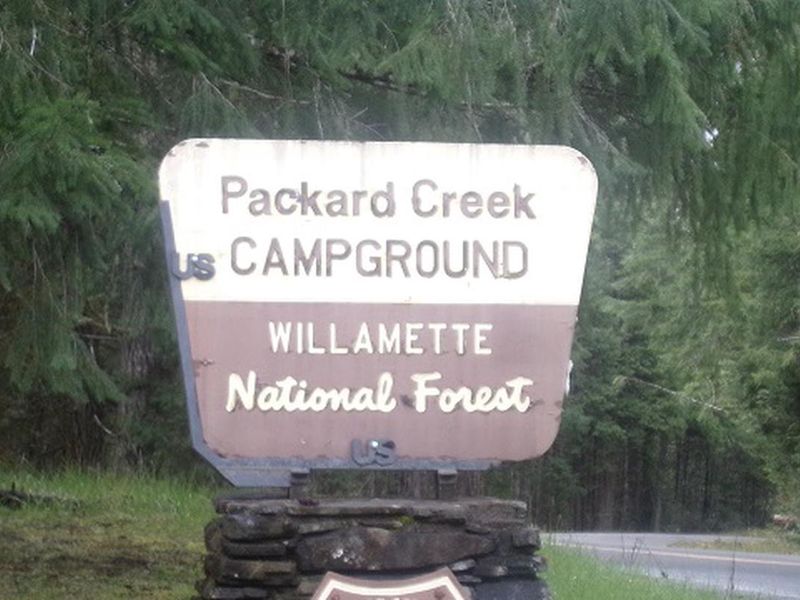
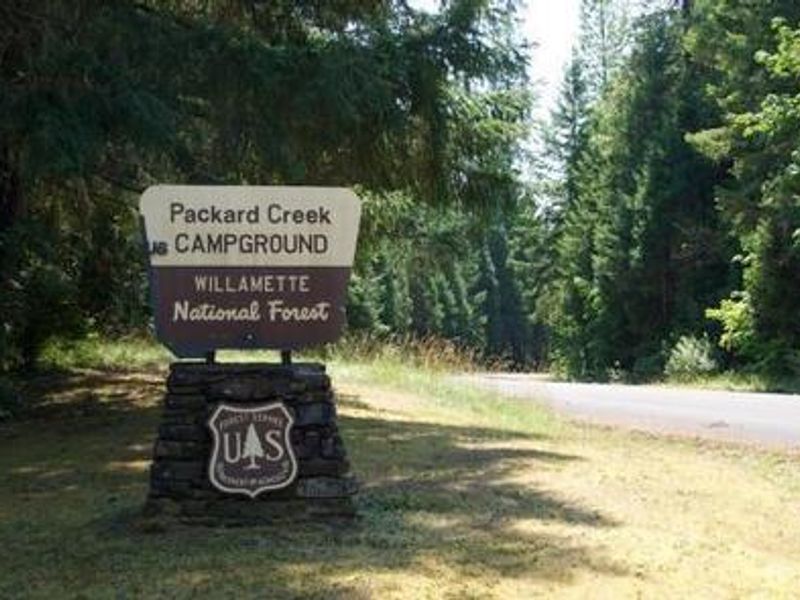
Picnic Area 2
Closed

Opens for the 2026 season on May 22. Operating season runs May through September. Of the 37 sites, 14 are reservable through Recreation.gov; the remaining 22 are first-come, first-served.

Alcohol Prohibitions

This Order describes acts that are prohibited upon lands, roads and trails within the National Forest System administered by the Forest Service Pacific Northwest Region in regards to alcoholic beverages.

Aquatic Invasive Species

This Order prohibits 1) possessing, storing, or transporting any aquatic invasive animal species AND 2) prohibits possessing, storing, or transporting any aquatic or riparian invasive plant species - on National Forest System lands in the Pacific Northwest Region as specified in the Order.

Restrictions on Use of Forage and Mulch Products

This Order prohibits unloading, storing, or using any straw, hay, grain, seed, or other forage or mulch products that are not state-certified weed free on the National Forest System lands, roads or trails in any Closure Area as specific in the Order. Some examples of these include hay bales, hay…

Fireworks and Explosives are always Prohibited

Fireworks and explosives (including explosive targets) are always prohibited on national forest lands. The prohibition of fireworks and exploding targets on national forest system lands is part of a set of permanent fire safety regulations in the Code of Federal Regulations (CFR), listed below.…

Road over Detroit Dam closed May 8- 21

The U.S. Army Corps of Engineers is closing the road over Detroit Dam from Friday, May 8 until Thursday, May 21 for dam inspections and maintenance. No vehicles will be able to pass over the dam during this time period. Visitors will not be able to cross the dam to access Forest Service roads,…

Cedar Creek Fire Closure

To provide for public safety, a closure order is in place for the following areas impacted by the Cedar Creek Fire.

Terwilliger Hot Springs Nudity, Alcohol, and Closed Times

The following is prohibited: to park or possess an alcoholic beverage in restricted areas, be publicly nude visible from Forest Road 19, and to enter or use Terwilliger Hot Springs between 10 p.m. and sunrise.

Portion of Forest Service Road 1003 (Tom Creek Road) closed

A portion of Forest Service Road 1003, also known as Tom Creek Road, is closed. The road closure starts at the junction of FSR 10 and FSR 1003 and includes the first 4.1 miles of FSR 1003 to the junction with the 1003-416 and 1003-409 roads.

Emigrant Fire Closure Order

Pursuant to 16 USC 551 and 36 CFR § 261.50 (a) and (b), and to provide for public safety, the following acts are prohibited in the areas described in this Order on National Forest System lands within the administrative boundaries of the Willamette National Forest. This Order…

Tamolitch Parking / Trail Construction Closure

Tamolitch Parking and Trail Construction Closure Forest Order.Forest roads 2600-735, 2600-738, and 2600-739: and the area is described as beginning at the junction of Highway 126 and 2600-735 road, west along the 2600-735 road, then northwest to the highwater mark of the east bank of the McKenzie…

Detroit Dispersed Camping Restrictions

Pursuant to 16 USC§ 551 and 36 CFR 261.50(a) and (b), and to provide for public safety, the following acts are prohibited in the Closure Areas, roads and their associated spur roads, trailheads, and recreation sites described in this order on National Forest System lands within the administrative…

FIRE CLOSURES: Current wildfire closures on the Willamette National Forest

For updates on active fires, visit our fire Incident Information page. Fire Closures:Cedar Creek Fire Closure Order & Map (updated 3/23/26)Beachie Creek and Lionshead Fires Closure Order & Map (updated 05/22/25)Map of All Fire Closures in Pacific Northwest

Beachie Creek and Lionshead Fires Closure

Pursuant to 16 USC § 551 and 36 CFR § 261.50(a) and (b), and to provide for public safety, the following acts are prohibited in the roads and their associated spur roads, trailheads, and recreation sites described in this order on National Forest System lands within the administrative boundaries…

14 Day Stay Camping Limit

Camping, occupying, or otherwise leaving camping equipment and/or related supplies at any locations on the Willamette National Forest described in this order, overnight, for a period longer than 14 calendar days, in a 30-day period.

Camping Restrictions in Cougar Recreation Area

The Cougar Recreation Area is a specially designated area around Cougar Reservoir. It includes a 1/2-mile strip on either side of Forest Service Road 19 from Hwy 126 to Forest Service Road 1927 as well as Terwilliger Hot Springs, Hidden Lake Day Use Area, areas surrounding Delta Campground, Slide…

Moose and Gordon Dispersed Camping Closure

The purpose of this closure is to prohibit dispersed overnight camping and make these areas available as day-use only. This is to allow river access for all users, reduce conflict, reduce safety concerns, reduce and eliminate health and sanitation issues associated with improper disposal of human…

Special Wilderness Permit, Camping and Fire Restrictions

This outlines special restrictions on the Willamette and Deschutes National Forests.

Occupation Use Restriction in Middle Fork Ranger District

The following acts are prohibited in the areas described in this order within the administrative boundaries of the Willamette National Forest.Prohibitions:1. Being in the area after sundown to before sunrise.2. Parking in violation of posted instructions.

About

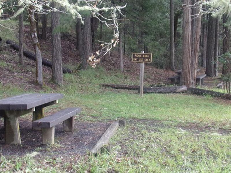
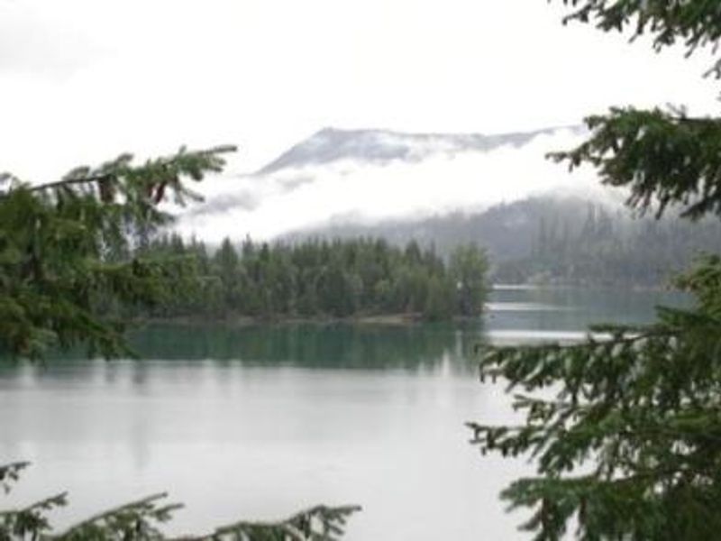
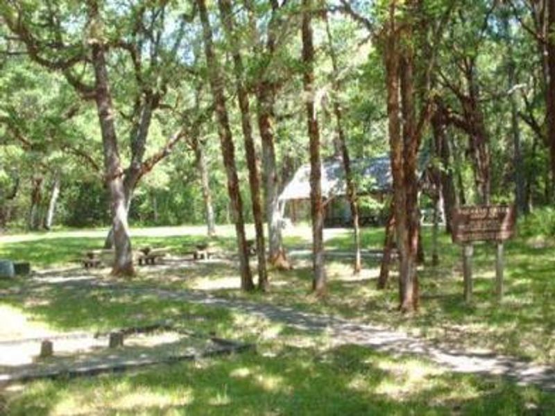
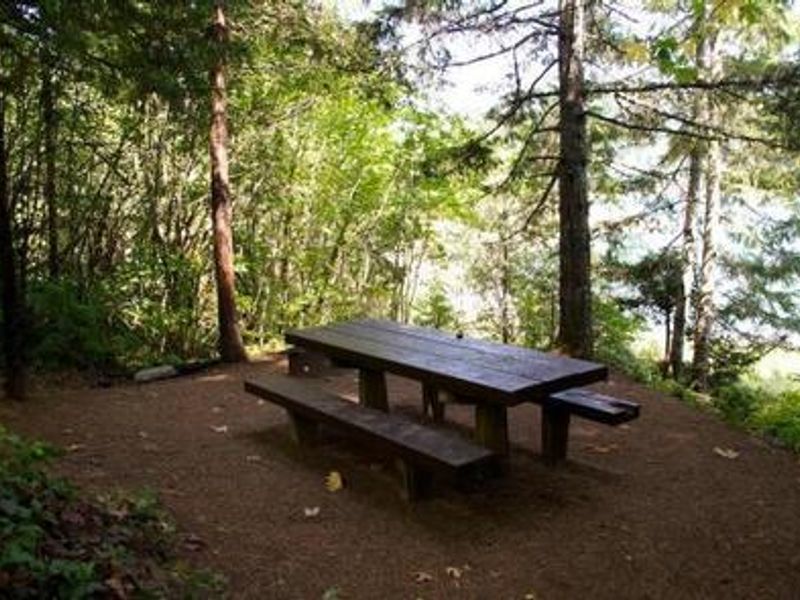
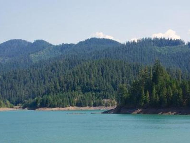
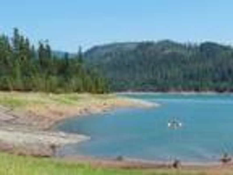
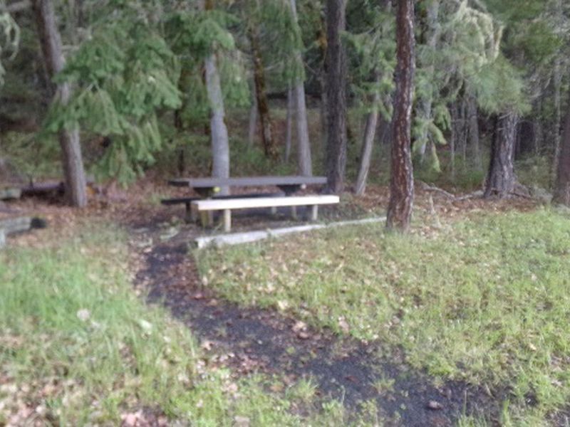
Packard Creek Campground sits on a large flat beside the 2,735-acre Hills Creek Reservoir in Willamette National Forest, about 7 miles southeast of Oakridge. The 37-site campground is shaded by a diverse mix of hemlock, Douglas fir, and red cedar, with many sites offering views of the lake. Each site includes a picnic table and fire ring, and several sites have individual boat docks for direct water access. The adjacent day-use area features a swimming beach, fishing dock, and boat ramp. Anglers target catfish, bluegill, crappie, and coho salmon. The Larison Creek Trail departs from the campground and follows Larison Cove and Creek through lush vegetation, open to hikers, equestrians, and mountain bikers. Most of the campground is ADA accessible. Be aware that poison oak is abundant throughout the area. The campground is heavily used on summer weekends, so plan accordingly if arriving without a reservation.

Directions

From Oakridge, Oregon: At the intersection of Crestview Street and Highway 58 (the only traffic light in Oakridge), travel east on Highway 58 for 1.7 miles. Turn right onto Kitson Springs Road and travel 0.5 miles. Turn right on Forest Road 21 and continue approximately 5.2 miles. The campground entrance is on the left.

Amenities

Water Yes
Fires Allowed Yes
Toilets Yes
Dump Station
Wifi No
Pets Allowed Yes
Showers No
Electric Hookups
Water Hookups
Sewer Hookups
Camp Store No
Price $24 - $200

Vehicle

Max RV Length 45ft
Max Trailer Length 45ft
Big Rig Friendly No
Pull Through Sites No

Contact

Email Help.Willamette.MiddleFork@AmericanLL.com
Phone +1 (801) 226-3564

Cell Service

AT&T None
Verizon None
T-Mobile None

Availability

Photos

Picnic Area 2
Packard Creek Sign
Picnic Area

Community Posts

No posts yet. Be the first to share your experience!