Mccarthy Point Lookout
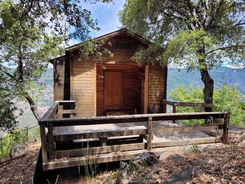
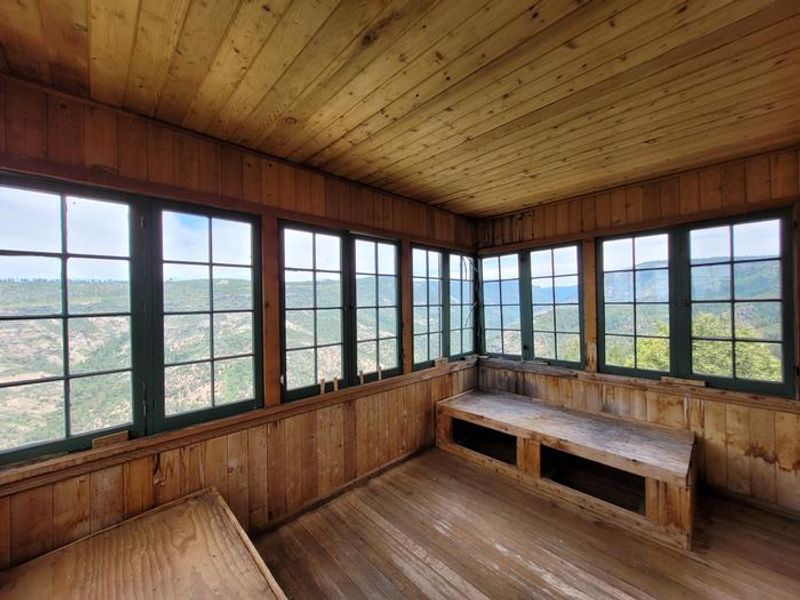
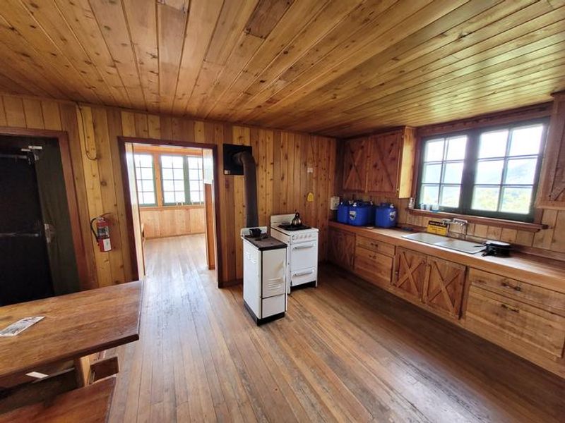
Permanently closed. The lookout cabin was destroyed by the 2024 Park Fire and is no longer accessible. Only the stone foundation remains.
National Forest System Roads
Follow California Vehicle Code on National Forest System Roads
Fireworks and Explosives are always Prohibited
Fireworks and explosives (including explosive targets) are always prohibited on national forest lands. The prohibition of fireworks and exploding targets on national forest system lands is part of a set of permanent fire safety regulations in the Code of Federal Regulations (CFR), listed below.…
Hat Creek RD - Temporary Office Closure for all Visitor Services
The Hat Creek Ranger District office will be closed and services will be unavailable July 21 and July 22, 2026. Normal hours will resume Thursday, July 23.For questions about recreation sites and other visitor services, please contact our Susanville office.
About
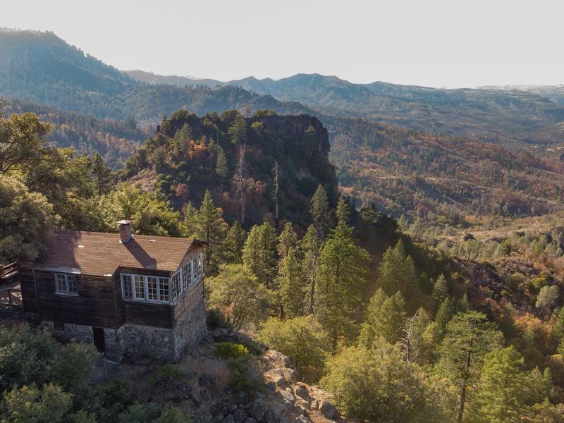
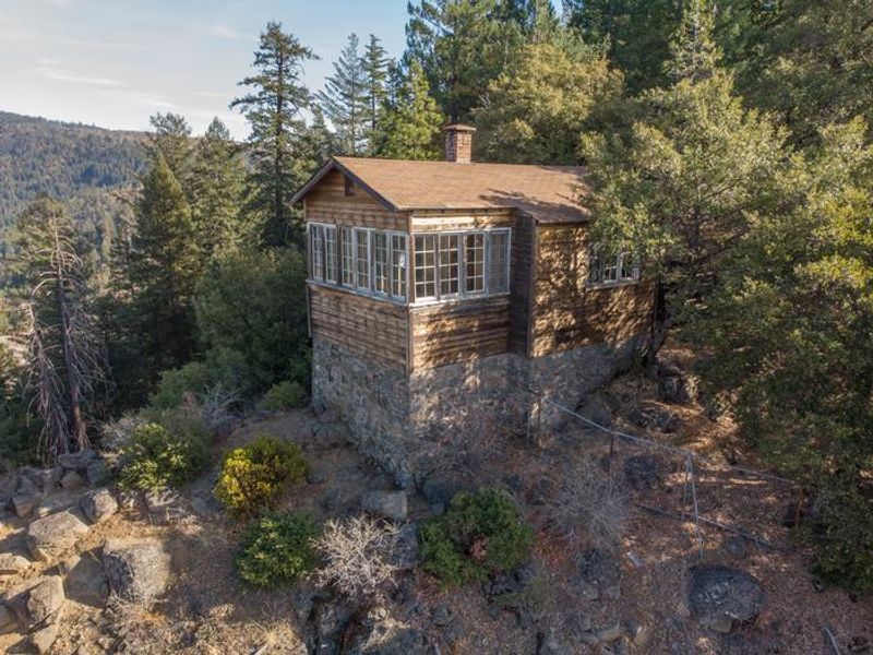
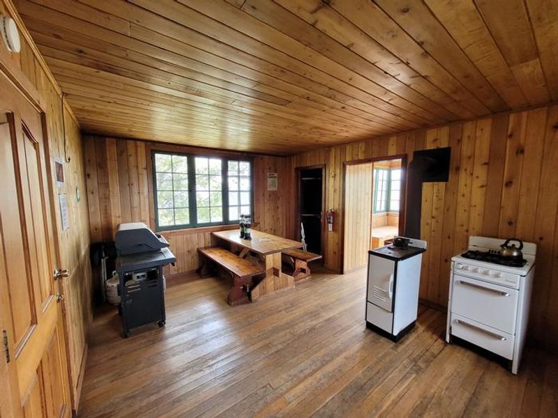
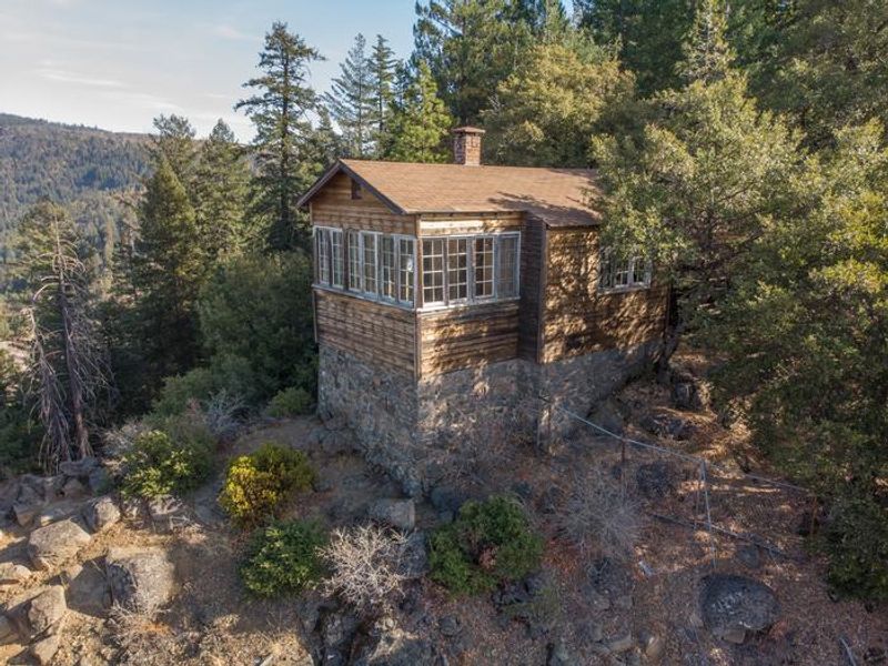
McCarthy Point Lookout was constructed in 1936 by the Civilian Conservation Corps for use in spotting wildfires across Lassen National Forest. During World War II, the lookout served as part of an aircraft defense monitoring system that extended throughout California. The cabin was perched at an elevation of 3,600 feet on the southern end of Mill Creek rim, offering panoramic views of Mill Creek Canyon and the Ishi Wilderness. The lookout was located within a state game refuge protecting species including wild hog, mountain lion, black bear, coyote, bobcat, and Tehama deer. A variety of raptors nested on nearby rock cliffs, including hawks, eagles, falcons, and owls. The site served as an excellent base for exploring the hiking and equestrian trails throughout the Ishi Wilderness. The nearly 90-year-old cabin was destroyed during the 2024 Park Fire, which burned over 429,000 acres in the region. Only the stone foundation remains. The site is now permanently closed to all public access.
Directions
From Red Bluff, drive east on Highway 36 toward Lassen National Park and Chester. Turn right onto Paynes Creek Loop in Paynes Creek, then turn right on Plum Creek Road (County Road 202) and continue for about 9 miles to the junction of County Road 707B (Forest Service Road 28N29/Ponderosa Way). Turn right and follow this road past Black Rock Campground until you reach Forest Service Road 27N08. Turn left and drive less than a mile to road 27N21. Turn left and proceed to McCarthy Point Lookout. Note: A high-clearance vehicle was recommended.
Amenities
| Water | — |
| Fires Allowed | — |
| Toilets | — |
| Dump Station | — |
| Wifi | — |
| Pets Allowed | — |
| Showers | — |
| Electric Hookups | — |
| Water Hookups | — |
| Sewer Hookups | — |
| Camp Store | — |
| Price | $75 |
Vehicle
| Max RV Length | — |
| Max Trailer Length | — |
| Big Rig Friendly | No |
| Pull Through Sites | No |
Contact
| Phone | +1 (530) 258-2141 |
Cell Service
| AT&T | None |
| Verizon | None |
| T-Mobile | None |
Availability
Photos

Community Posts
No posts yet. Be the first to share your experience!