Open for reservations May 1 through September 30. The cabin operates seasonally and will close if forest closures are in effect. No RV or tent camping permitted within a half-mile radius.
Flash Flood Warning issued July 20 at 2:57PM MST until July 20 at 6:00PM MST by NWS Flagstaff AZ
FFWFGZ The National Weather Service in Flagstaff has issued a * Flash Flood Warning for... The Dragon Bravo in... Coconino County in north central Arizona...This includes the Colorado River between river miles 36 and 61. * Until 600 PM MST /700 PM MDT/. * At 257 PM MST /357 PM MDT/, Doppler radar indicated thunderstorms producing heavy rain over the Dragon Bravo. Up to 2 inches of rain have fallen. Additional rainfall amounts up to 2 inches are possible in the warned area. Flash flooding is ongoing or expected to begin shortly. HAZARD...Life threatening flash flooding. Thunderstorms producing flash flooding in and around the Dragon Bravo. SOURCE...Radar indicated. IMPACT...Life threatening flash flooding of areas in and around the Dragon Bravo. * Some locations that will experience flash flooding include... Point Imperial Picnic Area, Saddle Mountain Overlook, Roosevelt Point Overlook, LCR Confluence Overlook, Saddle Mountain Wilderness, Triple Alcoves, Point Hansbrough, Royal Arches, Bert Loper's Boat, Anasazi Foot Bridge, Kwagunt Valley, Malgosa Canyon, Awatubi Canyon, Vista Encantada and Sixtymile Canyon. This includes the Colorado River between river miles 36 and 61. This includes the following recreation areas and campgrounds... Tatahatso Wash Camp Site, Tatahatso Camp Site, Above Martha's Camp Site, Martha's Camp Site, Redbud Alcove Camp Site, MCD Site Camp Site, Upper Buck Farm Camp Site, Buck Farm Camp Site, Below Buck Farm Camp Site, Loper's Boat Camp Site, Royal Arches Camp Site, Anasazi Bridge Camp Site, Lower Anasazi Camp Site, President Harding Camp Site, Eminence Camp Site, Above Willie Taylor Camp Site, Willie Taylor Camp Site, Triple Alcoves Camp Site, Duck N Quack Camp Site, Upper Saddle Camp Site, Lower Saddle Camp Site, Dinosaur Camp Site, Little Nankoweap Camp Site, Upper Nankoweap Camp Site, Main Nankoweap Camp Site, Lower Nankoweap Camp Site, Kwagunt Marsh Camp Site, Kwagunt Camp Site, Below Kwagunt Camp Site, Malgosa Camp Site, Opposite Malgosa Camp Site, Awatubi Camp Site, Below Awatubi Left Camp Site, Below Awatubi Right Camp Site, 60 Mile Ledge Camp Site and Old Fish Camp Site. This includes the following creeks, washes and rivers... "Crash Canyon", Clear Creek, Awatubi Canyon, Nankoweap Canyon, Nankoweap Creek, "Redbud Alcove", Saddle Canyon, Lava Canyon, Malgosa Canyon, Kwagunt Creek, Bekihatso Wash, Sixtymile Creek, Shinumo Wash, 60- Mile Canyon, North Canyon, Bright Angel Creek, Tatahoysa Wash, Nautiloid Canyon, Carbon Creek, Little Nankoweap Creek, Colorado River, Buck Farm Canyon, South Canyon, "Bert's Canyon", Little Colorado River and Tatahatso Wash.
Flash Flood Warning issued July 20 at 2:11PM MST until July 20 at 6:15PM MST by NWS Flagstaff AZ
FFWFGZ The National Weather Service in Flagstaff has issued a * Flash Flood Warning for... Coconino County in north central Arizona... * Until 615 PM MST. * At 211 PM MST, Doppler radar indicated thunderstorms producing heavy rain across the warned area. Up to 4 inches of rain have fallen. Additional rainfall amounts up to 2 inches are possible in the warned area. Flash flooding is ongoing or expected to begin shortly. HAZARD...Life threatening flash flooding. Thunderstorms producing flash flooding. SOURCE...Radar indicated. IMPACT...Life threatening flash flooding of creeks and streams, normally dry washes, urban areas, highways, streets and underpasses. * Some locations that will experience flash flooding include... Mainly rural areas of Coconino County. This includes the following creeks, washes and rivers... Jacks Canyon, Willow Creek and Clear Creek.
Flood Watch issued July 20 at 12:38PM MST until July 21 at 10:00PM MST by NWS Flagstaff AZ
* WHAT...Flash flooding caused by excessive rainfall is possible. * WHERE...Portions of east central, north central, northeast, and west central Arizona, including the following areas, in east central Arizona, Northern Gila County. In north central Arizona, Black Mesa Area, Coconino Plateau, Eastern Mogollon Rim, Grand Canyon Country, Kaibab Plateau, Little Colorado River Valley in Coconino County, Marble and Glen Canyons, Northeast Plateaus and Mesas Hwy 264 Northward, Northeast Plateaus and Mesas South of Hwy 264 and Western Mogollon Rim. In northeast Arizona, Little Colorado River Valley in Apache County, Little Colorado River Valley in Navajo County and White Mountains. In west central Arizona, Yavapai County Mountains. * WHEN...From Tuesday morning through Tuesday evening. * IMPACTS...Flash flooding will be possible in creeks, normally dry washes, swimming holes, and over recently burned areas. Raging killer currents will be possible in side canyons and narrow slot canyons. Low-water crossings may be flooded. * ADDITIONAL DETAILS... - Deep monsoon moisture in place across northern Arizona will lead to storms capable of producing rainfall in excess of 2 inches per hour, resulting in an enhanced risk of flash flooding. - Additional information is available at weather.gov/flagstaff.
About
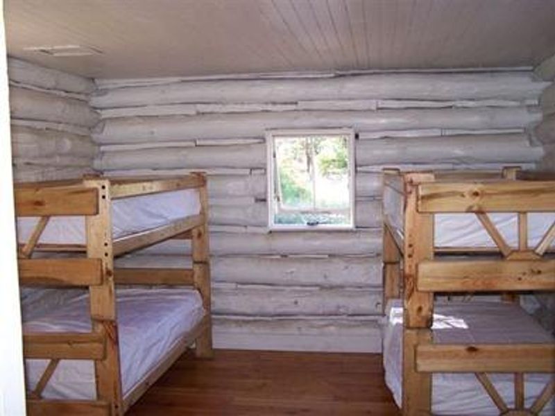
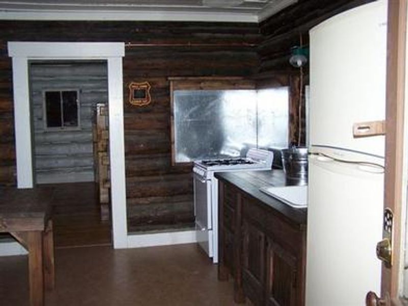
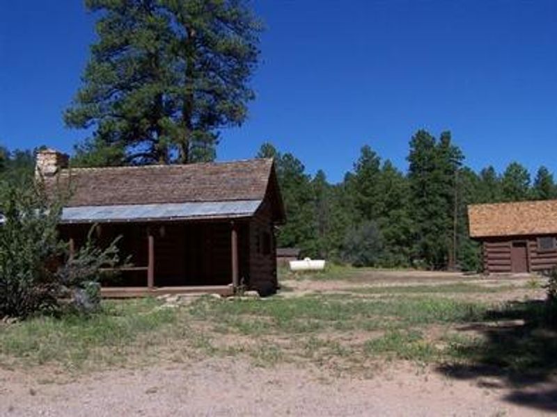
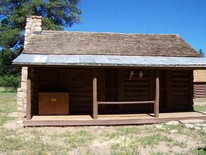
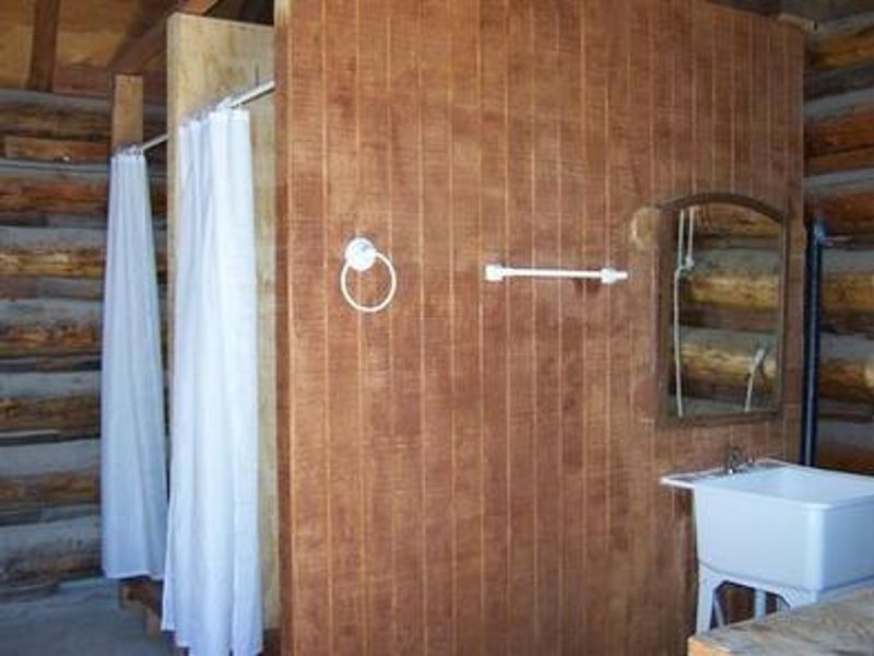
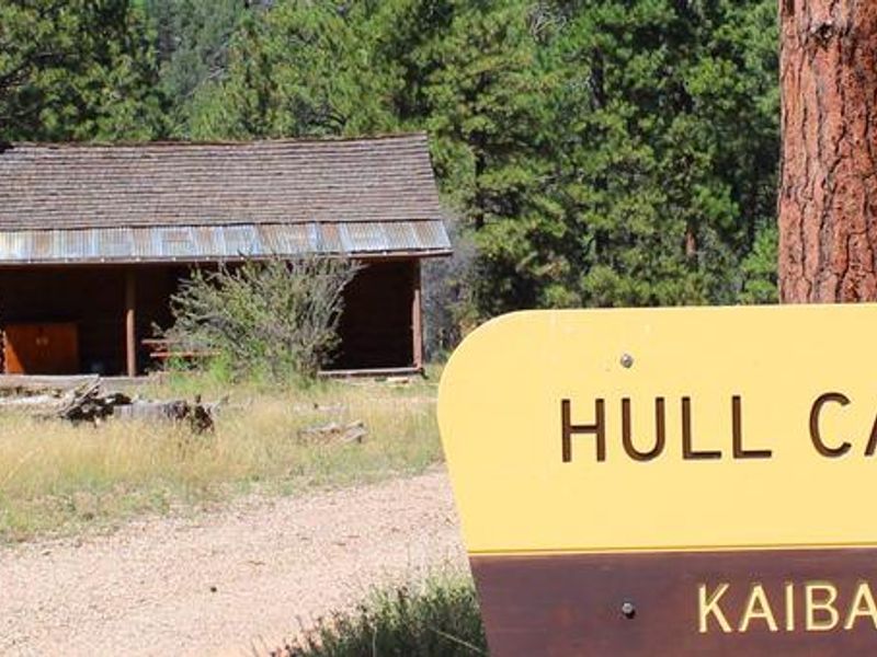
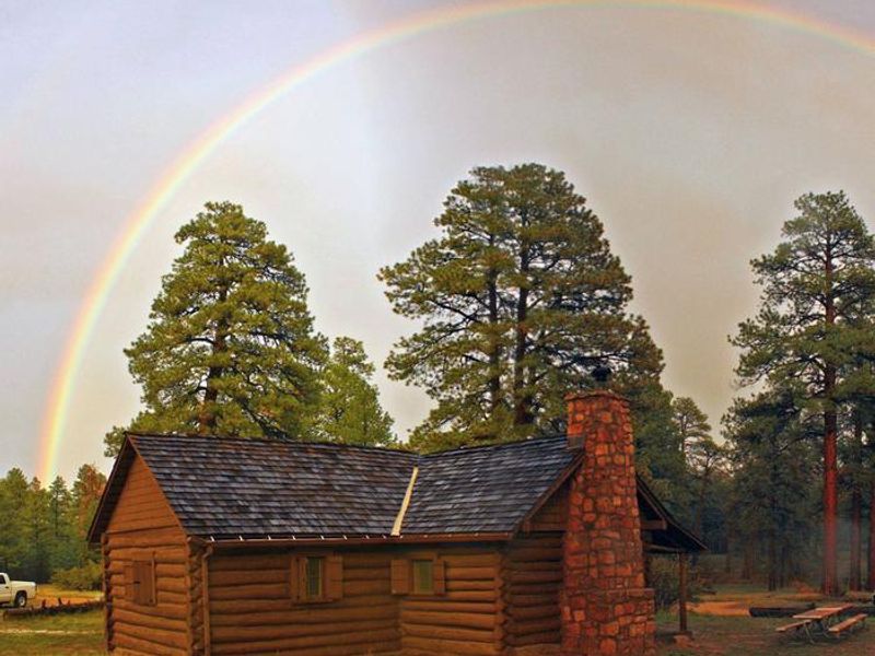
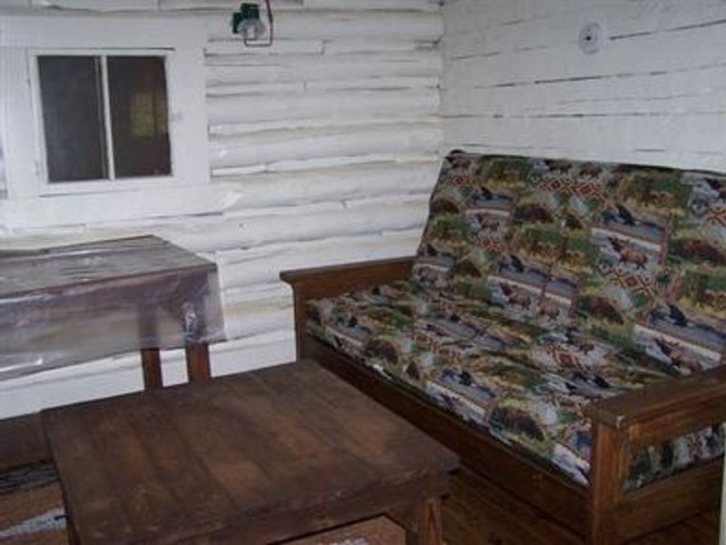
Hull Cabin offers a unique lodging experience just a mile from Grand Canyon National Park's South Rim. Originally a one-room homestead constructed with hand-hewn logs in the late 1880s, the cabin was acquired by the U.S. Forest Service in 1907 as a ranger station and added to the National Register of Historic Places in 1985. The cabin sits in a quiet meadow of old growth ponderosa pine at 6,500 feet, with easy access to Grandview Lookout Tower for panoramic canyon views. The cabin accommodates up to six guests with two sets of twin bunk beds in the bedroom and a queen futon in the living room. The fully equipped kitchen includes a stove, oven, refrigerator/freezer, dishes, and cookware. Water is hauled to the site for indoor plumbing. A separate shower house offers a vault toilet and two solar shower stalls. Guests must bring their own bedding, towels, food, trash bags, solar shower bladder bags, and an axe for splitting firewood from the on-site enclosure. Nearby Hull Tank attracts elk, mule deer, wild turkey, javelina, and potentially endangered California condors. Russell Tank offers seasonal fishing. Hiking, horseback riding, and mountain biking are accessible via the Arizona Trail and Grand Canyon National Park trails. The town of Tusayan, 16 miles west, provides restaurants, hotels, and supplies.
Directions
From Tusayan, turn east onto Forest Road 302 just south of the Grand Hotel. Turn left at the junction of FR 302 and FR 310, follow FR 310 for 1.5 miles, then turn right on FR 307. Hull Cabin is approximately 1 mile further. The 16-mile route uses graded gravel roads requiring slower speeds.
Location
Amenities
| Water | Yes |
| Fires Allowed | Yes |
| Toilets | Yes |
| Dump Station | No |
| Wifi | — |
| Pets Allowed | No |
| Showers | Yes |
| Electric Hookups | — |
| Water Hookups | — |
| Sewer Hookups | — |
| Camp Store | No |
| Price | $140 |
Vehicle
| Max RV Length | — |
| Max Trailer Length | — |
| Big Rig Friendly | No |
| Pull Through Sites | No |
Contact
| Phone | +1 (928) 638-2443 |
Cell Service
| AT&T | None |
| Verizon | Yes |
| T-Mobile | Yes |
Availability
Photos
Community Posts
No posts yet. Be the first to share your experience!