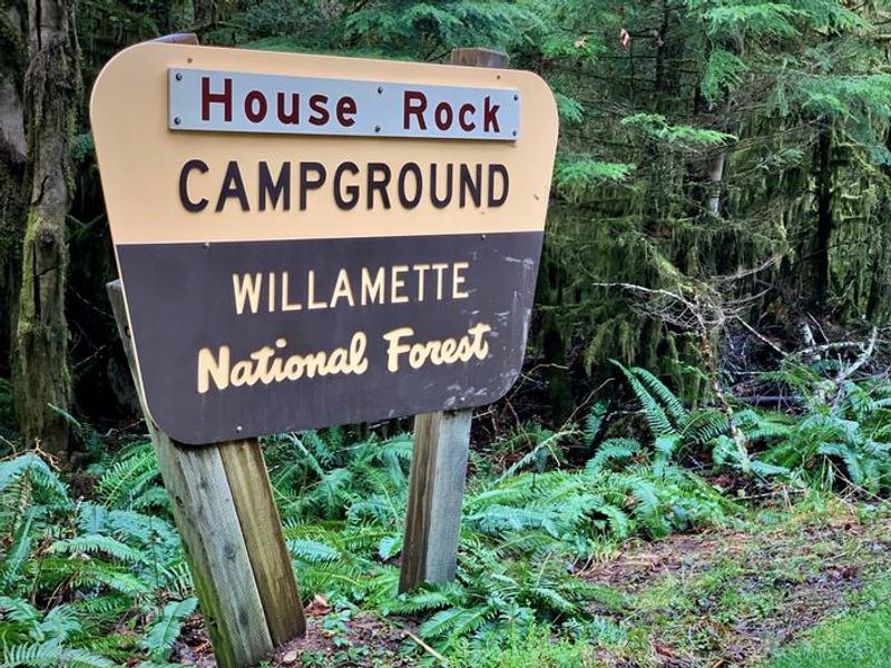
House Rock Campground
Open for the season, operating May through October. Sites are available both by reservation (up to 6 months in advance via Recreation.gov) and first-come, first-served with Scan and Pay option. Check-in is 2:00 p.m., check-out is 12:00 p.m. Camping limited to 14 days per 60-day period.
Alcohol Prohibitions
This Order describes acts that are prohibited upon lands, roads and trails within the National Forest System administered by the Forest Service Pacific Northwest Region in regards to alcoholic beverages.
Aquatic Invasive Species
This Order prohibits 1) possessing, storing, or transporting any aquatic invasive animal species AND 2) prohibits possessing, storing, or transporting any aquatic or riparian invasive plant species - on National Forest System lands in the Pacific Northwest Region as specified in the Order.
Restrictions on Use of Forage and Mulch Products
This Order prohibits unloading, storing, or using any straw, hay, grain, seed, or other forage or mulch products that are not state-certified weed free on the National Forest System lands, roads or trails in any Closure Area as specific in the Order. Some examples of these include hay bales, hay…
About
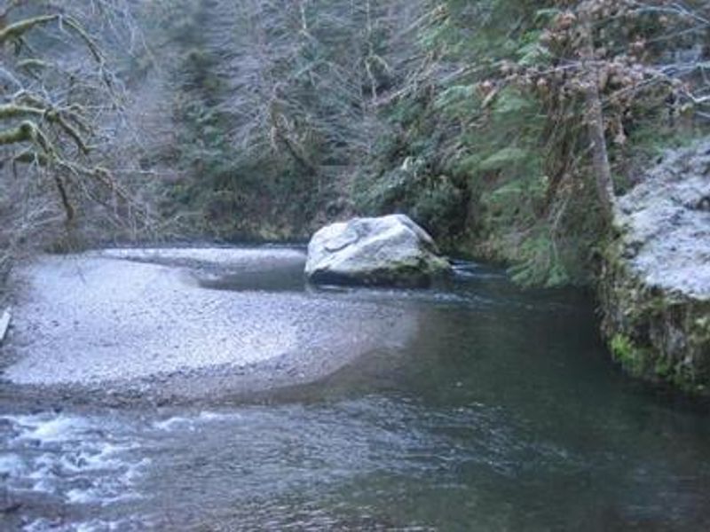
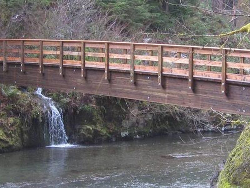
House Rock Campground is nestled in an old-growth forest grove at the confluence of Sheep Creek and the South Santiam River in Oregon's Willamette National Forest. The campground features 17 sites arranged in upper and lower loops, with packed dirt and rock roads and parking spurs. Many sites offer direct riverfront access to shallow swimming areas where the clear mountain waters of the South Santiam provide relief on warm days. The campground is well-suited for tent camping and smaller trailers up to 22 feet, though vehicles over 20 feet may find maneuvering challenging due to limited turnaround space. Each site comes equipped with a picnic table, fire ring, and grill. Drinking water is available from hand pumps in both loops, and accessible vault toilets serve the area. The adjacent day-use area provides access to the House Rock Trail, a 0.8-mile loop that follows portions of the historic Santiam Wagon Road once used to transport livestock across the Cascades. Additional hiking opportunities include the nearby Iron Mountain Trail and other routes in the Tombstone Pass area. Anglers can fish for native cutthroat trout in the river.
Directions
From Sweet Home, follow Highway 20 east for 26 miles to Forest Road 2044 and turn right. Follow Forest Road 2044 for a half mile and turn right, then drive for another quarter mile. House Rock Campground is across the Sheep Creek bridge.
Amenities
| Water | Yes |
| Fires Allowed | Yes |
| Toilets | Yes |
| Dump Station | No |
| Wifi | No |
| Pets Allowed | Yes |
| Showers | No |
| Electric Hookups | — |
| Water Hookups | — |
| Sewer Hookups | — |
| Camp Store | No |
| Price | $25 |
Vehicle
| Max RV Length | 64ft |
| Max Trailer Length | 64ft |
| Big Rig Friendly | No |
| Pull Through Sites | No |
Contact
| r6_willamette_wwweb_frontdesk@fs.fed.us | |
| Phone | +1 (541) 967-3917 |
Cell Service
| AT&T | None |
| Verizon | None |
| T-Mobile | None |
Availability
Photos
Community Posts
No posts yet. Be the first to share your experience!