Voyageurs National Park Camping Permits
Open for the 2026 summer camping season. High-use season runs May 15 through October 15. Low-use camping is available October 16 through May 14 at reduced rates. Ice-out typically occurs around early May but varies by year. All overnight camping requires a reservation through Recreation.gov. Select sites operate on a one-week rolling booking window for short-notice trips.
From Recreation.gov
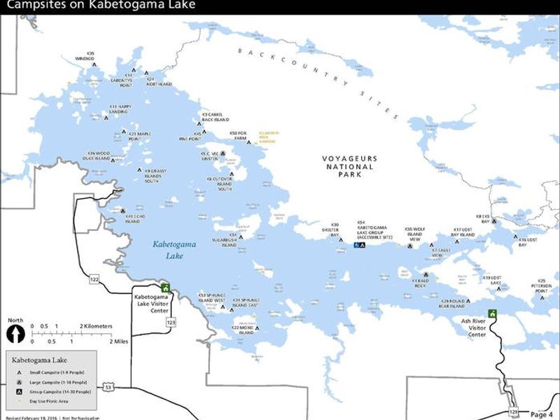
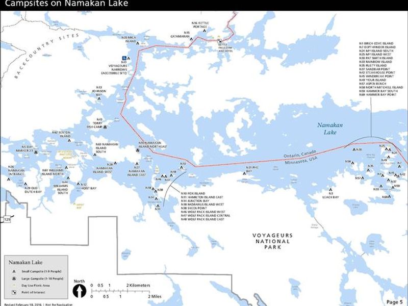
The following campsite are released on a one-week rolling booking window to provide options for short-term trip planners. * **Rainy Lake (west end):** Mio Beach R64 and Nuthatch R21 * **Rainy Lake (east end):** Jack Pine Bench R55 and Hitchcock R105 * **Kabetogama Lake:** Fox Farm K50 and Round Bear K29 * **Namakan Lake:** Johnson Bay N13 and Hammer Bay South N59 * **Sand Point Lake:** South Island S17 and Feldt Channel S5
About
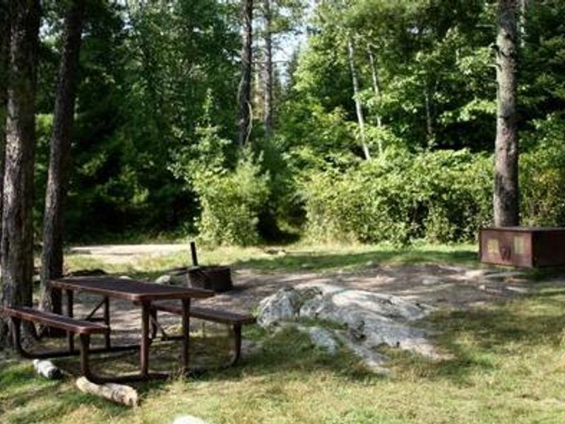
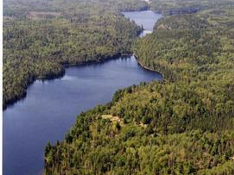
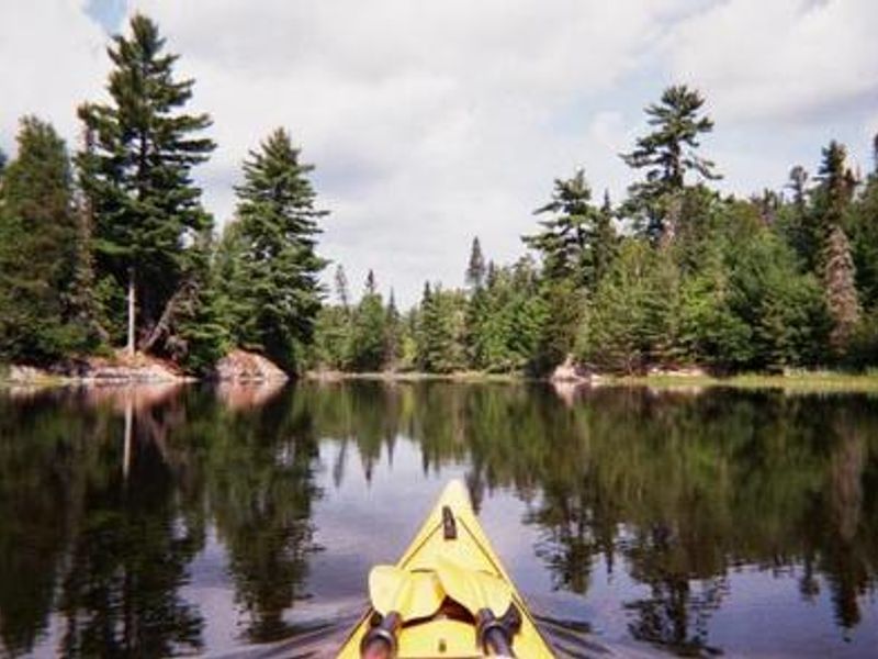
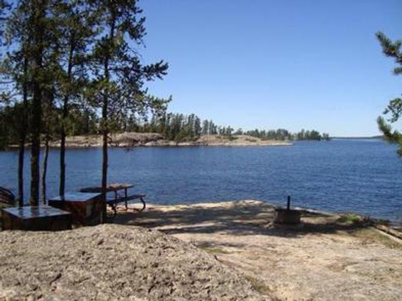
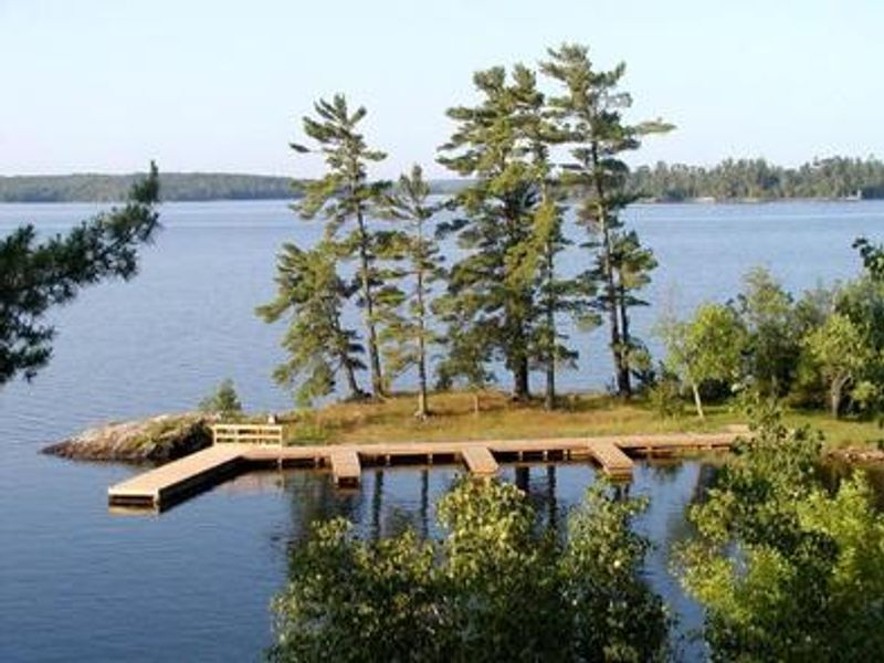
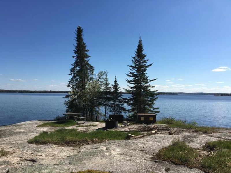
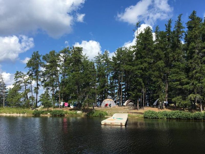
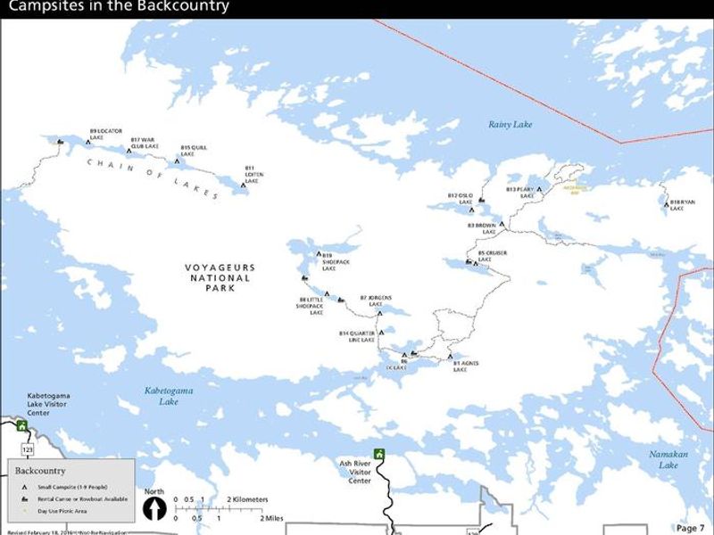
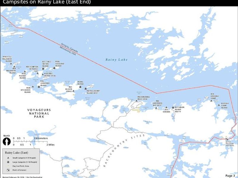
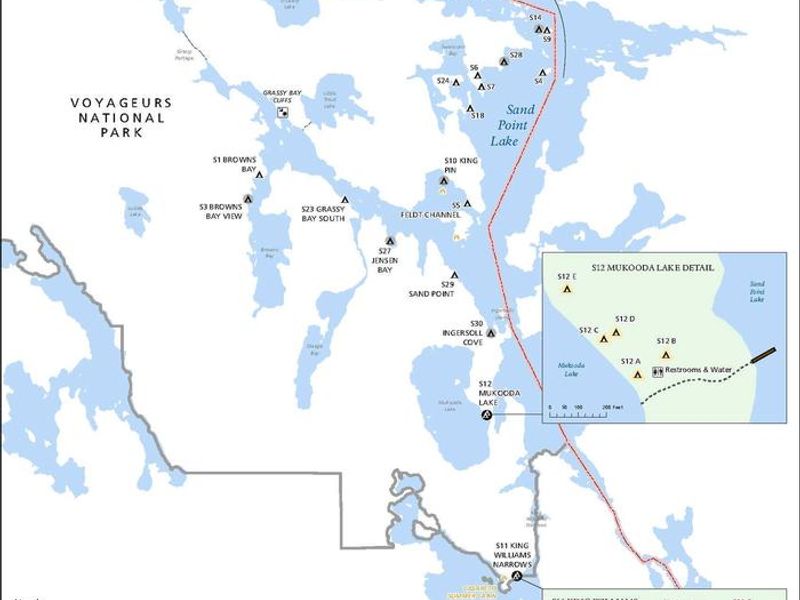
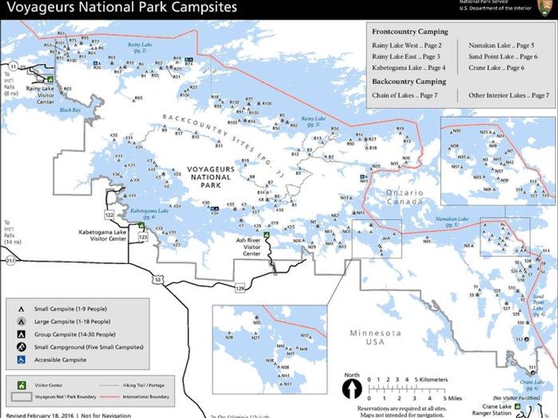
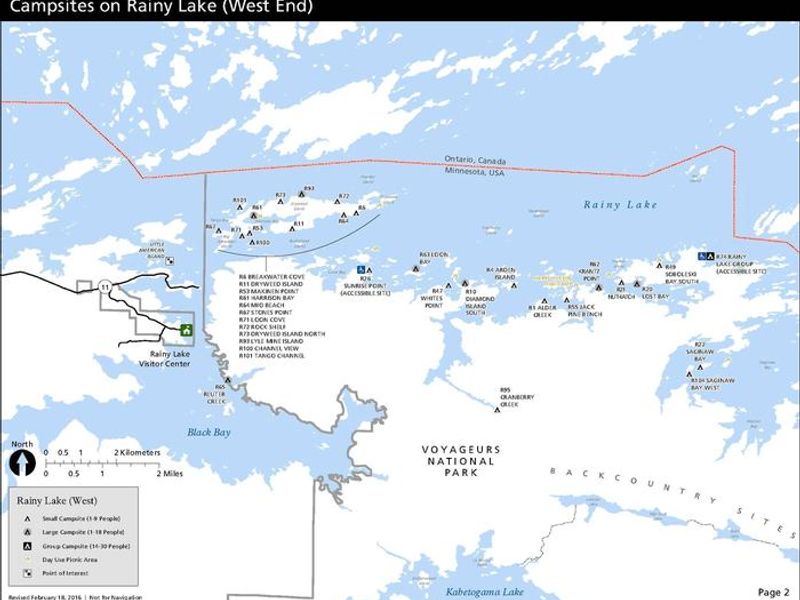
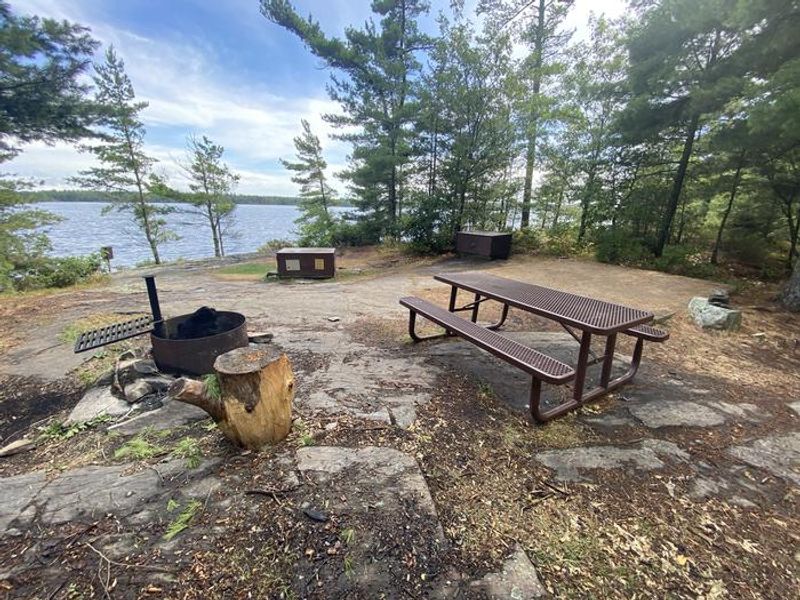
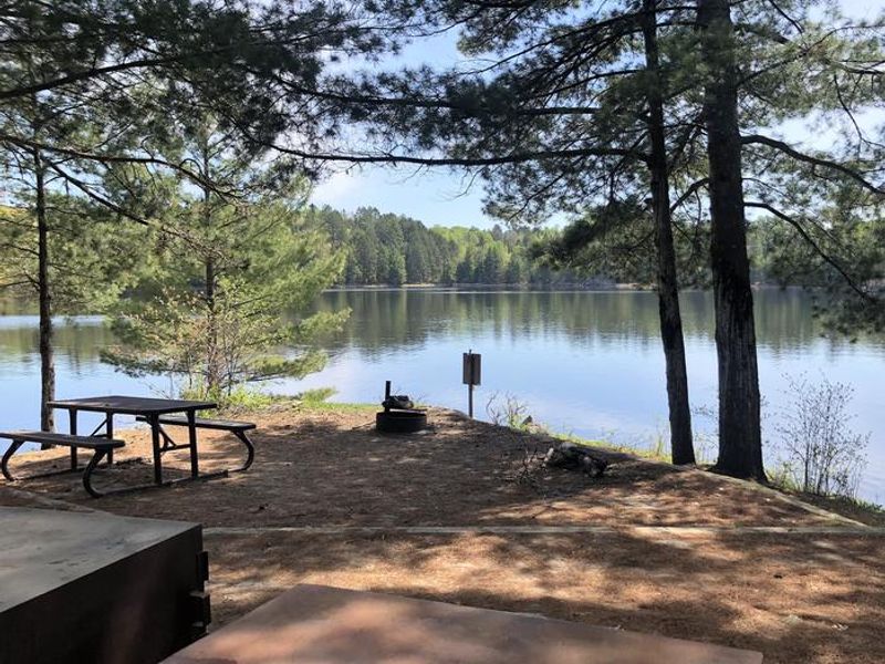
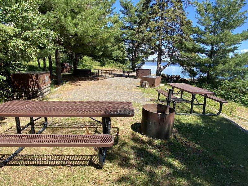
Voyageurs National Park preserves over 218,000 acres of interconnected waterways and boreal forest along the Minnesota-Canada border. The park's camping permit system covers 159 designated campsites spread across four major lakes and interior backcountry waters. All frontcountry and backcountry sites require travel by private watercraft or water taxi; there is no drive-up camping within the park. Frontcountry sites are the most accessible, located directly on the large lakes with either sand or dock landings. These sites include fire rings with cooking grates, 14x14-foot tent pads, bear-proof food lockers, picnic tables, and vault privies. Large sites accommodate up to 18 people with four tent pads, while group sites handle 30 campers. Backcountry sites on interior lakes like Locator, Shoepack, and Cruiser require hiking from boat-accessible trailheads and include a canoe with each reservation. The two primitive sites, Red Pine and Blueberry Ridge, are the park's only walk-in options, accessed via the 28-mile Kab-Ash Trail. These offer only fire rings and cleared tent areas with no privies or bear storage. Campers must follow strict Leave No Trace practices and hang food properly.
Directions
Voyageurs National Park is approximately 5 hours north of Minneapolis-St. Paul via I-35 and US-53, or 3 hours north of Duluth on US-53. Access points include Rainy Lake Visitor Center near International Falls, Kabetogama Lake Visitor Center, and Ash River Visitor Center. Falls International Airport in International Falls offers the closest commercial flights. No public transportation serves the park. All campsites require watercraft access from visitor center boat ramps, except primitive sites on the Kab-Ash Trail.
Amenities
| Water | No |
| Fires Allowed | Yes |
| Toilets | Yes |
| Dump Station | No |
| Wifi | No |
| Pets Allowed | Yes |
| Showers | No |
| Electric Hookups | — |
| Water Hookups | — |
| Sewer Hookups | — |
| Camp Store | No |
| Price | $10 - $60 |
Vehicle
| Max RV Length | — |
| Max Trailer Length | — |
| Big Rig Friendly | No |
| Pull Through Sites | No |
Contact
| Phone | +1 (218) 283-6600 |
Cell Service
| AT&T | Yes |
| Verizon | Yes |
| T-Mobile | Yes |
Availability
Photos

Community Posts
No posts yet. Be the first to share your experience!