Sunstrip
Closed indefinitely due to extensive damage from the 2020 Riverside Fire. Recovery and redesign plans are in progress with the Forest Service and partners. No reopening date has been announced.
Air Quality Alert issued July 22 at 10:11AM PDT by NWS Portland OR
Oregon Department of Environmental Quality has issued an Air Quality Advisory, which is IN EFFECT UNTIL 6 PM PDT THIS EVENING. An Air Quality Advisory for Smoke and Ozone remains in effect. Wildfires burning in the region combined with forecasted conditions will cause air quality to reach unhealthy levels due to smoke and ozone at times through 6 PM today. Pollutants in smoke can cause burning eyes, runny nose, aggravate heart and lung diseases, and aggravate other serious health problems. Limit outdoor activities and keep children indoors if it is smoky. Please follow medical advice if you have a heart or lung condition. More information about air quality can be found at: www.orcaa.org www.swcleanair.gov www.oregon.gov/DEQ www.lrapa.org
Alcohol Prohibitions
This Order describes acts that are prohibited upon lands, roads and trails within the National Forest System administered by the Forest Service Pacific Northwest Region in regards to alcoholic beverages.
Aquatic Invasive Species
This Order prohibits 1) possessing, storing, or transporting any aquatic invasive animal species AND 2) prohibits possessing, storing, or transporting any aquatic or riparian invasive plant species - on National Forest System lands in the Pacific Northwest Region as specified in the Order.
About
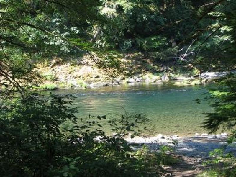
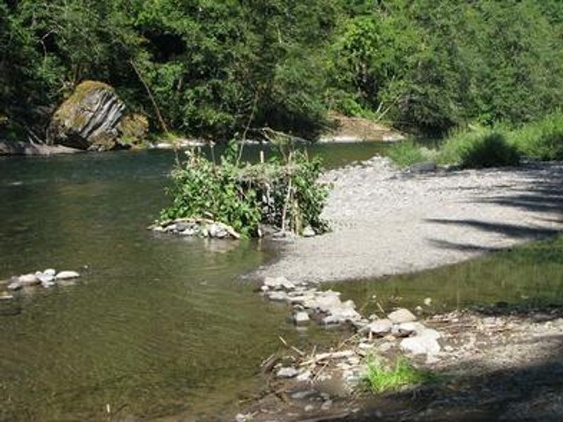
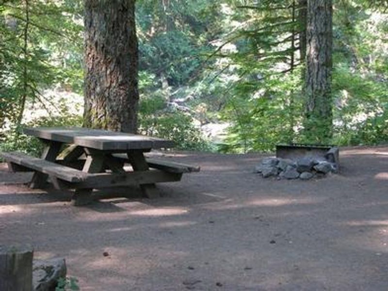
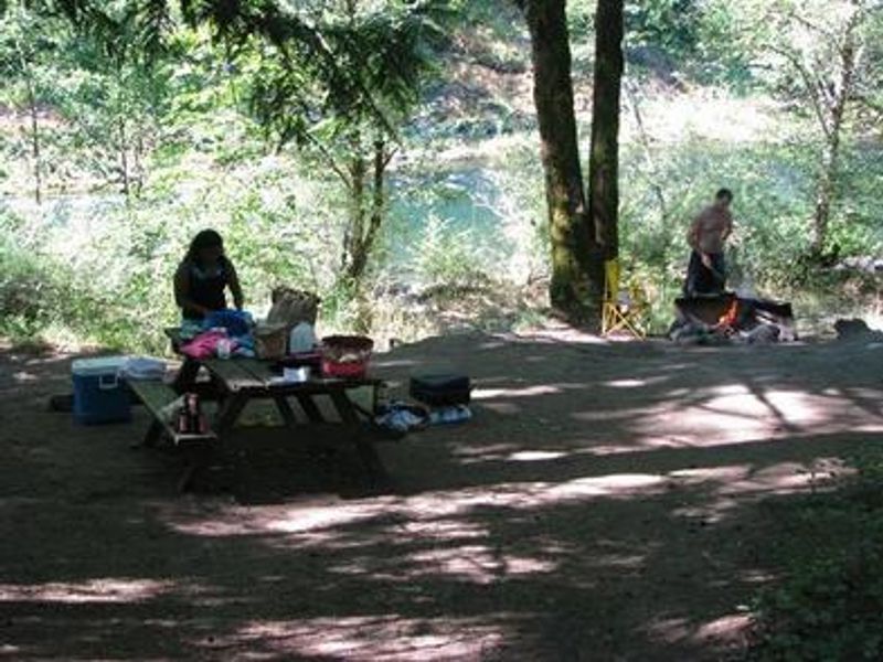
Sunstrip Campground is a primitive, tent-only campground nestled in a wooded area of Mt. Hood National Forest along the Clackamas Wild and Scenic River, at approximately 1,000 feet elevation. The campground features eight nonelectric sites, with roughly half positioned directly on the riverfront. The surrounding forest is thick with moss and old-growth greenery typical of the Oregon Cascades. Fishing is extremely popular on the Clackamas River, with opportunities for winter steelhead, spring Chinook, and late summer Kokanee salmon. Whitewater rafting is another favorite activity, with 12.5 miles of Class III-IV rapids stretching from Indian Henry Campground to North Fork Reservoir. A hiking trail meanders along the riverbank north and south of the campground, and the West Cascades National Scenic Byway offers scenic driving nearby. The campground has been closed since the 2020 Riverside Fire caused extensive damage. The Forest Service is working with partners on recovery and redesign plans for Sunstrip and six other Upper Clackamas River campgrounds, but no reopening date has been announced.
Directions
From Estacada, travel east on Highway 224 for about 21 miles to the campground.
Amenities
| Water | No |
| Fires Allowed | Yes |
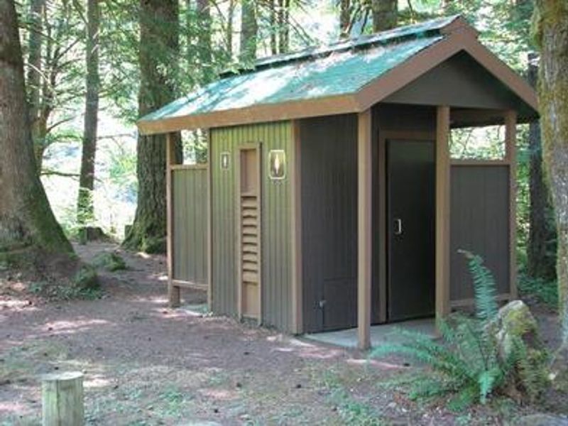
| Toilets | Yes |
| Dump Station | No |
| Wifi | No |
| Pets Allowed | — |
| Showers | No |
| Electric Hookups | — |
| Water Hookups | — |
| Sewer Hookups | — |
| Camp Store | No |
| Price | $22.29 |
Vehicle
| Max RV Length | — |
| Max Trailer Length | — |
| Big Rig Friendly | No |
| Pull Through Sites | No |
Contact
| Phone | +1 (971) 333-4100 |
Cell Service
| AT&T | None |
| Verizon | None |
| T-Mobile | None |
Availability
Photos
Community Posts
No posts yet. Be the first to share your experience!