Spillway Campground
Open for the season. The campground operates late May through mid-November depending on weather conditions. All 12 sites are first-come, first-served with no advance reservations. Fire restrictions may be imposed during hot, dry conditions.
Northern Region Camping & Target Restrictions, Pallet Prohibition
This order defines the maximum length of occupation at a single location or cumulatively at any number of locations within a calendar year, within the states of Montana, North Dakota, South Dakota, and Idaho
Weed Free Forage & Mulch Products Order for the Northern Region
It is illegal to possess, store or transport straw, hay, grain, seed or other forage or mulch products on Forest Service lands without documentation that the product is certified as “weed free” by a state certification process that meets or exceeds the North American Weed Free Forage standards.
R1-2023-02 - NCDE Food and Wildlife Attractant Storage Order
Northern Continental Divide Ecosystem Food/Wildlife Attractant Storage Order for the Flathead, Lolo, Kootenai, Helena-Lewis and Clark, and Beaverhead-Deerlodge National Forests within the Northern Continental Divide Ecosystem.
About
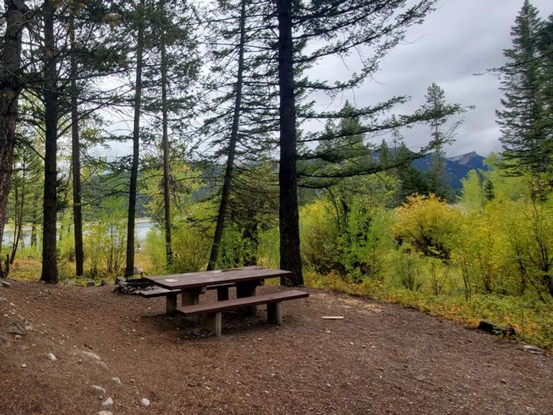
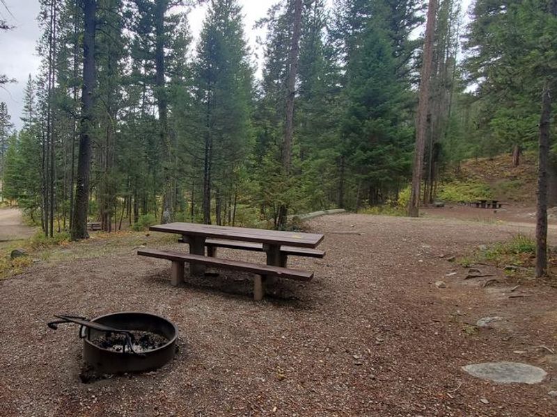
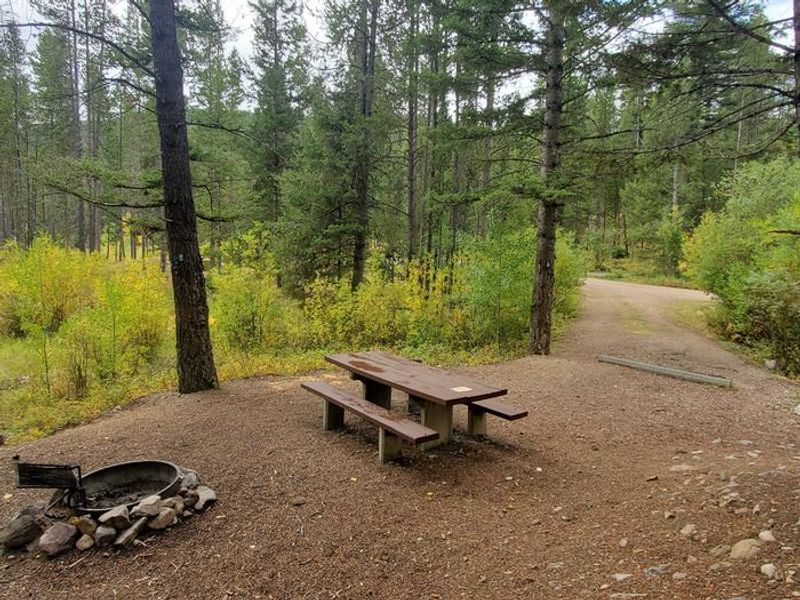
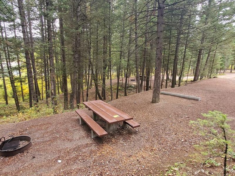
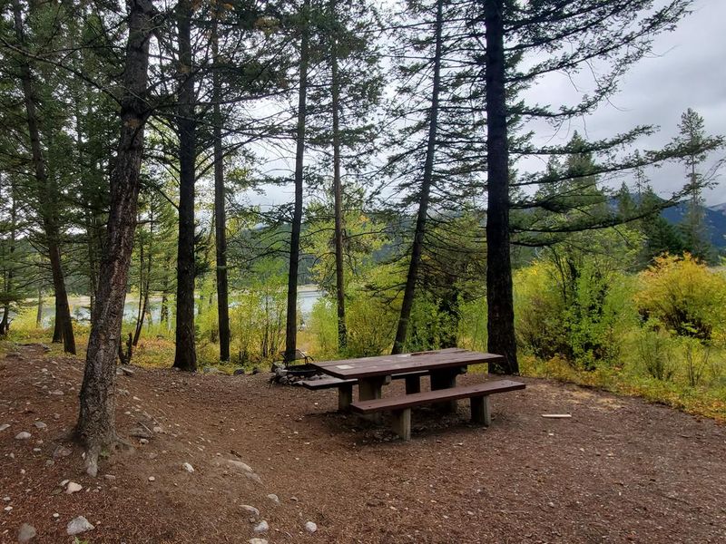
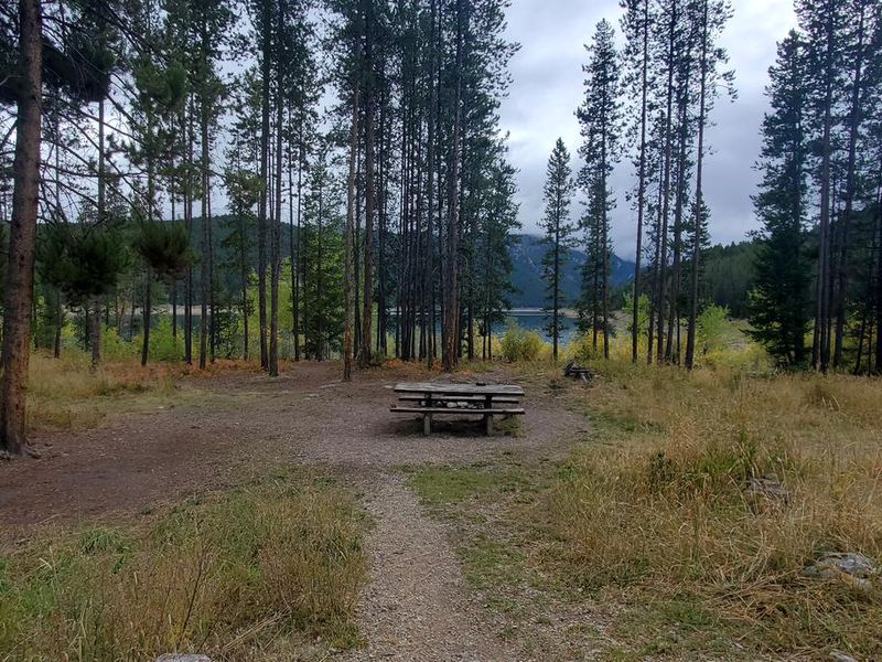
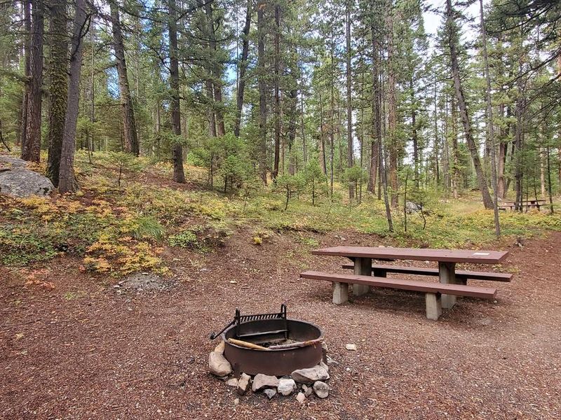
Spillway Campground occupies three acres on the northwestern shore of East Fork Reservoir, a 500-acre impoundment surrounded by timbered hillsides with views of the Anaconda Range. At 6,500 feet elevation, the 12 campsites are spread through mature lodgepole pine forest. Some sites sit directly along the reservoir shoreline while others are positioned slightly up the hillside. Each site includes a picnic table and fire ring. The campground has two double vault toilets, one hand-pump water spigot, and bear-resistant food storage lockers. The reservoir provides good fishing for rainbow and cutthroat trout. East Fork Rock Creek, which feeds the reservoir, hosts the largest bull trout population in the Upper Clark Fork drainage; targeting bull trout is prohibited and any caught must be released immediately. The nearby East Fork Trailhead accesses Page Lake Trail and East Fork Trail, both of which quickly enter the Anaconda-Pintler Wilderness and connect to the Continental Divide Trail. Other recreation includes boating, hunting, OHV riding on designated routes, and mountain biking outside wilderness boundaries. The campground operates first-come, first-served with no advance reservations. Payment can be made via the Recreation.gov mobile app's Scan and Pay feature or by cash/check at the self-serve fee station. The maximum stay is 16 days. Grizzly and black bears inhabit the area, so proper food storage is required under the forest-wide Food Storage Order.
Directions
From Philipsburg, drive south on Highway 1 for 6.5 miles to the junction with Skalkaho Highway (Highway 38). Turn right onto Highway 38 and continue west for 6.1 miles to the signed turn for East Fork Reservoir/Wilderness Access/Forest Road 672. Turn right onto County Road 672 and follow signs for 5.4 miles. At the junction, continue straight as the road becomes County Road 5141 for 1 mile. At the reservoir, turn right and continue 0.3 miles to the campground entrance on the left.
Amenities
| Water | Yes |
| Fires Allowed | Yes |
| Toilets | Yes |
| Dump Station | No |
| Wifi | No |
| Pets Allowed | Yes |
| Showers | No |
| Electric Hookups | — |
| Water Hookups | — |
| Sewer Hookups | — |
| Camp Store | No |
| Price | $15 |
Vehicle
| Max RV Length | — |
| Max Trailer Length | 22ft |
| Big Rig Friendly | No |
| Pull Through Sites | No |
Contact
| Phone | +1 (406) 859-3211 |
Cell Service
| AT&T | None |
| Verizon | None |
| T-Mobile | None |
Useful Links
| View on Recreation.gov | |
| USFS Spillway Campground |
Availability
Photos
Community Posts
No posts yet. Be the first to share your experience!