Flint Creek Campground
The campground is currently closed, likely due to early season conditions. While officially designated as open year-round, mountain campgrounds in this area often have delayed openings in spring due to snow and frozen ground. No advance reservations are accepted; sites are first-come, first-served with on-site payment via cash, check, or QR code scan through the Recreation.gov mobile app.
Northern Region Camping & Target Restrictions, Pallet Prohibition
This order defines the maximum length of occupation at a single location or cumulatively at any number of locations within a calendar year, within the states of Montana, North Dakota, South Dakota, and Idaho
Weed Free Forage & Mulch Products Order for the Northern Region
It is illegal to possess, store or transport straw, hay, grain, seed or other forage or mulch products on Forest Service lands without documentation that the product is certified as “weed free” by a state certification process that meets or exceeds the North American Weed Free Forage standards.
R1-2023-02 - NCDE Food and Wildlife Attractant Storage Order
Northern Continental Divide Ecosystem Food/Wildlife Attractant Storage Order for the Flathead, Lolo, Kootenai, Helena-Lewis and Clark, and Beaverhead-Deerlodge National Forests within the Northern Continental Divide Ecosystem.
About
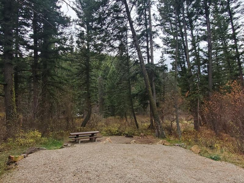
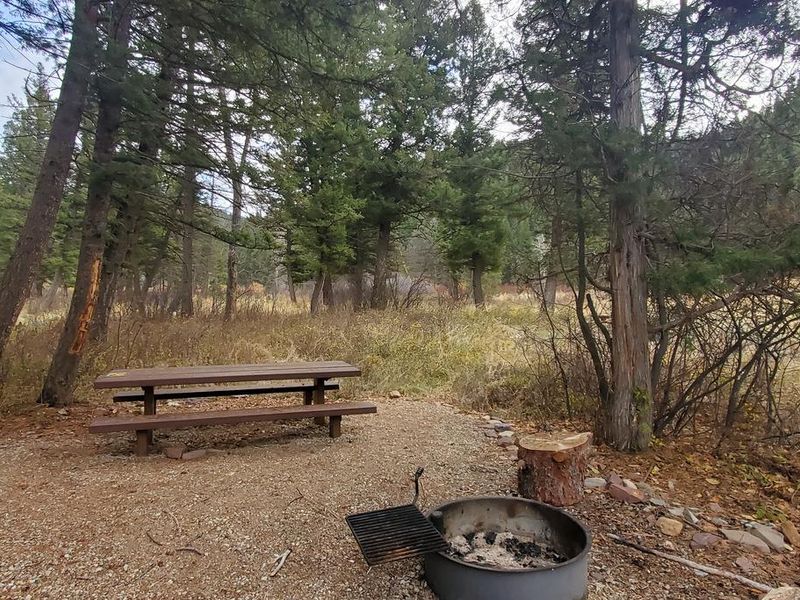
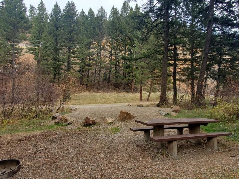
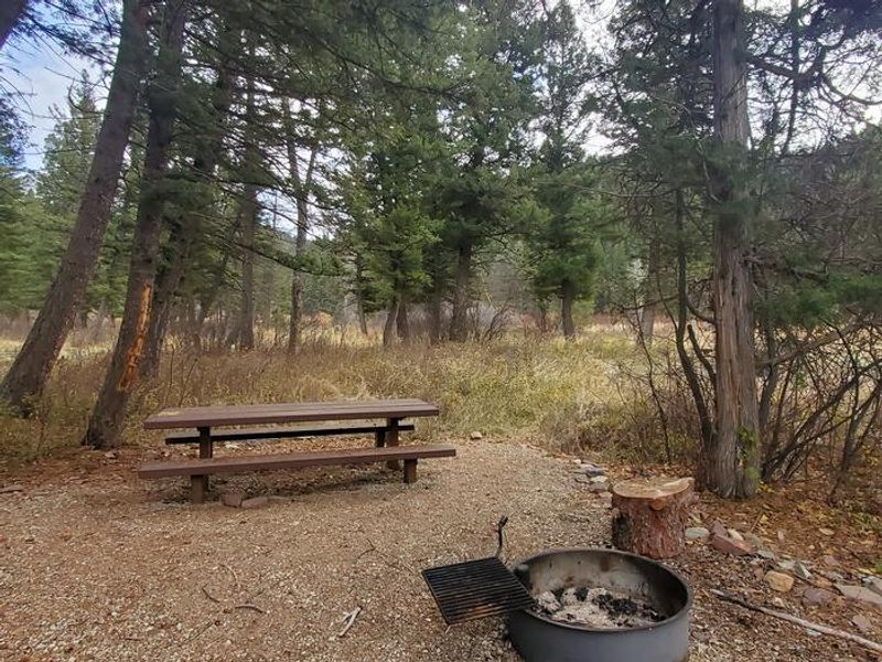
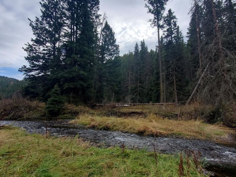
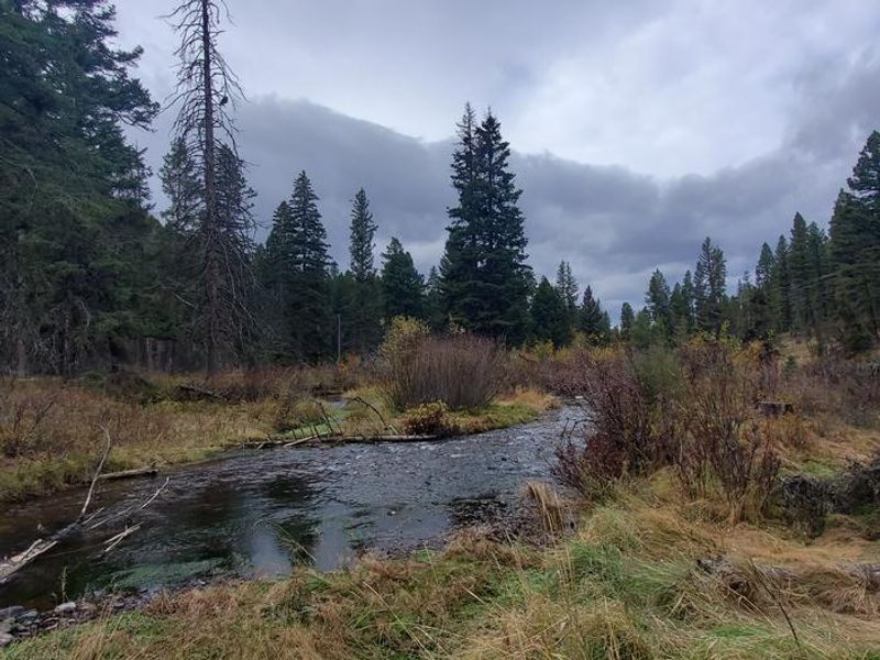
Flint Creek Campground sits at the base of the Anaconda Range in Beaverhead-Deerlodge National Forest, eight miles south of Philipsburg and four miles north of Georgetown Lake. The 10 campsites are shaded by mixed conifers and positioned along Flint Creek, offering streamside access for trout fishing and occasional moose sightings. Each site includes a picnic table and fire ring, with a double-vault ADA-accessible restroom centrally located. The campground operates first-come, first-served only with no advance reservations. Campers should bring their own drinking water as no potable water is available on site. The area falls under a food storage order due to grizzly and black bear activity; bear-resistant storage lockers are provided. Pack out all trash as there is no garbage service. Georgetown Lake is a 10-minute drive south and offers fishing, boating, and day-use areas. The Pintler Ranger District provides access to numerous trails leading into the Anaconda-Pintler Wilderness, which spans nearly 250 square miles along the Continental Divide.
Directions
From Philipsburg, travel south on Highway 1 for approximately 7.8 miles. Turn left onto Power House Road into the campground.
Amenities
| Water | No |
| Fires Allowed | Yes |
| Toilets | Yes |
| Dump Station | No |
| Wifi | No |
| Pets Allowed | Yes |
| Showers | No |
| Electric Hookups | — |
| Water Hookups | — |
| Sewer Hookups | — |
| Camp Store | No |
| Price | $15 |
Vehicle
| Max RV Length | — |
| Max Trailer Length | 22ft |
| Big Rig Friendly | No |
| Pull Through Sites | No |
Contact
| Phone | +1 (406) 859-3211 |
Cell Service
| AT&T | None |
| Verizon | None |
| T-Mobile | None |
Useful Links
| View on Recreation.gov | |
| USFS Flint Creek Campground |
Availability
Photos


Community Posts
No posts yet. Be the first to share your experience!