East Fork Campground
Closed for the season. Opens late May through mid-November, weather dependent. First-come, first-served only with on-site payment by cash, check, or Recreation.gov app QR code. 16-day stay limit.
Northern Region Camping & Target Restrictions, Pallet Prohibition
This order defines the maximum length of occupation at a single location or cumulatively at any number of locations within a calendar year, within the states of Montana, North Dakota, South Dakota, and Idaho
Weed Free Forage & Mulch Products Order for the Northern Region
It is illegal to possess, store or transport straw, hay, grain, seed or other forage or mulch products on Forest Service lands without documentation that the product is certified as “weed free” by a state certification process that meets or exceeds the North American Weed Free Forage standards.
R1-2023-02 - NCDE Food and Wildlife Attractant Storage Order
Northern Continental Divide Ecosystem Food/Wildlife Attractant Storage Order for the Flathead, Lolo, Kootenai, Helena-Lewis and Clark, and Beaverhead-Deerlodge National Forests within the Northern Continental Divide Ecosystem.
About
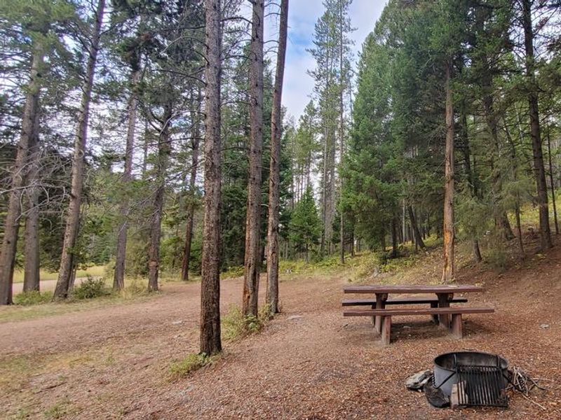
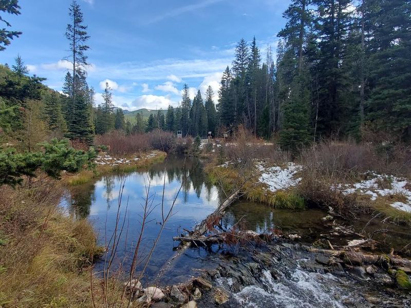
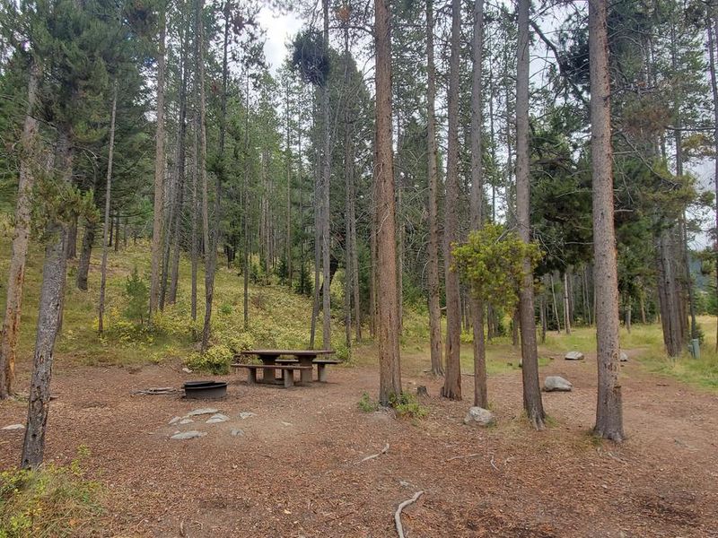
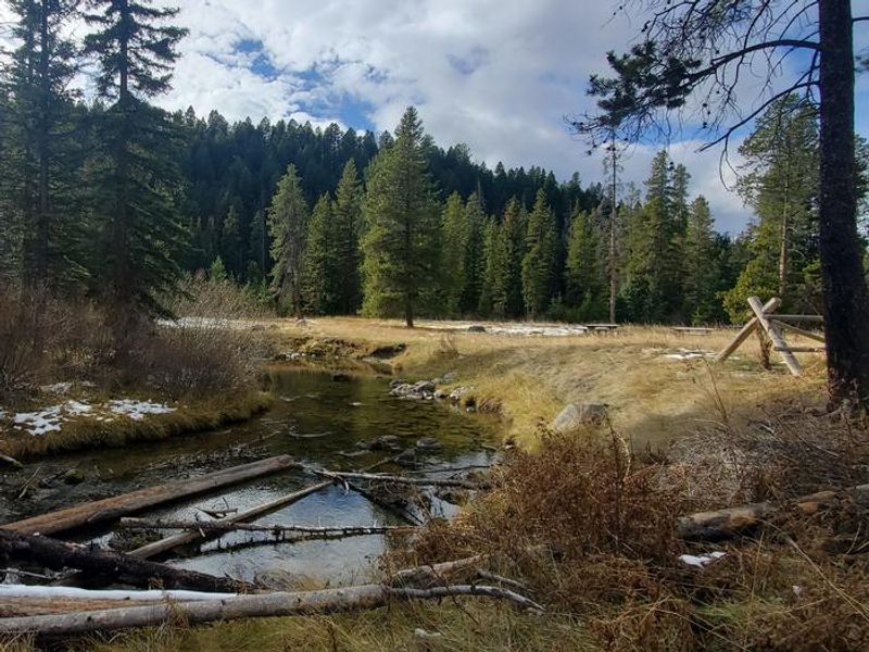
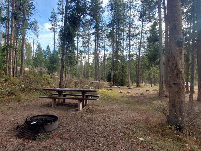
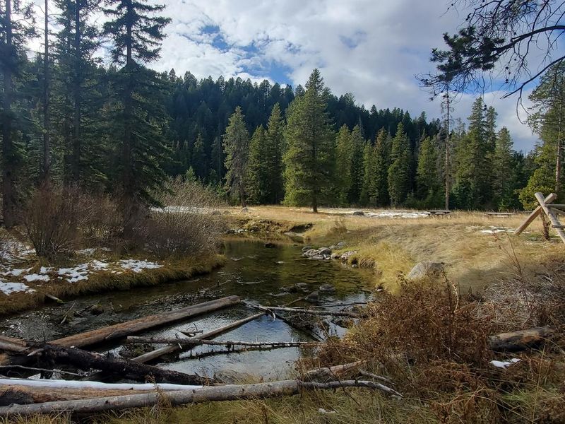
East Fork Campground is a small, intimate forest campground located in the Pintler Ranger District of Beaverhead-Deerlodge National Forest in western Montana. Situated at the base of a lodgepole pine-covered hillside, the campground sits alongside East Fork Rock Creek and just below the scenic 380-acre East Fork Reservoir, which offers views of the Anaconda Range. The campground has 8 first-come, first-served sites, each with a picnic table and fire ring. Potable water is available from a hand pump, and a single vault toilet serves the facility. A day-use picnic area with dedicated parking provides space for visitors not staying overnight. The area is known for good fishing for rainbow and cutthroat trout in East Fork Rock Creek, which also holds the largest bull trout population in the Upper Clark Fork drainage. The East Fork Trailhead is nearby, serving as the starting point for Page Lake Trail and East Fork Trail, both of which quickly enter the Anaconda-Pintler Wilderness and connect to the Continental Divide Trail. The surrounding district supports elk, moose, deer, mountain lions, and both black and grizzly bears. A forest-wide food storage order is in effect.
Directions
From Philipsburg, travel south on Highway 1 for about 6.5 miles to the junction with Skalkaho Highway/Highway 38. Turn right onto Highway 38 and continue west for 6.1 miles, then turn left onto County Road 672 (signed for East Fork Reservoir/Wilderness Access). Take County Road 672 for 5.1 miles to the junction with County Road 9349. Turn right and continue 0.8 miles to the campground.
Amenities
| Water | Yes |
| Fires Allowed | Yes |
| Toilets | Yes |
| Dump Station | No |
| Wifi | No |
| Pets Allowed | Yes |
| Showers | No |
| Electric Hookups | — |
| Water Hookups | — |
| Sewer Hookups | — |
| Camp Store | No |
| Price | $15 |
Vehicle
| Max RV Length | — |
| Max Trailer Length | — |
| Big Rig Friendly | — |
| Pull Through Sites | No |
Contact
| Phone | +1 (406) 859-3211 |
Cell Service
| AT&T | None |
| Verizon | None |
| T-Mobile | None |
Useful Links
| View on Recreation.gov |
Availability
Photos


Community Posts
No posts yet. Be the first to share your experience!