San Rafael Swinging Bridge Campground
Open year-round on a first-come-first-served basis. No reservations accepted. No potable water or trash services available; campers must bring water and pack out all trash.
Flood Watch issued July 20 at 12:15PM MDT until July 22 at 3:00AM MDT by NWS Salt Lake City UT
* WHAT...Flash flooding caused by excessive rainfall is possible. * WHERE...A portion of Utah, including the following areas, Castle Country, Central Mountains, Eastern Juab/Millard Counties, San Rafael Swell, Sanpete Valley, Sevier Valley, Wasatch Plateau/Book Cliffs, Western Millard and Juab Counties, Bryce Canyon Country, Capitol Reef National Park and Vicinity, Glen Canyon Recreation Area/Lake Powell, South Central Utah, Southern Mountains, Upper Sevier River Valleys, Western Canyonlands, Lower Washington County, Southwest Utah and Zion National Park. This includes recent burn scars such as Cottonwood, Silver King, Forsyth, France Canyon, Monroe Canyon. * WHEN...From Tuesday afternoon through late Tuesday night. * IMPACTS...Excessive rainfall may result in flooding of slot canyons, normally dry washes, slick rock areas, recent burn scars including Forsyth, France Canyon, Cottonwood, Silver King, and Monroe Canyon, and other low-lying and flood-prone locations. Flooding may occur in poor drainage and urban areas. * ADDITIONAL DETAILS... - http://www.weather.gov/safety/flood
Special Weather Statement issued July 20 at 11:41PM MDT by NWS Salt Lake City UT
At 1140 PM MDT, Doppler radar was tracking a strong thunderstorm 29 miles north of Hanksville, moving west at 20 mph. HAZARD...Wind gusts of 50 to 55 mph. SOURCE...Radar indicated. IMPACT...Gusty winds could knock down tree limbs and blow around unsecured objects. This storm will remain over mainly rural areas of south central Emery County. This includes the following highways... Interstate 70 between mile markers 115 and 144. Utah Route 24 between mile markers 136 and 146, and between mile markers 148 and 155.
About
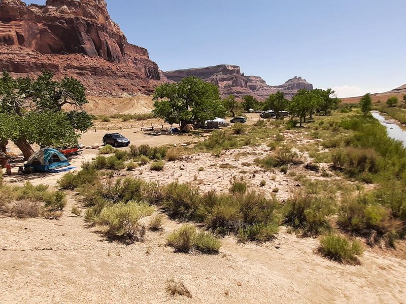
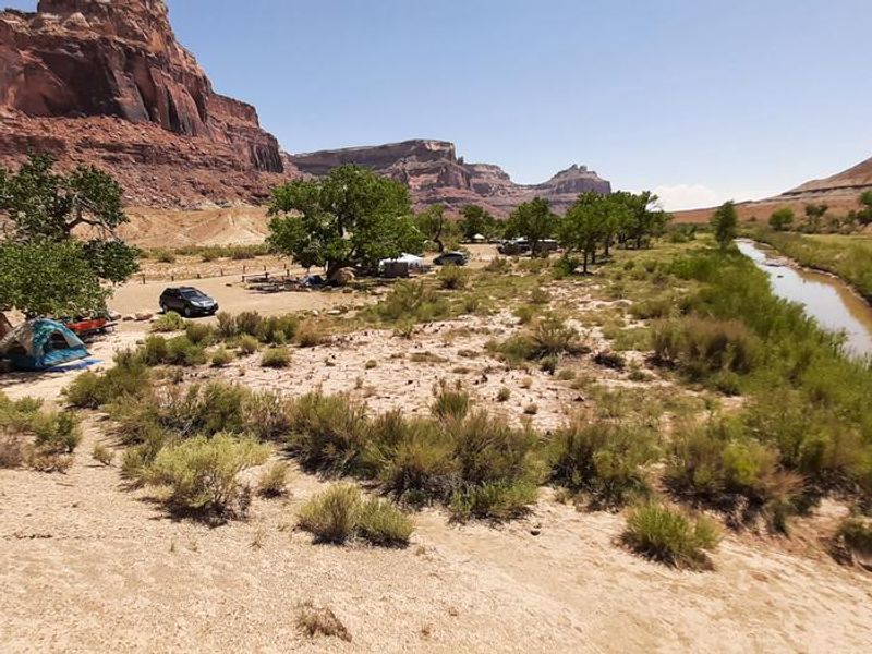
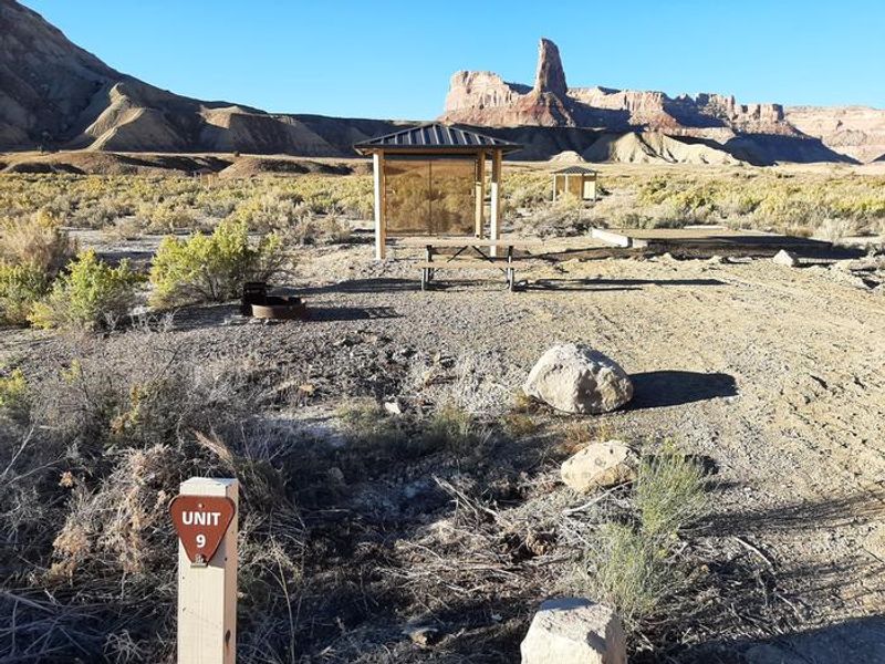
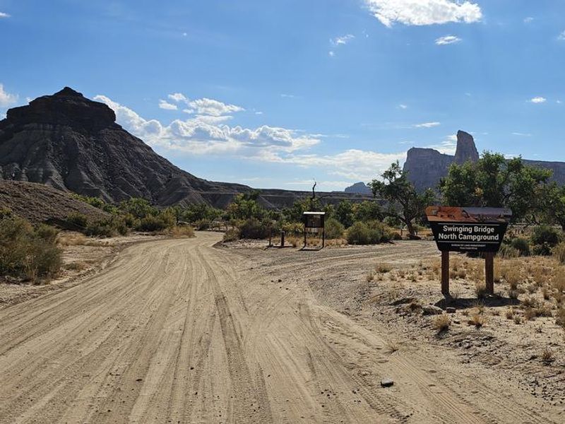
San Rafael Swinging Bridge Campground occupies a scenic location in the heart of the northern San Rafael Swell where Buckhorn Wash converges with the San Rafael River. The campground takes its name from the adjacent historic San Rafael Swinging Bridge, a 160-foot suspension bridge constructed by the Civilian Conservation Corps in 1937. This bridge served as the only crossing over the San Rafael River until 1990 and remains Utah's oldest intact suspension bridge. The campground comprises three distinct loops totaling 25 individual sites plus one group site. Swinging Bridge North offers 8 sites beneath cottonwood trees providing welcome shade during hot summer months. Swinging Bridge South features 11 sites with constructed shade structures. The Equestrian Loop accommodates horse campers with 6 sites, each equipped with individual corrals plus access to a central corral area. All sites include tent pads, picnic tables, fire rings, and parking. This is a primitive campground with no potable water, trash collection, or hookups. Campers must bring all water and pack out all trash. The surrounding area offers exceptional recreation including OHV trails, rock climbing, hiking, and mountain biking. Nearby attractions include the Little Grand Canyon hiking trail, Assembly Hall Peak, Window Blind Peak, Buckhorn Draw with its Native American rock art and dinosaur tracks, and the Wedge Overlook.
Directions
From Price, Utah, head east on Highway 6/191 then turn north onto Highway 10 toward Castle Dale. From Castle Dale, take Buckhorn Draw Road (Emery County Road 332) east for approximately 25 miles through Buckhorn Draw to the campground, located where Buckhorn Wash meets the San Rafael River.
Nearby Campgrounds
Amenities
| Water | No |
| Fires Allowed | Yes |
| Toilets | Yes |
| Dump Station | No |
| Wifi | No |
| Pets Allowed | Yes |
| Showers | No |
| Electric Hookups | — |
| Water Hookups | — |
| Sewer Hookups | — |
| Camp Store | No |
| Price | $15 - $35 |
Vehicle
| Max RV Length | — |
| Max Trailer Length | — |
| Big Rig Friendly | — |
| Pull Through Sites | No |
Contact
| utvnmail@blm.gov | |
| Phone | +1 (435) 636-3600 |
Cell Service
| AT&T | Yes |
| Verizon | None |
| T-Mobile | Yes |
Useful Links
| View on Recreation.gov | |
| BLM Campground Page |
Availability
Photos
Community Posts
No posts yet. Be the first to share your experience!