Buckhorn Draw
Open year-round, first-come-first-served. No reservations required. Pay via fee envelope or Recreation.gov app. No potable water available. Roads may be impassable in wet or icy conditions. Flash flood risk in washes.
Flood Watch issued July 20 at 12:15PM MDT until July 22 at 3:00AM MDT by NWS Salt Lake City UT
* WHAT...Flash flooding caused by excessive rainfall is possible. * WHERE...A portion of Utah, including the following areas, Castle Country, Central Mountains, Eastern Juab/Millard Counties, San Rafael Swell, Sanpete Valley, Sevier Valley, Wasatch Plateau/Book Cliffs, Western Millard and Juab Counties, Bryce Canyon Country, Capitol Reef National Park and Vicinity, Glen Canyon Recreation Area/Lake Powell, South Central Utah, Southern Mountains, Upper Sevier River Valleys, Western Canyonlands, Lower Washington County, Southwest Utah and Zion National Park. This includes recent burn scars such as Cottonwood, Silver King, Forsyth, France Canyon, Monroe Canyon. * WHEN...From Tuesday afternoon through late Tuesday night. * IMPACTS...Excessive rainfall may result in flooding of slot canyons, normally dry washes, slick rock areas, recent burn scars including Forsyth, France Canyon, Cottonwood, Silver King, and Monroe Canyon, and other low-lying and flood-prone locations. Flooding may occur in poor drainage and urban areas. * ADDITIONAL DETAILS... - http://www.weather.gov/safety/flood
Special Weather Statement issued July 20 at 11:41PM MDT by NWS Salt Lake City UT
At 1140 PM MDT, Doppler radar was tracking a strong thunderstorm 29 miles north of Hanksville, moving west at 20 mph. HAZARD...Wind gusts of 50 to 55 mph. SOURCE...Radar indicated. IMPACT...Gusty winds could knock down tree limbs and blow around unsecured objects. This storm will remain over mainly rural areas of south central Emery County. This includes the following highways... Interstate 70 between mile markers 115 and 144. Utah Route 24 between mile markers 136 and 146, and between mile markers 148 and 155.
About
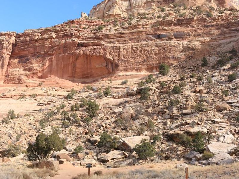
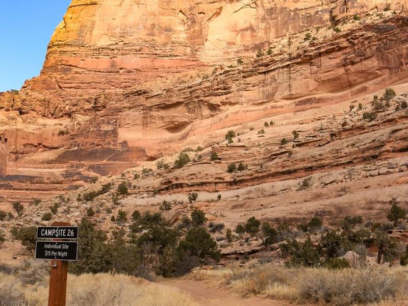
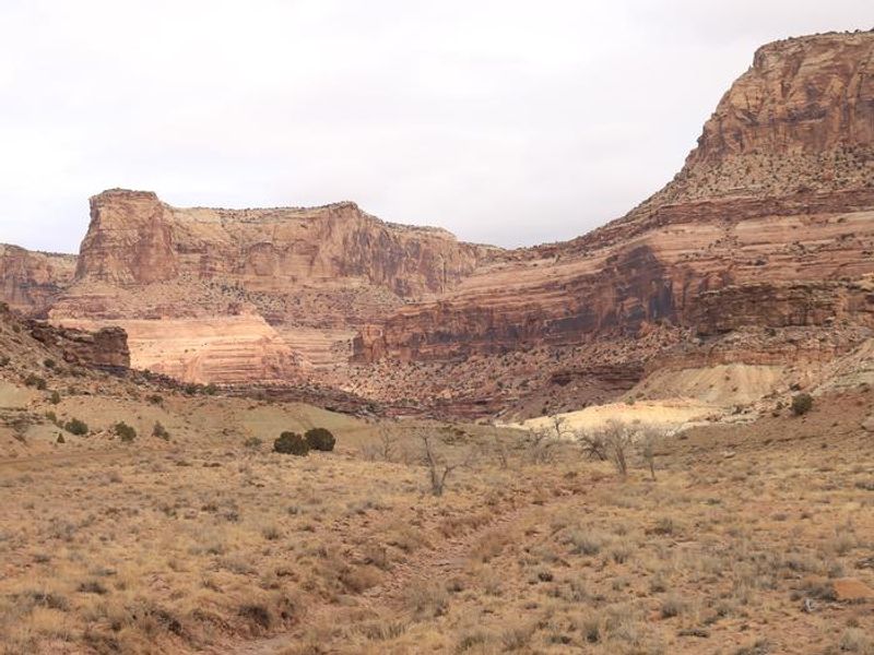
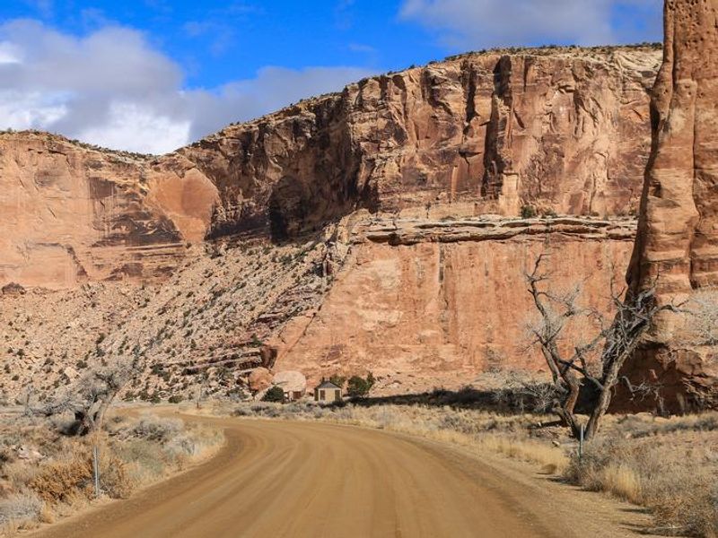
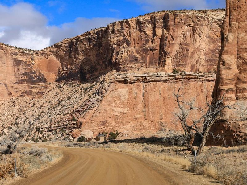
Buckhorn Draw campground spans nine miles of the San Rafael River's longest tributary canyon, with 26 individual campsites and 7 large group sites scattered along the road from the canyon rim to its confluence with the river at Swinging Bridge. Each site includes a picnic table and fire ring, with vault toilets stationed throughout the canyon. The campsites vary significantly in size and accessibility, from RV-suitable pull-offs to primitive tent sites requiring high-clearance vehicles. The canyon cuts through layers of Navajo, Kayenta, and Wingate sandstone, creating a striking landscape that draws rock climbers, hikers, and off-road enthusiasts. Notable attractions include the Buckhorn Pictograph Panel featuring Barrier Canyon-style rock art, dinosaur tracks, and Furniture Draw slot canyon. Designated wilderness flanks both sides of the draw, offering backcountry opportunities while restricting motorized access beyond established routes. The campground operates on a first-come-first-served basis with payment via fee envelopes at information stations or the Recreation.gov app. No potable water is available anywhere in the campground. County roads leading to Buckhorn Draw are generally maintained but may become impassable in wet or icy conditions. Flash flooding is a significant hazard; never camp or park in washes.
Directions
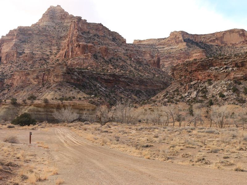
From Castle Dale: Head north on Highway 10, turn right on Green River Cutoff Road (signed for San Rafael Swell), continue 13 miles to Buckhorn Information Center, then 2.4 miles to the signed Buckhorn Draw intersection. From I-70 Exit 131: Take Buckhorn Draw Road north for 20 miles to Swinging Bridge, then 1.5 miles to reach the south entrance. All approaches require 15+ miles of gravel road; high clearance recommended, especially in wet conditions.
Nearby Campgrounds
Amenities
| Water | No |
| Fires Allowed | Yes |
| Toilets | Yes |
| Dump Station | No |
| Wifi | No |
| Pets Allowed | — |
| Showers | No |
| Electric Hookups | — |
| Water Hookups | — |
| Sewer Hookups | — |
| Camp Store | No |
| Price | $15 - $50 |
Vehicle
| Max RV Length | — |
| Max Trailer Length | — |
| Big Rig Friendly | No |
| Pull Through Sites | No |
Contact
| Phone | +1 (435) 636-3600 |
Cell Service
| AT&T | Yes |
| Verizon | None |
| T-Mobile | Yes |
Useful Links
| View on Recreation.gov | |
| BLM Buckhorn Draw Page |
Availability
Photos
Community Posts
No posts yet. Be the first to share your experience!