River Side
Closed for the season. Reopens June 19, 2026. Reservations available through Recreation.gov. Season runs mid-June through September 30. After the regular season, dispersed camping is allowed until snow arrives but water and toilet services are unavailable.
Weed Free Hay Order 04-2021-03
Prohibited by this order: Possessing, storing, or transporting non-pelletized hay, straw, or mulch in the Intermountain Region, unless it is certified as weed free by the state where the product originated.
Fireworks and Spark Arrestor Order 04-2021-01
Prohibited by this order: Possessing, discharging, or using any kind of firework or other pyrotechnic device. 36 CFR §261.52(t)Operating or using any internal or external combustion engine without a spark arresting device properly installed, maintained and in effective working order as described…
Explosives and Exploding Target Order 04-2021-02
This order prohibits the use of explosives and exploding targets on National Forest System lands within the Intermountain Region.
About
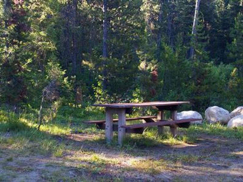
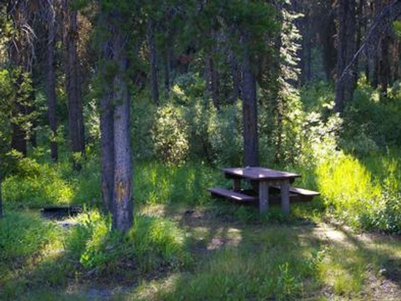
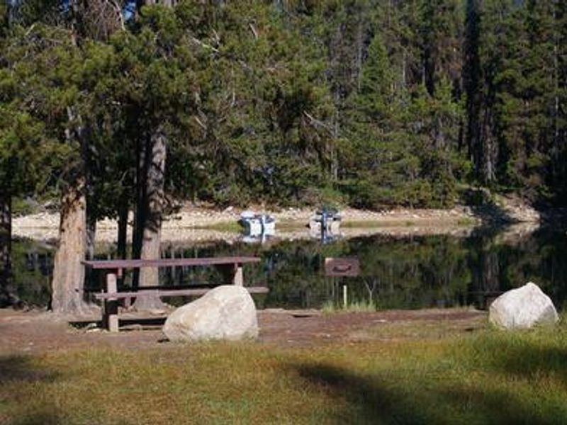
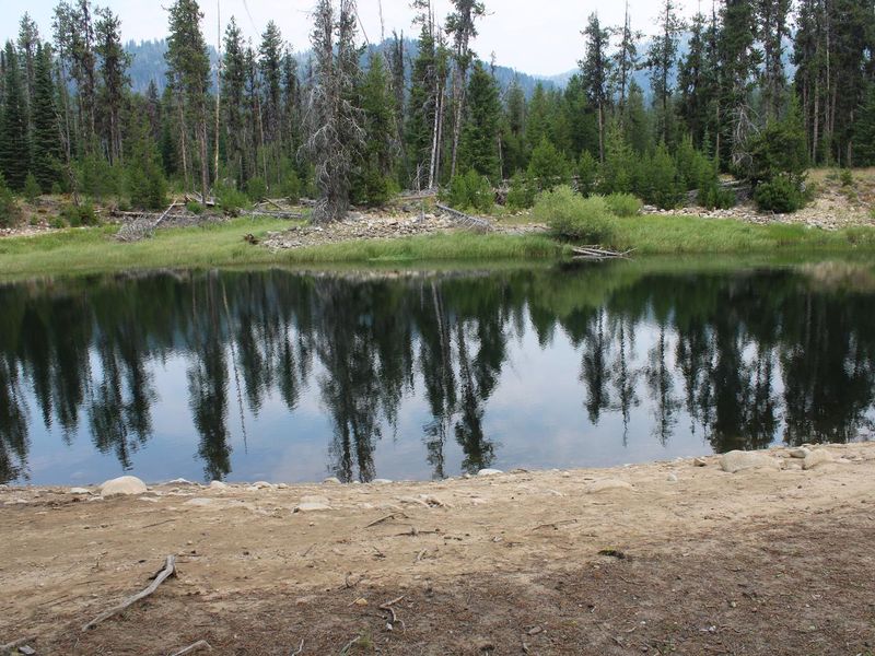
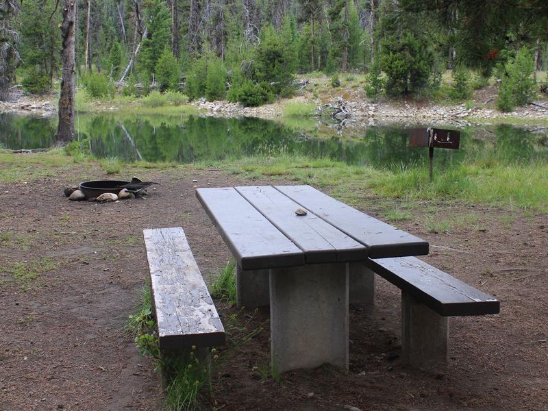
River Side Campground occupies a peaceful spot on the Deadwood River at the north end of Deadwood Reservoir in Idaho's Boise National Forest. At 5,300 feet elevation, the campground sits in a mixed-growth pine forest that provides shade and views of the river. The remote setting keeps crowds minimal while offering quality fishing for Chinook and Kokanee salmon, rainbow trout, and cutthroat trout. The eight primitive waterfront sites feature direct river access, dirt roads, and dirt parking spurs. Each site has a picnic table and fire ring. A vault toilet is located uphill from the camping area, and potable water is available from a hand pump. No electric hookups are provided. A boat ramp is available about 2 miles away at Cozy Cove Campground. Beyond fishing and boating, the area offers hiking, mountain biking, horseback riding, and OHV trails. After the regular season ends September 30, dispersed camping is permitted until snow arrives, though water and toilet facilities are not maintained during that period.
Directions
From Boise, take State Highway 55 north. At Banks, take Highway 17/Banks-Lowman Highway east to Lowman. Turn left on Highway 21. Continue along Highway 17 over Banner Summit. Turn west on Forest Road 579. Continue on FR 579 to Deadwood Reservoir.
Amenities
| Water | Yes |
| Fires Allowed | Yes |
| Toilets | Yes |
| Dump Station | — |
| Wifi | No |
| Pets Allowed | Yes |
| Showers | No |
| Electric Hookups | — |
| Water Hookups | — |
| Sewer Hookups | — |
| Camp Store | No |
| Price | $12 |
Vehicle
| Max RV Length | 100ft |
| Max Trailer Length | 100ft |
| Big Rig Friendly | No |
| Pull Through Sites | No |
Contact
| Phone | +1 (208) 259-3361 |
Cell Service
| AT&T | None |
| Verizon | None |
| T-Mobile | None |
Availability
Photos

Community Posts
No posts yet. Be the first to share your experience!