Picnic Point
Open for the season, mid-May through mid-September. The campground has both reservable sites through Recreation.gov and first-come, first-served availability.
Weed Free Hay Order 04-2021-03
Prohibited by this order: Possessing, storing, or transporting non-pelletized hay, straw, or mulch in the Intermountain Region, unless it is certified as weed free by the state where the product originated.
Fireworks and Spark Arrestor Order 04-2021-01
Prohibited by this order: Possessing, discharging, or using any kind of firework or other pyrotechnic device. 36 CFR §261.52(t)Operating or using any internal or external combustion engine without a spark arresting device properly installed, maintained and in effective working order as described…
Explosives and Exploding Target Order 04-2021-02
This order prohibits the use of explosives and exploding targets on National Forest System lands within the Intermountain Region.
About
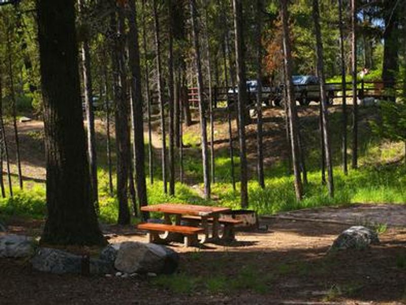
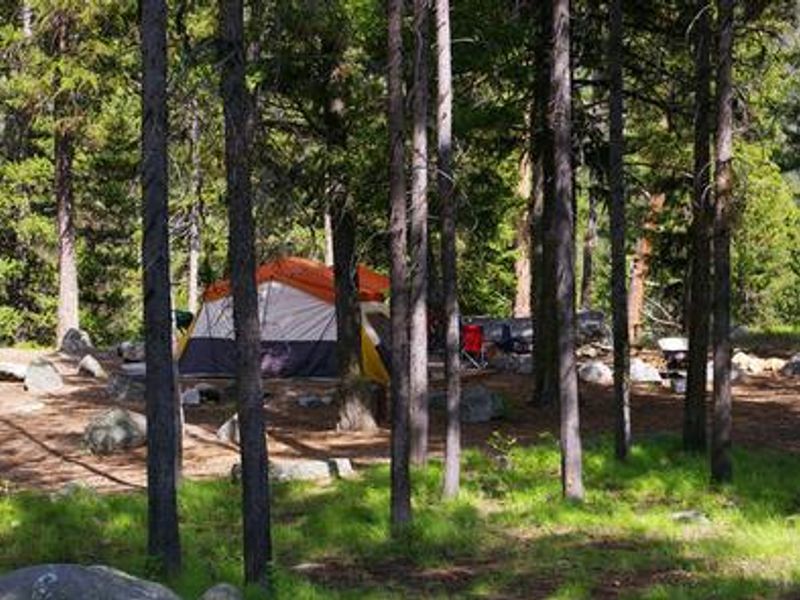
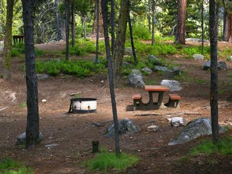
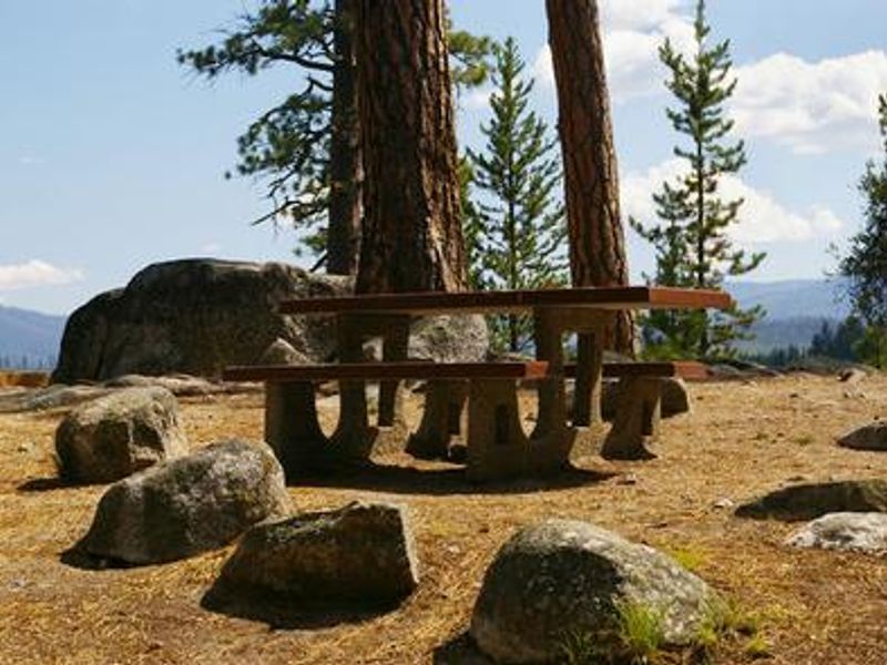
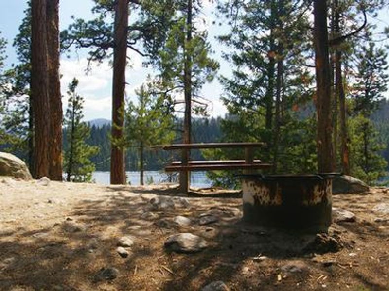
Picnic Point Campground sits at 5,300 feet elevation on a forested bluff overlooking Warm Lake in the Cascade Ranger District of Boise National Forest. The campground features 8 tent-only sites tucked beneath towering ponderosa pines, with some sites offering direct lake views. Because sites require a 50 to 200 foot hike from the dirt parking area, this campground is best suited for tent campers seeking a quieter, more secluded experience. Warm Lake provides outstanding fishing opportunities for cutthroat, rainbow, lake, and bull trout. Boating and swimming are popular activities, with a boat ramp at neighboring Shoreline Campground and Billy Rice Swim Beach within walking distance. The WeWuKiye Trail (No. 252) near Shoreline Campground offers hiking and mountain biking, while Telephone Ridge Trail (No. 112) provides 20 miles of OHV trails for all skill levels. Wildlife in the area includes bears, deer, elk, fox, eagles, osprey, and otters. Bears frequent the campground, so proper food storage is essential. North Shore Lodge, a short distance away, offers a small restaurant, lounge, and store with limited supplies.
Directions
From Boise, travel approximately 80 miles north on State Highway 55 to Cascade. Continue 1 mile north to Forest Highway 22 (Warm Lake Highway) and turn east. Travel 25 miles to the Forest Road 427 turnoff just past South Fork Salmon River Campground. Turn right onto FS Road 427 and proceed approximately 1 mile to the campground.
Amenities
| Water | Yes |
| Fires Allowed | Yes |
| Toilets | Yes |
| Dump Station | — |
| Wifi | No |
| Pets Allowed | — |
| Showers | No |
| Electric Hookups | — |
| Water Hookups | — |
| Sewer Hookups | — |
| Camp Store | No |
| Price | $15 |
Vehicle
| Max RV Length | — |
| Max Trailer Length | — |
| Big Rig Friendly | No |
| Pull Through Sites | No |
Contact
| Phone | +1 (208) 382-7400 |
Cell Service
| AT&T | None |
| Verizon | None |
| T-Mobile | None |
Availability
Photos


Community Posts
No posts yet. Be the first to share your experience!