North Arm Campground
Closed for the season. Opens Friday of Memorial Day weekend (May 22, 2026) and closes the second full weekend of September. Reservations available via Recreation.gov.
Alcohol Prohibitions
This Order describes acts that are prohibited upon lands, roads and trails within the National Forest System administered by the Forest Service Pacific Northwest Region in regards to alcoholic beverages.
Aquatic Invasive Species
This Order prohibits 1) possessing, storing, or transporting any aquatic invasive animal species AND 2) prohibits possessing, storing, or transporting any aquatic or riparian invasive plant species - on National Forest System lands in the Pacific Northwest Region as specified in the Order.
Restrictions on Use of Forage and Mulch Products
This Order prohibits unloading, storing, or using any straw, hay, grain, seed, or other forage or mulch products that are not state-certified weed free on the National Forest System lands, roads or trails in any Closure Area as specific in the Order. Some examples of these include hay bales, hay…
About
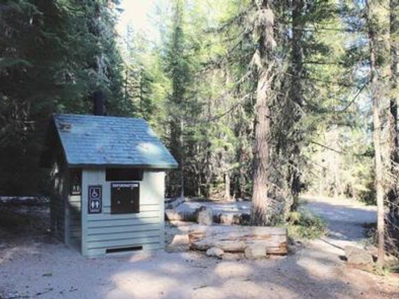
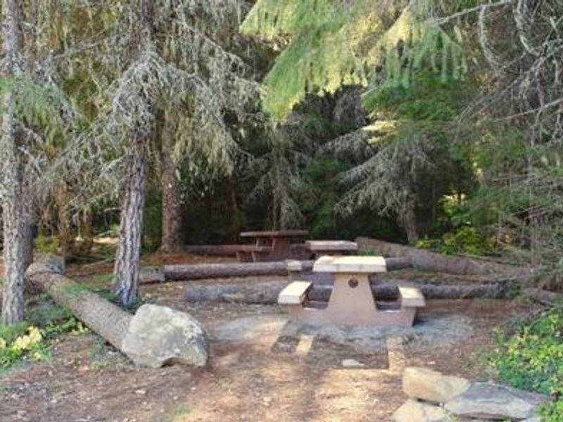
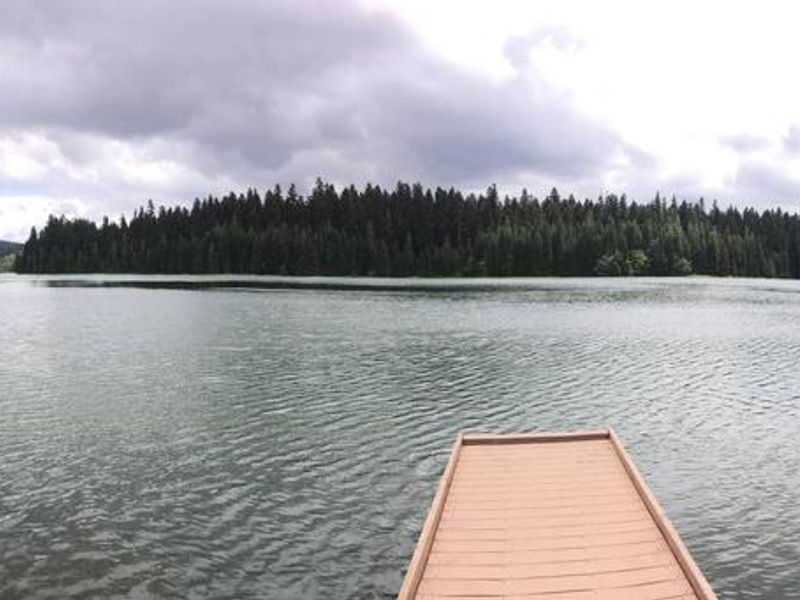
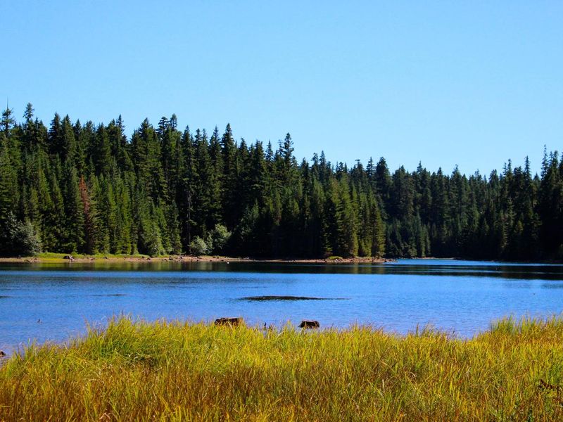
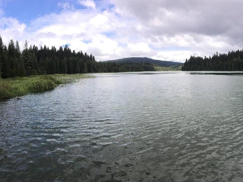
North Arm Campground occupies a peaceful spot on the northeastern shore of Timothy Lake, a 1,400-acre reservoir created in 1956 for the Oak Grove Hydroelectric Project. At 3,400 feet elevation in the shadow of Mt. Hood, the campground is nestled in a dense mixed conifer forest with thick understory providing privacy between sites. It's smaller and more secluded than other Timothy Lake campgrounds, making it a good choice for those seeking a quieter experience. The campground offers 12 standard drive-in sites and 4 hike-to tent sites closer to the water. Each site includes a picnic table and fire ring. Vault toilets and potable water are available, but there are no hookups or dump stations. Boating, swimming, fishing, and windsurfing are popular on the lake, with kokanee salmon, trout, and crayfish available for anglers. The 12-mile Timothy Lake Trail circles the lake and connects to the Pacific Crest National Scenic Trail. Little Crater Lake, a striking turquoise artesian spring, is a short hike away. The Clackamas Lake Ranger Station Historic District, featuring early 1900s Forest Service architecture, lies within 10 miles. Note that driving apps may direct visitors to rough forest roads; the recommended route via FS Road 42 and FS Road 57 is suitable for RVs and trailers.
Directions
From Government Camp, travel east on Highway 26 for approximately 11 miles to Skyline Road / FS Road 42. Turn right on Skyline Road and continue south for just over 8 miles. Turn right on FS Road 57 and travel west for approximately 3.5 miles, crossing the dam at Timothy Lake. Take the 2nd right onto FS Road 5810. North Arm is approximately 5 miles from here. Keep right at all intersections as the road becomes FS Road 5890. The campground is on the right.
Nearby Campgrounds
Amenities
| Water | Yes |
| Fires Allowed | Yes |
| Toilets | Yes |
| Dump Station | No |
| Wifi | No |
| Pets Allowed | Yes |
| Showers | No |
| Electric Hookups | — |
| Water Hookups | — |
| Sewer Hookups | — |
| Camp Store | No |
| Price | $28 |
Vehicle
| Max RV Length | 35ft |
| Max Trailer Length | 30ft |
| Big Rig Friendly | — |
| Pull Through Sites | No |
Contact
| Phone | +1 (503) 464-8515 |
Cell Service
| AT&T | Yes |
| Verizon | None |
| T-Mobile | None |
Availability
Photos
Community Posts
No posts yet. Be the first to share your experience!