Mountain View
The campground opens May 19 for the 2026 season and operates through September 30. A mix of reservable and first-come, first-served sites are available. After September 30, services are unavailable and the area reverts to dispersed camping.
Weed Free Hay Order 04-2021-03
Prohibited by this order: Possessing, storing, or transporting non-pelletized hay, straw, or mulch in the Intermountain Region, unless it is certified as weed free by the state where the product originated.
Fireworks and Spark Arrestor Order 04-2021-01
Prohibited by this order: Possessing, discharging, or using any kind of firework or other pyrotechnic device. 36 CFR §261.52(t)Operating or using any internal or external combustion engine without a spark arresting device properly installed, maintained and in effective working order as described…
Explosives and Exploding Target Order 04-2021-02
This order prohibits the use of explosives and exploding targets on National Forest System lands within the Intermountain Region.
About
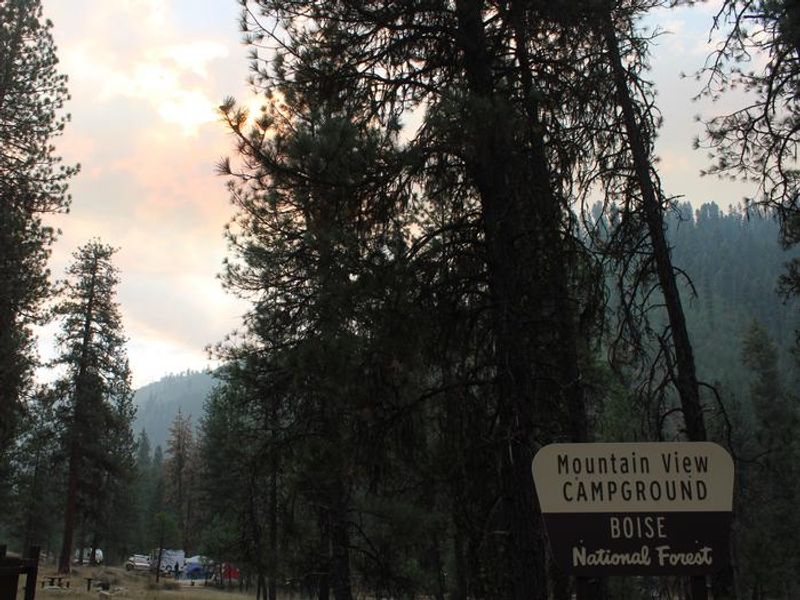
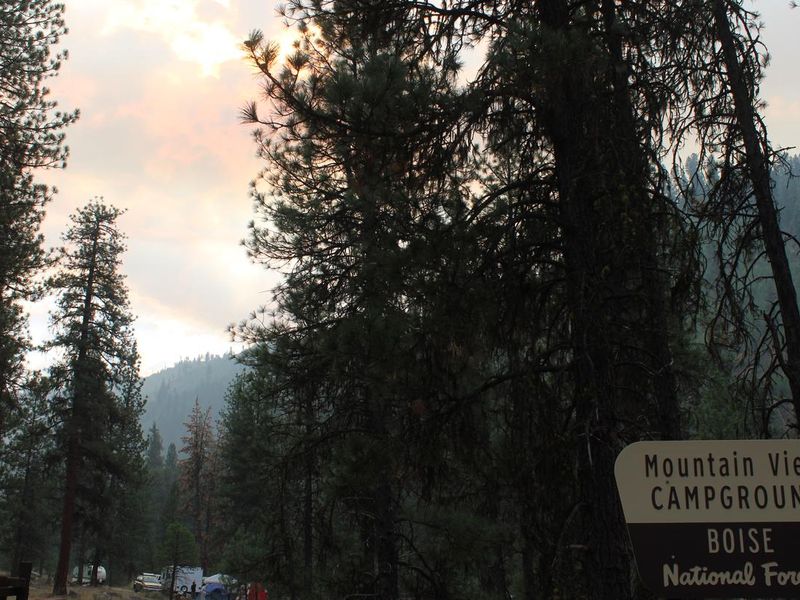
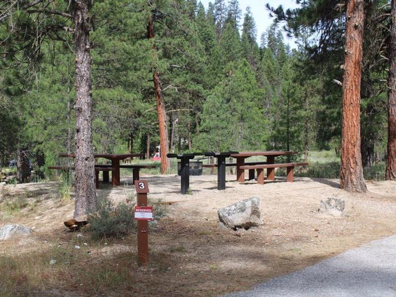
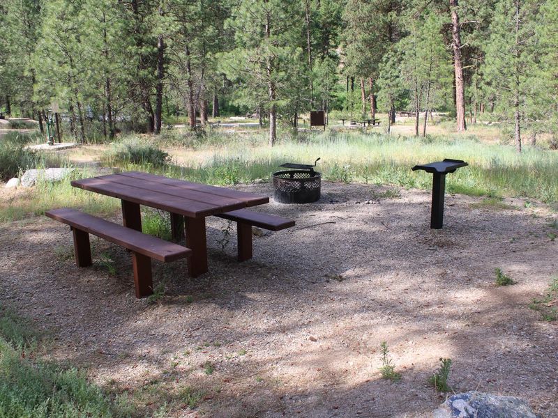
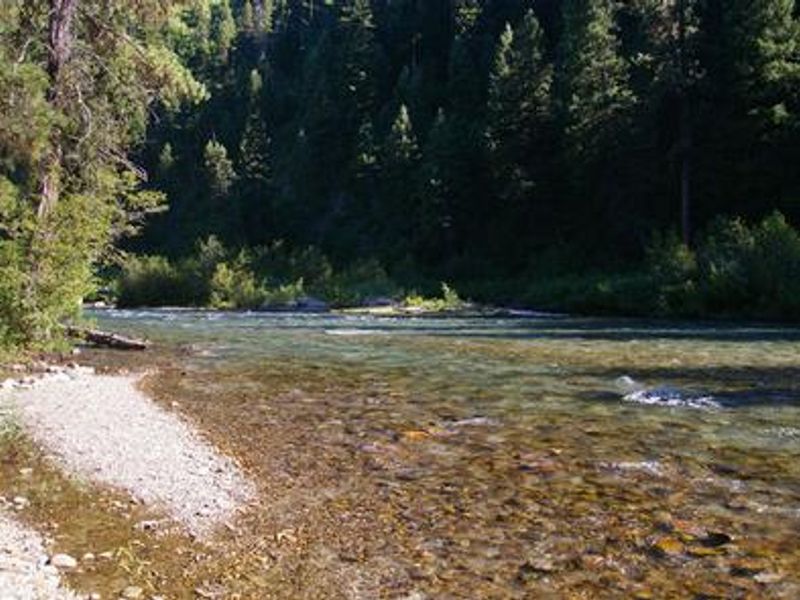
Mountain View Campground is located along Highway 21 at milepost 73.2, just east of Lowman, Idaho, at an elevation of 3,900 feet in Boise National Forest. The campground features paved roads and parking spurs shaded by towering Ponderosa pines. Each site includes a picnic table, campfire ring, and grill. Vault toilets, potable drinking water, and trash collection are provided, with a campground host on-site during the operating season. The area is a hub for river recreation and hot springs exploration. The South Fork Payette River flows nearby, providing opportunities for whitewater rafting, kayaking, and trout fishing. Kirkham Hot Springs, featuring multiple soaking pools right on the river's edge, is less than 3 miles from the campground. The Deadwood and Danskin River Access areas are also close by. Highway 21 is part of the Ponderosa Pine Scenic Byway, offering scenic views, wildlife watching, and historical information kiosks. The Banks-Lowman Highway (Wildlife Canyon Scenic Byway) provides additional natural hot springs pools and trail opportunities. Deer and elk may occasionally wander through the campground, and summer wildflowers dot the landscape.
Directions
From Boise, travel north on State Highway 55 to Banks (approximately 38 miles). At Banks, turn right (east) onto State Highway 17 (Banks-Lowman Road) and travel 31 miles to Lowman. At Lowman, turn left at the intersection of Highway 17 and Highway 21. Proceed east toward Stanley on Highway 21. Mountain View Campground is on the right at milepost 73.2, about a mile past Lowman.
Amenities
| Water | Yes |
| Fires Allowed | Yes |
| Toilets | Yes |
| Dump Station | — |
| Wifi | No |
| Pets Allowed | — |
| Showers | No |
| Electric Hookups | — |
| Water Hookups | — |
| Sewer Hookups | — |
| Camp Store | — |
| Price | $20 |
Vehicle
| Max RV Length | 70ft |
| Max Trailer Length | 70ft |
| Big Rig Friendly | — |
| Pull Through Sites | No |
Contact
| Phone | +1 (208) 259-3361 |
Cell Service
| AT&T | None |
| Verizon | None |
| T-Mobile | None |
Availability
Photos
Community Posts
No posts yet. Be the first to share your experience!