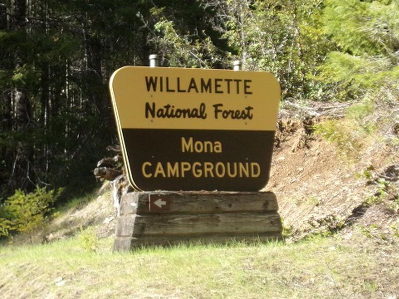
Mona Sign
Open

Open for the 2026 season, operating May through September. Reservations available via Recreation.gov up to six months in advance (minimum four days prior); some sites are first-come, first-served. Quiet hours 10 p.m. to 6 a.m. Maximum stay 14 days per 60-day period.

Alcohol Prohibitions

This Order describes acts that are prohibited upon lands, roads and trails within the National Forest System administered by the Forest Service Pacific Northwest Region in regards to alcoholic beverages.

Aquatic Invasive Species

This Order prohibits 1) possessing, storing, or transporting any aquatic invasive animal species AND 2) prohibits possessing, storing, or transporting any aquatic or riparian invasive plant species - on National Forest System lands in the Pacific Northwest Region as specified in the Order.

Restrictions on Use of Forage and Mulch Products

This Order prohibits unloading, storing, or using any straw, hay, grain, seed, or other forage or mulch products that are not state-certified weed free on the National Forest System lands, roads or trails in any Closure Area as specific in the Order. Some examples of these include hay bales, hay…

Fireworks and Explosives are always Prohibited

Fireworks and explosives (including explosive targets) are always prohibited on national forest lands. The prohibition of fireworks and exploding targets on national forest system lands is part of a set of permanent fire safety regulations in the Code of Federal Regulations (CFR), listed below.…

Cedar Creek Fire Closure

To provide for public safety, a closure order is in place for the following areas impacted by the Cedar Creek Fire.

Terwilliger Hot Springs Nudity, Alcohol, and Closed Times

The following is prohibited: to park or possess an alcoholic beverage in restricted areas, be publicly nude visible from Forest Road 19, and to enter or use Terwilliger Hot Springs between 10 p.m. and sunrise.

Portion of Forest Service Road 1003 (Tom Creek Road) closed

A portion of Forest Service Road 1003, also known as Tom Creek Road, is closed. The road closure starts at the junction of FSR 10 and FSR 1003 and includes the first 4.1 miles of FSR 1003 to the junction with the 1003-416 and 1003-409 roads.

Emigrant Fire Closure Order

Pursuant to 16 USC 551 and 36 CFR § 261.50 (a) and (b), and to provide for public safety, the following acts are prohibited in the areas described in this Order on National Forest System lands within the administrative boundaries of the Willamette National Forest. This Order…

Tamolitch Parking / Trail Construction Closure

Tamolitch Parking and Trail Construction Closure Forest Order.Forest roads 2600-735, 2600-738, and 2600-739: and the area is described as beginning at the junction of Highway 126 and 2600-735 road, west along the 2600-735 road, then northwest to the highwater mark of the east bank of the McKenzie…

Detroit Dispersed Camping Restrictions

Pursuant to 16 USC§ 551 and 36 CFR 261.50(a) and (b), and to provide for public safety, the following acts are prohibited in the Closure Areas, roads and their associated spur roads, trailheads, and recreation sites described in this order on National Forest System lands within the administrative…

FIRE CLOSURES: Current wildfire closures on the Willamette National Forest

For updates on active fires, visit our fire Incident Information page. Fire Closures:Cedar Creek Fire Closure Order & Map (updated 3/23/26)Beachie Creek and Lionshead Fires Closure Order & Map (updated 05/21/26)Map of All Fire Closures in Pacific Northwest

Beachie Creek and Lionshead Fires Closure

The Willamette National Forest has issued a closure order to restrict visitors from being on specific roads, trails, or developed recreation sites as listed in the Forest Order. The closed areas were impacted by the Beachie Creek and Lionshead Fires.

14 Day Stay Camping Limit

Camping, occupying, or otherwise leaving camping equipment and/or related supplies at any locations on the Willamette National Forest described in this order, overnight, for a period longer than 14 calendar days, in a 30-day period.

Camping Restrictions in Cougar Recreation Area

The Cougar Recreation Area is a specially designated area around Cougar Reservoir. It includes a 1/2-mile strip on either side of Forest Service Road 19 from Hwy 126 to Forest Service Road 1927 as well as Terwilliger Hot Springs, Hidden Lake Day Use Area, areas surrounding Delta Campground, Slide…

Moose and Gordon Dispersed Camping Closure

The purpose of this closure is to prohibit dispersed overnight camping and make these areas available as day-use only. This is to allow river access for all users, reduce conflict, reduce safety concerns, reduce and eliminate health and sanitation issues associated with improper disposal of human…

Special Wilderness Permit, Camping and Fire Restrictions

This outlines special restrictions on the Willamette and Deschutes National Forests.

Occupation Use Restriction in Middle Fork Ranger District

The following acts are prohibited in the areas described in this order within the administrative boundaries of the Willamette National Forest.Prohibitions:1. Being in the area after sundown to before sunrise.2. Parking in violation of posted instructions.

About

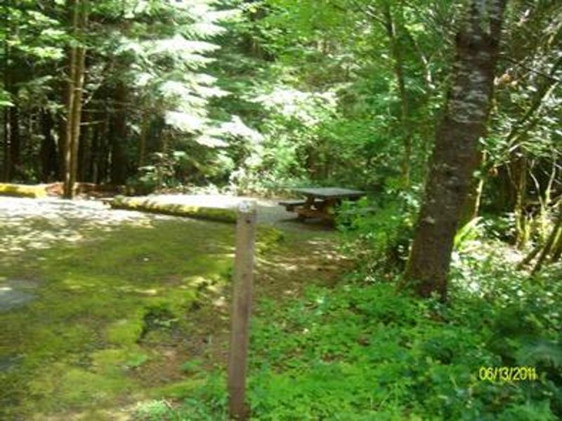
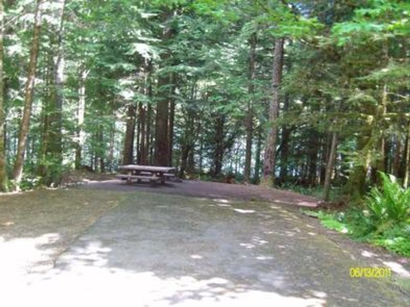
Mona Campground occupies a scenic stretch along the northwest shore of Blue River Reservoir in Oregon's Willamette National Forest. The campground features 23 sites (20 single, 3 double) tucked into mixed conifers, with thick vegetation providing seclusion between sites. All sites have picnic tables and fire rings, and the paved roads and mostly flat parking spurs accommodate both tents and trailers/RVs. Blue River Reservoir draws visitors for fishing, swimming, water skiing, and motorized boating. Nearby trails include Buck Mountain Trail and Lookout Creek Old Growth Trail. The campground is accessed via the West Cascades National Scenic Byway. Amenities include potable water from hand pumps, vault toilets, firewood for sale, and an onsite host. Senior/Access Pass holders receive a 50% discount on campsite fees. Dogs must be leashed at all times, chainsaws are prohibited, and horses/pack animals are not allowed.

Directions

From Blue River, OR, travel 3 miles east on Highway 126 to Forest Road 15. Proceed north 3 miles on FR 15 to the north side of Blue River Reservoir. Cross the bridge west on Forest Road 120, then head south on FR 120 to Mona Campground.

Amenities

Water Yes
Fires Allowed Yes
Toilets Yes
Dump Station
Wifi No
Pets Allowed Yes
Showers No
Electric Hookups
Water Hookups
Sewer Hookups
Camp Store No
Price $24 - $48

Vehicle

Max RV Length 70ft
Max Trailer Length 70ft
Big Rig Friendly Yes
Pull Through Sites No

Contact

Phone +1 (541) 822-3381

Cell Service

AT&T None
Verizon None
T-Mobile None

Availability

Photos

Mona Sign

Community Posts

No posts yet. Be the first to share your experience!