Killiansburg Cave Hiker-biker Campsite
Open year-round, first-come first-served with no fee or reservation required. Overnight stays limited to one night per trip. Non-potable water available mid-April through mid-November only; water is shut off during winter months.
About
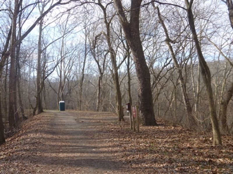
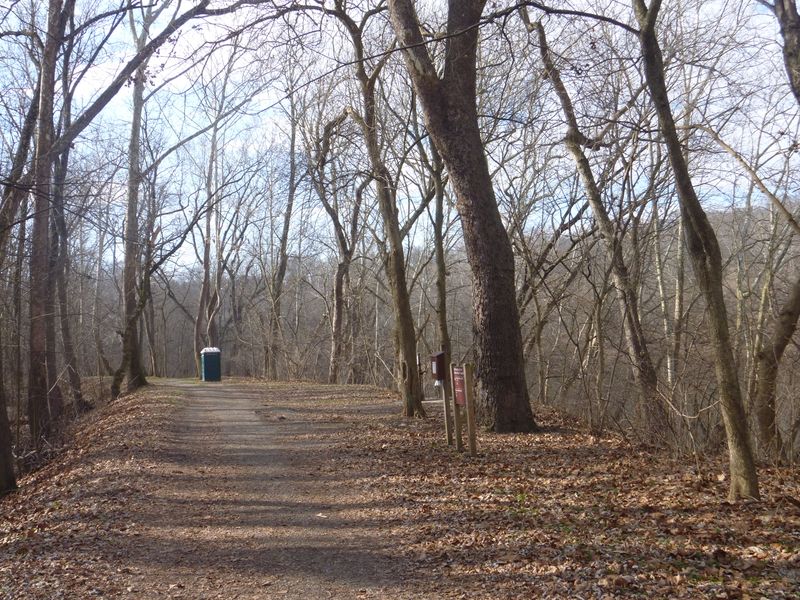
Killiansburg Cave Hiker-Biker Campsite is one of 30 primitive campsites spaced approximately every 5-7 miles along the 184.5-mile C&O Canal towpath. Located at mile marker 75.2 near Sharpsburg in Washington County, Maryland, this site serves long-distance hikers and cyclists traveling the historic canal corridor. The campsite can accommodate 5-10 tents depending on configuration. Amenities include a chemical toilet, picnic table, grill, and firepit. Non-potable well water is available from mid-April through mid-November; campers must filter, chemically treat, or boil the water before drinking or cooking. Water is shut off during winter months to prevent freezing. Fires are restricted to the provided grills and fire rings or portable grills positioned off the ground; coals must be extinguished and removed from the park. This is a walk-in or bike-in only site with no vehicle access. The nearest parking area is 1-5 miles away. Camping is free, first-come first-served, with no reservations accepted. Stays are limited to one night per site per trip. Pets must be leashed at all times. Quiet hours are 10 PM to 6 AM. The site is located near the Potomac River and may be subject to flooding after heavy rains.
Directions
Located at mile 75.2 on the C&O Canal towpath near Sharpsburg. Accessible only by foot, bicycle, or horseback along the towpath.
Nearby Campgrounds
Location
Amenities
| Water | No |
| Fires Allowed | Yes |
| Toilets | Yes |
| Dump Station | No |
| Wifi | — |
| Pets Allowed | Yes |
| Showers | No |
| Electric Hookups | — |
| Water Hookups | — |
| Sewer Hookups | — |
| Camp Store | — |
| Price | $0 |
Vehicle
| Max RV Length | — |
| Max Trailer Length | — |
| Big Rig Friendly | No |
| Pull Through Sites | No |
Contact
| CHOH_information@nps.gov | |
| Phone | +1 (301) 739-4200 |
Cell Service
| AT&T | Yes |
| Verizon | None |
| T-Mobile | None |
Photos
Community Posts
No posts yet. Be the first to share your experience!