Cumberland Valley Hiker-biker Overnight Campsite
Open year-round, first-come first-served with no fee or reservation required. Well water is available mid-April through mid-November; water handles are removed during winter months for freeze protection. Stays limited to one night per site per trip.
About
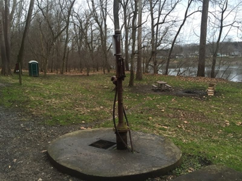
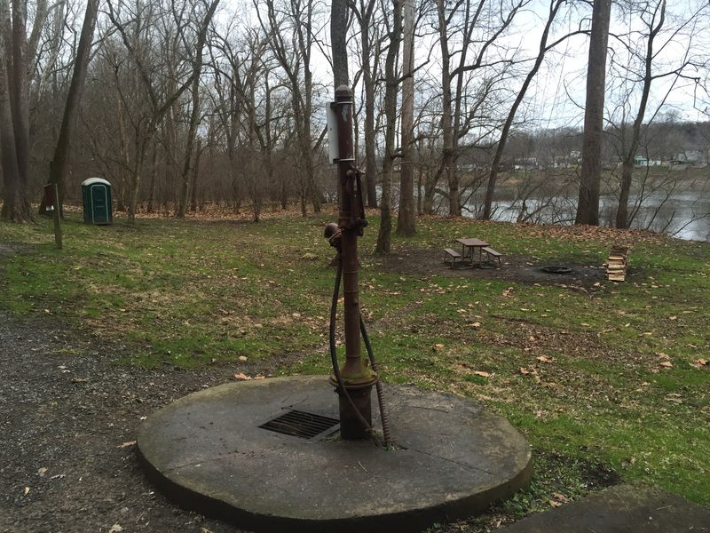
Cumberland Valley Hiker-Biker Campsite sits at mile 95.2 along the Chesapeake and Ohio Canal towpath, one of approximately 30 primitive hiker-biker sites spaced every 5-7 miles along the 184.5-mile trail. This free, walk-in tent site serves cyclists and hikers traveling the towpath, accommodating up to 5-10 tents depending on group sizes. The campsite provides basic amenities including a chemical toilet (year-round), a picnic table, and a fire pit/grill. Well water is available from mid-April through mid-November but is non-potable; campers must filter, chemically treat, or boil before drinking or cooking. Firewood may be collected from dead material on the ground within the park. Stays are limited to one night per site per trip, enforced to keep sites available for through-travelers. The site is near the Potomac River and can be subject to flooding after heavy rains. Pets are permitted but must remain leashed at all times.
Directions
Located at mile 95.2 on the C&O Canal towpath near Williamsport, Maryland. Access is walk-in only from the towpath.
Nearby Campgrounds
Amenities
| Water | No |
| Fires Allowed | Yes |
| Toilets | Yes |
| Dump Station | No |
| Wifi | No |
| Pets Allowed | Yes |
| Showers | No |
| Electric Hookups | — |
| Water Hookups | — |
| Sewer Hookups | — |
| Camp Store | No |
| Price | $0 |
Vehicle
| Max RV Length | — |
| Max Trailer Length | — |
| Big Rig Friendly | No |
| Pull Through Sites | No |
Contact
| choh_information@nps.gov | |
| Phone | +1 (301) 739-4200 |
Cell Service
| AT&T | Yes |
| Verizon | Yes |
| T-Mobile | Yes |
Photos
Community Posts
No posts yet. Be the first to share your experience!