Big Woods Hiker-biker Overnight Campsite
Open year-round, first-come, first-served, no fee or reservation required. Overnight stays limited to one night. Non-potable well water available mid-April through mid-November only; bring water treatment capability.
About
Big Woods Hiker-Biker Campsite sits at mile 82.7 along the historic Chesapeake and Ohio Canal towpath in Washington County, Maryland. Part of a network of hiker-biker campsites spaced every 5-7 miles along the 184.5-mile towpath, Big Woods provides a convenient overnight stop for long-distance cyclists and hikers traveling the trail. This primitive, tent-only campsite is free and operates on a first-come, first-served basis with no reservations accepted. Each site includes a chemical toilet, picnic table, and firepit. Non-potable well water is available from mid-April through mid-November; campers must filter, chemically treat, or boil all water before use. Well handles are removed during winter months to prevent freeze damage. Fires are restricted to provided firepits and grills or portable grills positioned off the ground. All coals must be fully extinguished and packed out. This is a trash-free park requiring campers to pack out all waste. Quiet hours are 10 PM to 6 AM. The site accommodates 5-10 tents depending on conditions, with overnight stays limited to one night per trip.
Directions
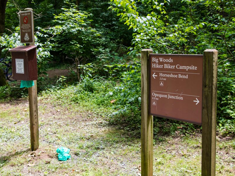
Located at mile 82.7 on the C&O Canal towpath near Mercersville. Accessible only by foot or bicycle. A sign marks the path from the towpath to the campsite, which is set back from the main trail for privacy.
Nearby Campgrounds
Location
Amenities
| Water | No |
| Fires Allowed | Yes |
| Toilets | Yes |
| Dump Station | No |
| Wifi | — |
| Pets Allowed | Yes |
| Showers | No |
| Electric Hookups | — |
| Water Hookups | — |
| Sewer Hookups | — |
| Camp Store | — |
| Price | $0 |
Vehicle
| Max RV Length | — |
| Max Trailer Length | — |
| Big Rig Friendly | No |
| Pull Through Sites | No |
Contact
| CHOH_information@nps.gov | |
| Phone | +1 (301) 739-4200 |
Cell Service
| AT&T | None |
| Verizon | None |
| T-Mobile | None |
Photos
Community Posts
No posts yet. Be the first to share your experience!