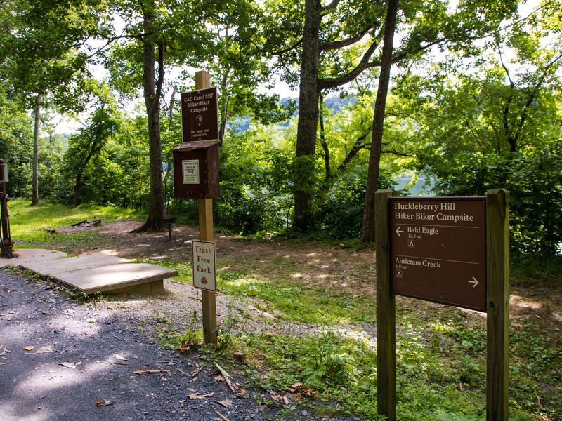
Huckleberry Hill Hiker-biker Campsite
Open year-round, first-come, first-served, no fee or reservation required. Non-potable well water is available mid-April through mid-November only. Stays limited to one night per trip.
About
Huckleberry Hill Hiker-Biker Campsite is one of numerous primitive campsites spaced approximately every 5-7 miles along the 184.5-mile C&O Canal towpath. Located at mile 62.9 in Washington County, Maryland, this free campsite serves long-distance hikers and cyclists traveling the historic canal route between Georgetown and Cumberland. The site provides basic amenities including a chemical toilet, picnic table, and fire pit. Non-potable well water is available mid-April through mid-November but must be filtered, chemically treated, or boiled before consumption. Water handles are removed during winter months. Camping is first-come, first-served with no reservations or fees. Stays are limited to one night per site per trip. Fires must be confined to the provided fire pit or a portable grill elevated off the ground, and campers must bring kiln-fired or dried wood. This is a trash-free park, so all waste must be packed out. Quiet hours are 10pm to 6am.
Directions
The campsite is located at mile 62.9 of the C&O Canal towpath, approximately 1-5 miles from the nearest parking area. Access is on foot or by bicycle only.
Nearby Campgrounds
Amenities
| Water | No |
| Fires Allowed | Yes |
| Toilets | Yes |
| Dump Station | No |
| Wifi | No |
| Pets Allowed | Yes |
| Showers | No |
| Electric Hookups | — |
| Water Hookups | — |
| Sewer Hookups | — |
| Camp Store | No |
| Price | $0 |
Vehicle
| Max RV Length | — |
| Max Trailer Length | — |
| Big Rig Friendly | No |
| Pull Through Sites | No |
Contact
| choh_information@nps.gov | |
| Phone | +1 (301) 739-4200 |
Cell Service
| AT&T | Yes |
| Verizon | Yes |
| T-Mobile | None |
Photos
Community Posts
No posts yet. Be the first to share your experience!