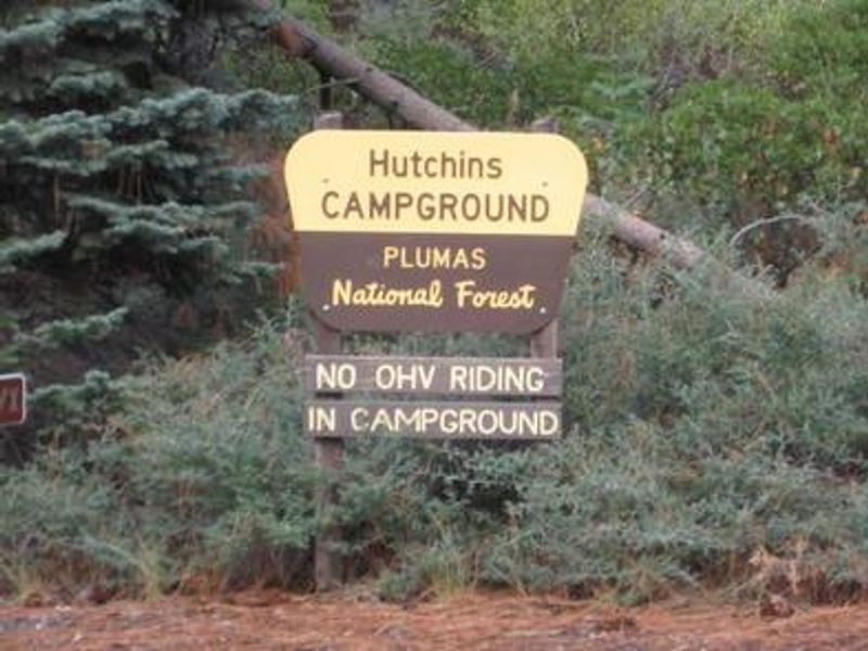
Hutchins
Currently closed for the season. The campground typically operates from early June through early October. No potable water is available on-site due to system limitations. The area remains barren with limited shade following the 2021 Dixie Fire and subsequent timber salvage.
National Forest System Roads
Follow California Vehicle Code on National Forest System Roads
Fireworks and Explosives are always Prohibited
Fireworks and explosives (including explosive targets) are always prohibited on national forest lands. The prohibition of fireworks and exploding targets on national forest system lands is part of a set of permanent fire safety regulations in the Code of Federal Regulations (CFR), listed below.…
Stage I Fire Restrictions - Plumas National Forest
The Plumas National Forest is entering Stage I Fire Restrictions on Thursday, July 9, based on increased fire danger and fire behavior indices, combined with drying fuels.
About
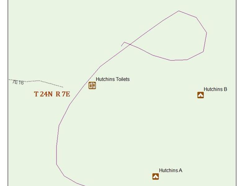
Hutchins Group Campground is located in the Bucks Lake Recreation Area of Plumas National Forest, approximately 17 miles southwest of Quincy, California. Situated at 5,200 feet elevation, the campground offers three reservable group sites ideal for family reunions, scout troops, or other large gatherings. Each site can accommodate up to 24 people and 8 vehicles, with multiple picnic tables, fire rings with grills, vault toilets, and bear boxes provided. The campground was severely impacted by the 2021 Dixie Fire, and subsequent timber salvage operations have left the area barren with minimal shade. Campers should prepare accordingly by bringing their own shade structures. No potable water is available at the campground; water can be obtained at the nearby Sandy Point Day Use Area or Haskins Campground. The greater Bucks Lake area offers excellent fishing, boating, and canoeing opportunities. The campground is within walking distance of Bucks Lake, and hiking trails including the Pacific Crest Trail are accessible from nearby trailheads at Mill Creek and Bucks Summit. American Land & Leisure operates the campground under agreement with PG&E and the USDA Forest Service.
Directions
From Quincy, travel west on Oro-Quincy Highway (Highway 162) approximately 10 miles toward Bucks Lake. From Oroville, travel east on Highway 162 for approximately 45 miles to Bucks Lake Dam Road, turn left and continue 3 miles to the campground.
Amenities
| Water | No |
| Fires Allowed | Yes |
| Toilets | Yes |
| Dump Station | — |
| Wifi | No |
| Pets Allowed | — |
| Showers | No |
| Electric Hookups | — |
| Water Hookups | — |
| Sewer Hookups | — |
| Camp Store | No |
| Price | $50 |
Vehicle
| Max RV Length | 27ft |
| Max Trailer Length | 27ft |
| Big Rig Friendly | — |
| Pull Through Sites | No |
Contact
| recinfo@pge.com | |
| Phone | +1 (530) 283-0555 |
Cell Service
| AT&T | None |
| Verizon | None |
| T-Mobile | None |
Availability
Photos
Community Posts
No posts yet. Be the first to share your experience!