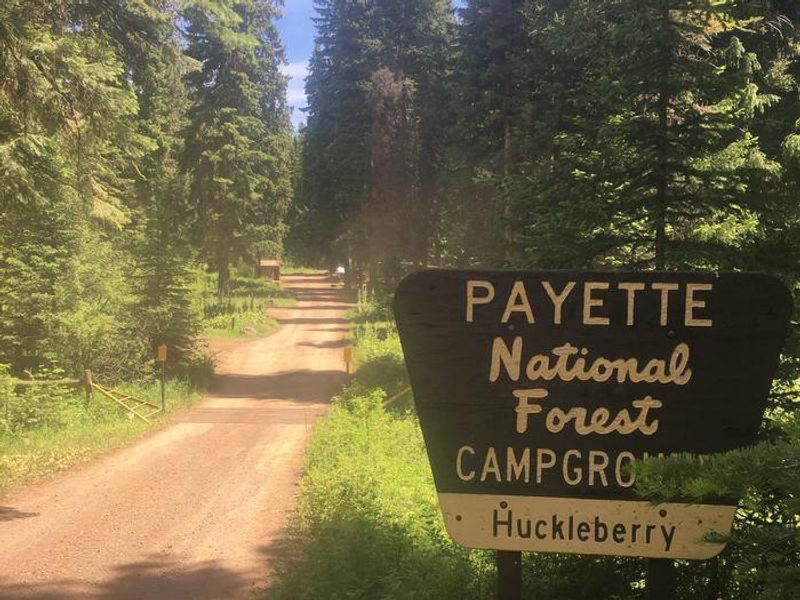
Huckleberry
Open for the 2026 season. Operating season runs mid-May through the end of November. All 8 sites are first-come, first-served with no advance reservations.
Weed Free Hay Order 04-2021-03
Prohibited by this order: Possessing, storing, or transporting non-pelletized hay, straw, or mulch in the Intermountain Region, unless it is certified as weed free by the state where the product originated.
Fireworks and Spark Arrestor Order 04-2021-01
Prohibited by this order: Possessing, discharging, or using any kind of firework or other pyrotechnic device. 36 CFR §261.52(t)Operating or using any internal or external combustion engine without a spark arresting device properly installed, maintained and in effective working order as described…
Explosives and Exploding Target Order 04-2021-02
This order prohibits the use of explosives and exploding targets on National Forest System lands within the Intermountain Region.
About
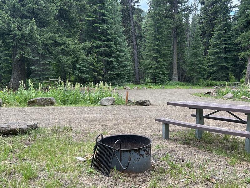
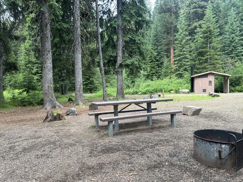
Huckleberry Campground offers a quiet, forested camping experience in the Bear/Cuprum area of the Payette National Forest. The 8-unit campground sits along a small creek suitable for fishing, shaded by mature Ponderosa Pine and Douglas Fir trees. This is a primitive campground with vault toilets and seasonal potable water from a hand pump. The campground operates on a first-come, first-served basis only. Campers must physically arrive to claim and pay for a site. Payment may be available via QR code through the Recreation.gov mobile app where cell service permits. Check-in is at 2:00 p.m. and check-out is 11:00 a.m. Access requires travel on forest roads. From Highway 95, take Council to Cuprum Road #002 (Hornet Ridge Road) to the junction with Forest Road #105 toward Bear, then follow Forest Road #105 to the junction with Forest Road #110 to reach the campground.
Directions
From Highway 95 at Council, take Council to Cuprum Road #002 (Hornet Ridge Road) to the junction with Forest Road #105 toward Bear. Follow Forest Road #105 to the junction with Forest Road #110 to the campground, approximately 30 miles north of Council.
Location
Amenities
| Water | Yes |
| Fires Allowed | Yes |
| Toilets | Yes |
| Dump Station | No |
| Wifi | — |
| Pets Allowed | Yes |
| Showers | No |
| Electric Hookups | — |
| Water Hookups | — |
| Sewer Hookups | — |
| Camp Store | — |
| Price | $10 |
Vehicle
| Max RV Length | — |
| Max Trailer Length | — |
| Big Rig Friendly | — |
| Pull Through Sites | No |
Contact
| Phone | +1 (208) 253-0100 |
Cell Service
| AT&T | None |
| Verizon | None |
| T-Mobile | None |
Availability
Photos
Community Posts
No posts yet. Be the first to share your experience!