Cold Springs Campground
The campground is currently closed and opens May 22, 2026 for first-come-first-served camping. The water system is not yet functioning for the season. Reservable sites can be booked up to six months in advance through Recreation.gov.
Weed Free Hay Order 04-2021-03
Prohibited by this order: Possessing, storing, or transporting non-pelletized hay, straw, or mulch in the Intermountain Region, unless it is certified as weed free by the state where the product originated.
Fireworks and Spark Arrestor Order 04-2021-01
Prohibited by this order: Possessing, discharging, or using any kind of firework or other pyrotechnic device. 36 CFR §261.52(t)Operating or using any internal or external combustion engine without a spark arresting device properly installed, maintained and in effective working order as described…
Explosives and Exploding Target Order 04-2021-02
This order prohibits the use of explosives and exploding targets on National Forest System lands within the Intermountain Region.
About
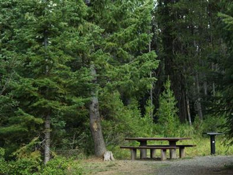
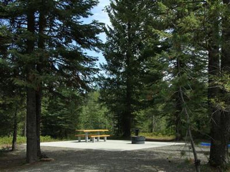
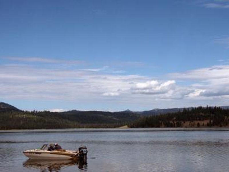
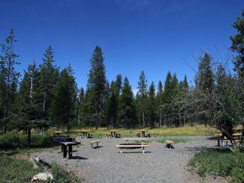
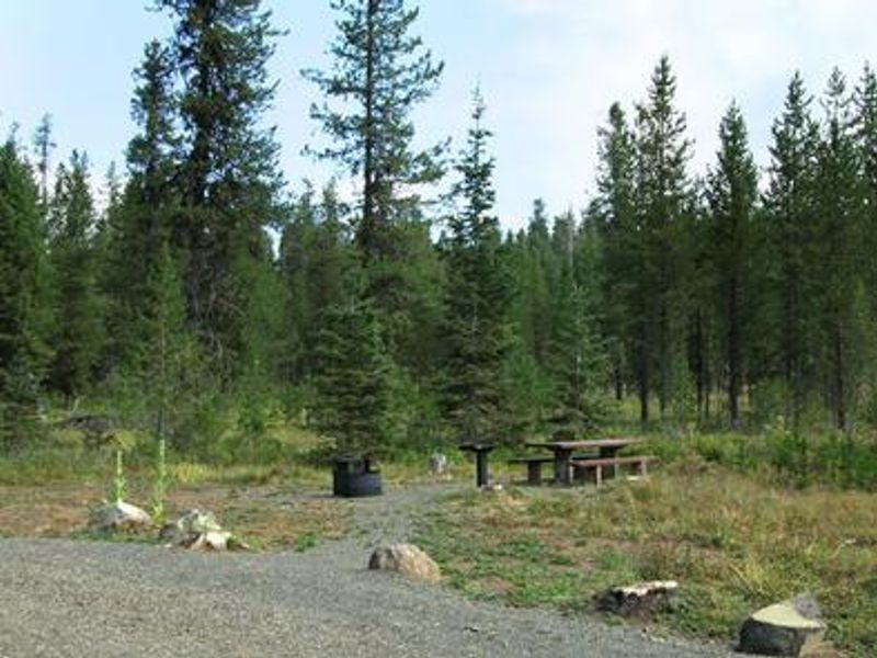
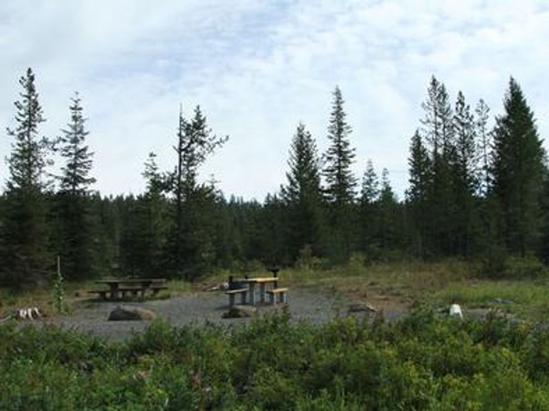
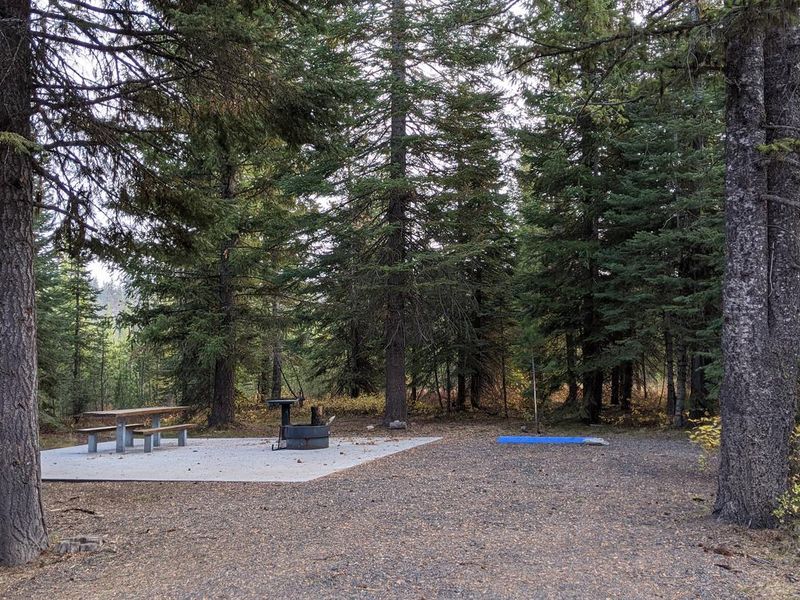
Cold Springs Campground is located near Lost Valley Reservoir in Payette National Forest, approximately 10 miles from New Meadows, Idaho. Set in an open meadow bordered by ponderosa pine and Douglas fir at an elevation of 5,000 feet, the campground offers 32 sites including single, double, and two group sites accommodating 75 and 50 guests respectively. Summer wildflowers are abundant in the surrounding meadows. The campground features vault toilets, potable water from a hand pump during summer months, and fire rings and picnic tables at each site. Two campsites are ADA accessible. A volunteer camp host is typically on-site during the season. There are no hookups, showers, or dump station, and campers must pack out all trash. Lost Valley Reservoir is less than a mile away, offering excellent boating, canoeing, swimming, and fishing opportunities. A boat ramp is located on the southeast shore of the reservoir. The Lost Creek Interpretive Site on the north end of the reservoir provides good bird watching opportunities.
Directions
From New Meadows, head south on Highway 95 for 8 miles. Turn west on Forest Road 089 at the Pine Ridge Store junction. Follow this improved gravel road for approximately three miles to the campground.
Amenities
| Water | Yes |
| Fires Allowed | Yes |
| Toilets | Yes |
| Dump Station | No |
| Wifi | No |
| Pets Allowed | Yes |
| Showers | No |
| Electric Hookups | — |
| Water Hookups | — |
| Sewer Hookups | — |
| Camp Store | No |
| Price | $15 - $20 |
Vehicle
| Max RV Length | 24ft |
| Max Trailer Length | 24ft |
| Big Rig Friendly | — |
| Pull Through Sites | No |
Contact
| Phone | +1 (208) 634-0700 |
Cell Service
| AT&T | None |
| Verizon | Yes |
| T-Mobile | None |
Availability
Photos
Community Posts
No posts yet. Be the first to share your experience!