Hager Mountain Lookout
Open for reservations through May 15, 2026. The lookout closes May 16 when Forest Service fire detection staff take over for the summer season. Reopens November 15. Winter access only via 4-mile snowshoe/ski trek from the trailhead. Contact Silver Lake Ranger District at (541) 576-2107 for current snow and weather conditions before departing.
Red Flag Warning issued July 21 at 4:43PM PDT until July 22 at 11:00PM PDT by NWS Medford OR
* AFFECTED AREA...Areas in southern Oregon along and east of the Cascades and along the western foothills and slopes of the Cascades, including Fire Weather Zones 617...622...623...624 and 625. * THUNDERSTORMS...Moving roughly north to northeast around 20 mph. Storm mode will be mostly wet thunderstorms, but dry lightning strikes can occur outside of wet cores. * OUTFLOW WINDS...Isolated gusts up to 45 mph. * DETAILED URL...View the hazard area in detail at https://weather.gov/wrh/hazards?wfo=mfr
Alcohol Prohibitions
This Order describes acts that are prohibited upon lands, roads and trails within the National Forest System administered by the Forest Service Pacific Northwest Region in regards to alcoholic beverages.
Aquatic Invasive Species
This Order prohibits 1) possessing, storing, or transporting any aquatic invasive animal species AND 2) prohibits possessing, storing, or transporting any aquatic or riparian invasive plant species - on National Forest System lands in the Pacific Northwest Region as specified in the Order.
About
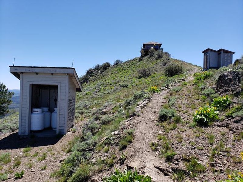
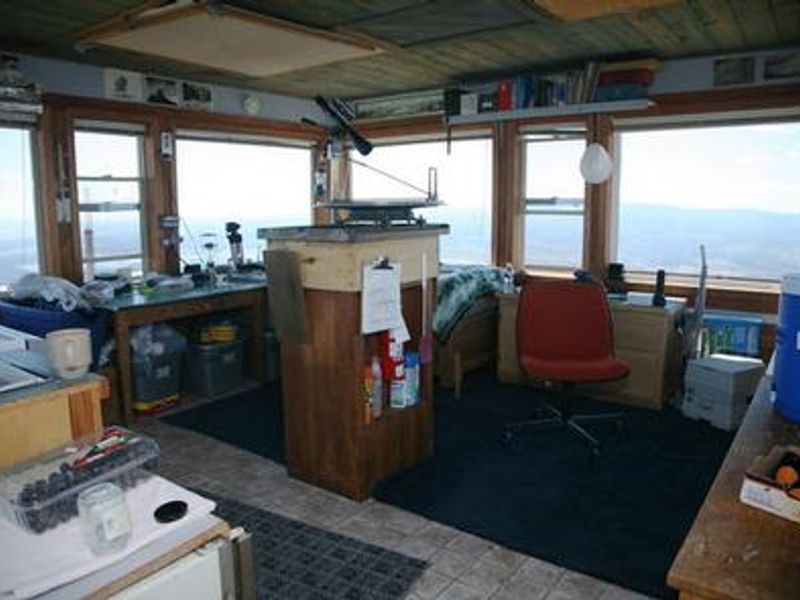
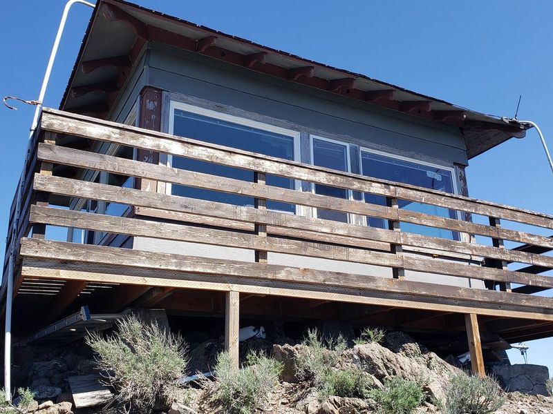
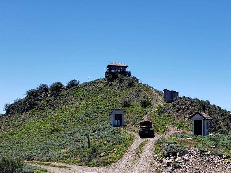
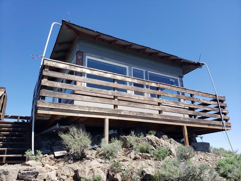
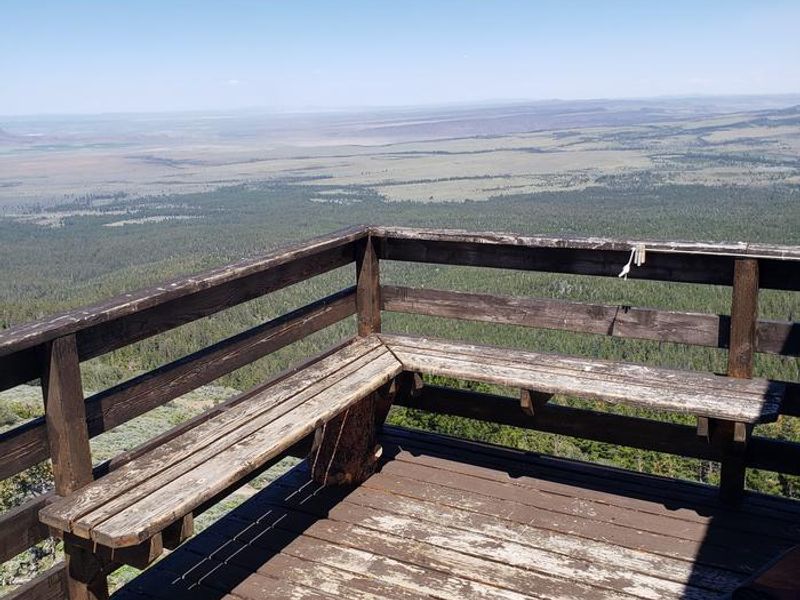
Hager Mountain Lookout sits at 7,195 feet elevation in Oregon's Fremont-Winema National Forest, offering 360-degree panoramic views of the surrounding volcanic landscape. On clear days, visitors can see as far as Mount Hood to the north and Mount Shasta to the south. This historic structure is one of the few remaining fire lookouts still actively staffed for fire detection during summer months, and it opens to the public as a winter rental from November 15 through May 15. The 14x14-foot cabin accommodates up to four people and comes furnished with a bed and mattress, three folding cots, table and chairs, propane stove, woodstove with firewood provided, heater, and refrigerator. Limited cookware is available. A vault toilet and picnic table are located outside. There is no potable water on-site, so guests must bring adequate supplies for drinking, cooking, and washing. Garbage must be packed out. Access to the lookout is a rugged adventure in itself. From the Hager Mountain Trailhead off Forest Road 28, guests must hike, snowshoe, or cross-country ski approximately 4 miles to reach the summit. Winter conditions can change rapidly at this elevation, and several groups have required search and rescue assistance after becoming disoriented. Contact the Silver Lake Ranger District before your trip to check current weather and snow conditions.
Directions
From Silver Lake, take Oregon Highway 31 east for less than half a mile, then turn right onto County Highway 4-12 (East Bay Road). County Highway 4-12 becomes Forest Road 28. Continue on Forest Road 28 for 8.7 miles to the Hager Mountain Trailhead. Take Trail #160 for approximately 4 miles to the summit. In winter, access is by foot, snowshoes, or cross-country skis only.
Nearby Campgrounds
Amenities
| Water | No |
| Fires Allowed | — |
| Toilets | Yes |
| Dump Station | No |
| Wifi | No |
| Pets Allowed | Yes |
| Showers | No |
| Electric Hookups | — |
| Water Hookups | — |
| Sewer Hookups | — |
| Camp Store | No |
| Price | $40 |
Vehicle
| Max RV Length | — |
| Max Trailer Length | — |
| Big Rig Friendly | No |
| Pull Through Sites | No |
Contact
| Phone | +1 (541) 576-2107 |
Cell Service
| AT&T | Yes |
| Verizon | Yes |
| T-Mobile | Yes |
Availability
Photos

Community Posts
No posts yet. Be the first to share your experience!