Confluence Recreation Area
Open for day-use shelter reservations. This is a picnic shelter rental, not an overnight campground. Shelter cancellations must be made at least one day in advance.
Heat Advisory issued October 7 at 8:51AM PDT until October 8 at 10:00PM PDT by NWS Sacramento CA
* WHAT...High temperatures of 92 to 101 degrees expected and overnight low temperatures in the mid 60s to low 70s, with widespread Moderate HeatRisk and areas of Major HeatRisk. * WHERE...The Sacramento and northern San Joaquin Valleys, Delta and Carquinez Strait, and foothills. * WHEN...Until 10 PM PDT Thursday. * IMPACTS...Hot temperatures may cause heat illnesses, especially to anyone without effective cooling and/or adequate hydration. * ADDITIONAL DETAILS...Hottest days expected Today and Thursday. Temperatures begin a cooling trend on Friday, with Moderate HeatRisk in the foothill thermal belts and in Sacramento; Minor HeatRisk elsewhere.
About
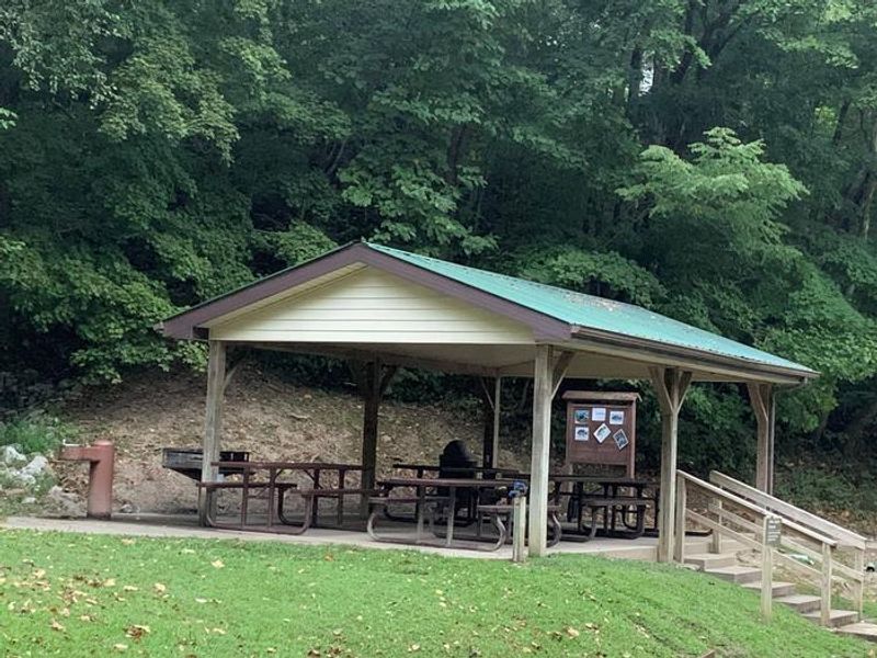
Confluence Recreation Area is a day-use recreation site located at Buckhorn Lake in Perry County, Kentucky, managed by the U.S. Army Corps of Engineers. The facility centers around Hemlock Shelter, a covered group picnic area available for reservation. Visitors can enjoy playground equipment and fishing access along the lake shoreline. This is not an overnight camping facility. The site functions as a picnic shelter rental for day-use activities such as family gatherings, reunions, and group outings. Restroom facilities are available on-site. For overnight camping in the area, visitors should consider nearby Trace Branch Campground, which offers traditional campsites, a boat ramp, and additional recreational facilities. The recreation area sits in the scenic Middle Fork of the Kentucky River valley, where Buckhorn Lake provides opportunities for fishing and boating. Shelter reservations can be made through Recreation.gov, with cancellations required at least one day in advance.
Directions
From Chavies, KY, take a left onto Highway 451. In 4.3 miles, turn right on Trace Branch Road. Continue 2.6 miles and stay right on Mosley Bend Road. In 1.2 miles, turn right onto Bridge Road. The destination is on your right in 0.5 miles.
Amenities
| Water | — |
| Fires Allowed | — |
| Toilets | Yes |
| Dump Station | No |
| Wifi | — |
| Pets Allowed | — |
| Showers | No |
| Electric Hookups | — |
| Water Hookups | — |
| Sewer Hookups | — |
| Camp Store | No |
Vehicle
| Max RV Length | — |
| Max Trailer Length | — |
| Big Rig Friendly | — |
| Pull Through Sites | No |
Contact
| Phone | +1 (606) 398-7251 |
Cell Service
| AT&T | None |
| Verizon | None |
| T-Mobile | None |
Useful Links
| View on Recreation.gov |
Availability
Photos
Community Posts
No posts yet. Be the first to share your experience!