Bald Butte Lookout
Closed for the season. Opens June 15, weather and snow conditions permitting, through October 15. Reservations available via Recreation.gov.
Red Flag Warning issued July 21 at 4:43PM PDT until July 22 at 11:00PM PDT by NWS Medford OR
* AFFECTED AREA...Areas in southern Oregon along and east of the Cascades and along the western foothills and slopes of the Cascades, including Fire Weather Zones 617...622...623...624 and 625. * THUNDERSTORMS...Moving roughly north to northeast around 20 mph. Storm mode will be mostly wet thunderstorms, but dry lightning strikes can occur outside of wet cores. * OUTFLOW WINDS...Isolated gusts up to 45 mph. * DETAILED URL...View the hazard area in detail at https://weather.gov/wrh/hazards?wfo=mfr
Alcohol Prohibitions
This Order describes acts that are prohibited upon lands, roads and trails within the National Forest System administered by the Forest Service Pacific Northwest Region in regards to alcoholic beverages.
Aquatic Invasive Species
This Order prohibits 1) possessing, storing, or transporting any aquatic invasive animal species AND 2) prohibits possessing, storing, or transporting any aquatic or riparian invasive plant species - on National Forest System lands in the Pacific Northwest Region as specified in the Order.
About
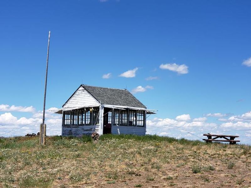
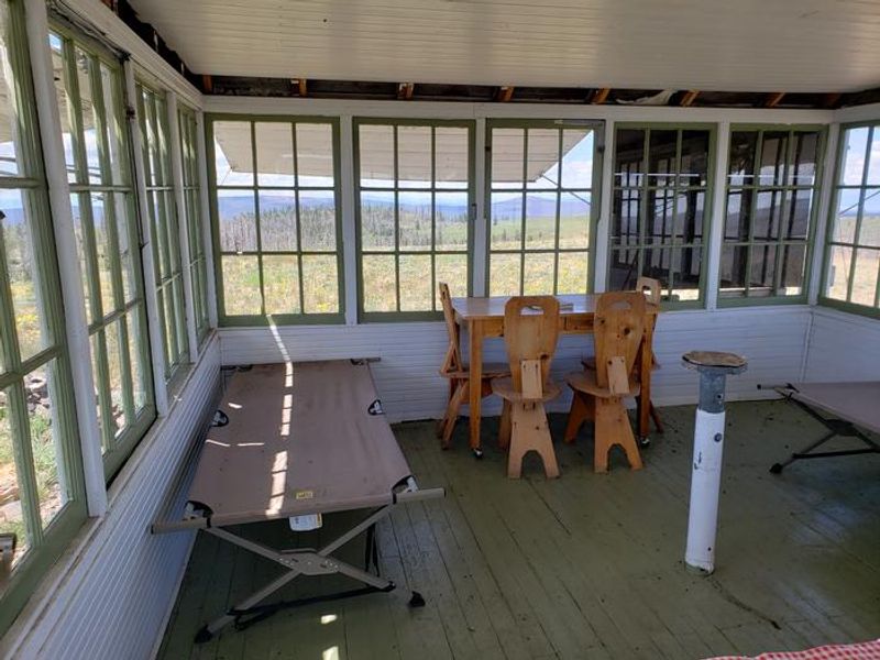
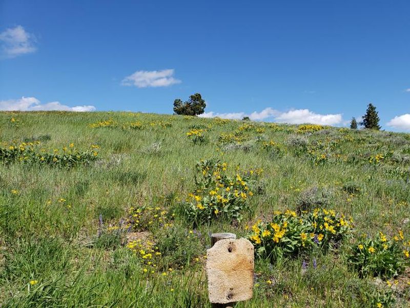
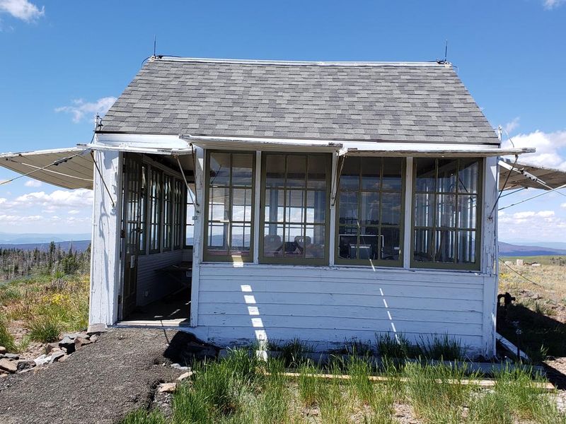
Bald Butte Lookout is a historic fire detection tower built in 1931 using an Aladdin L4 ground-mounted kit, with all materials packed to the remote summit by horseback. The structure served the Forest Service for over 50 years before being abandoned. After falling into disrepair, it was meticulously restored in 1993-1994 as a Passport in Time project, with period furniture built from original 1930s plans. The 14' x 14' lookout sits atop Bald Butte in Fremont-Winema National Forest, offering sweeping views of the Gearhart Wilderness, Dead Horse Rim, and distant snowcapped peaks including Mount Shasta. The exposed summit provides exceptional stargazing due to minimal light pollution. The cozy interior accommodates two guests with cots, a table, bench, and storage cabinets. Propane powers the stove, heater, and lights. Outside amenities include an accessible vault toilet, picnic table, and fire ring. There is no potable water, so guests must bring sufficient supplies for drinking, cooking, and washing. All trash must be packed out. The access road is steep, rough, and potentially rocky for the final two miles, making the lookout unsuitable for RVs or low-clearance vehicles.
Directions
From Paisley, travel 0.5 miles north on Highway 31 and turn left on Mill Street. Stay on Mill Street to the Y junction, then turn right on Forest Road 3315. Continue 21 miles on FR 3315, turn left on FR 28 for 0.5 miles, then right on FR 3411 for 2 miles to unmarked FR 450. Turn right on FR 450 to the summit. The last 2 miles are steep, rough, and may have large rocks requiring removal. Not suitable for low-clearance vehicles or RVs.
Amenities
| Water | No |
| Fires Allowed | Yes |
| Toilets | Yes |
| Dump Station | No |
| Wifi | No |
| Pets Allowed | Yes |
| Showers | No |
| Electric Hookups | — |
| Water Hookups | — |
| Sewer Hookups | — |
| Camp Store | No |
| Price | $40 |
Vehicle
| Max RV Length | — |
| Max Trailer Length | — |
| Big Rig Friendly | No |
| Pull Through Sites | No |
Contact
| Phone | +1 (541) 943-3114 |
Cell Service
| AT&T | None |
| Verizon | Yes |
| T-Mobile | None |
Availability
Photos

Community Posts
No posts yet. Be the first to share your experience!