Demotte
Open for the 2026 season as of May 15. Operating through mid-October, weather dependent. Half of sites available by reservation via Recreation.gov; the other half are first-come, first-served. Bear activity in area requires proper food storage. Highway 67 closes in winter.
Flash Flood Warning issued September 16 at 1:09PM MST until September 16 at 5:15PM MST by NWS Flagstaff AZ
FFWFGZ The National Weather Service in Flagstaff has issued a * Flash Flood Warning for... The Pocket Fire scar in... Coconino County in north central Arizona... Yavapai County in west central Arizona... * Until 515 PM MST. * At 109 PM MST, Doppler radar indicated thunderstorms producing heavy rain over the Pocket Fire scar. Up to 1.5 inches of rain have fallen. Flash flooding is ongoing or expected to begin shortly. HAZARD...Life threatening flash flooding. Thunderstorms producing flash flooding in and around the Pocket Fire scar. SOURCE...Radar indicated. IMPACT...Life threatening flash flooding of areas in and around the Pocket Fire scar. * Some locations that will experience flash flooding include... Sedona, Edge of the World, East Pocket Lookout Tower, Fernow Cabin, Slide Rock State Park, Red Rock-Secret Mountain Wilderness, West Fork of Oak Creek, Indian Gardens and Uptown Sedona. This includes the following highways... State Route 179 near mile marker 313. State Route 89A between mile markers 366 and 368...and between mile markers 374 and 385. This includes the following recreation areas and campgrounds... Manzanita Campground and Cave Springs Campground. This includes the following swimming holes... Slide Rock, Encinoso, Grasshopper Point and Midgely Bridge. This includes the following creeks, washes and rivers... Dry Creek, Spring Creek, West Fork Oak Creek and Oak Creek.
Flash Flood Warning issued September 16 at 12:44PM MST until September 16 at 4:45PM MST by NWS Flagstaff AZ
FFWFGZ The National Weather Service in Flagstaff has issued a * Flash Flood Warning for... Coconino County in north central Arizona... * Until 445 PM MST /545 PM MDT/. * At 1244 PM MST /144 PM MDT/, Doppler radar indicated thunderstorms producing heavy rain across the warned area. Up to 2 inches of rain have fallen. Flash flooding is ongoing or expected to begin shortly. HAZARD...Life threatening flash flooding. Thunderstorms producing flash flooding. SOURCE...Radar indicated. IMPACT...Life threatening flash flooding of creeks and streams, normally dry washes, urban areas, highways, streets and underpasses. * Some locations that will experience flash flooding include... Tappan Spring, Little Colorado River Navajo Tribal Park and Cameron. This includes State Route 64 between mile markers 275 and 295. This includes the following recreation areas and campgrounds... Willows Camp. This includes the following swimming holes... Tappan Spring. This includes the following creeks, washes and rivers... Burro Canyon Wash, Tappan Wash, Cedar Wash, Little Colorado River, Lee Canyon, Deer Tank Wash, Campbell Francis Wash, Moenkopi Wash, Lava Wash and Needmore Wash.
Flash Flood Warning issued September 16 at 12:18PM MST until September 16 at 4:15PM MST by NWS Flagstaff AZ
FFWFGZ The National Weather Service in Flagstaff has issued a * Flash Flood Warning for... Coconino County in north central Arizona... This includes Bright Angel Creek and the Colorado River between river miles 79 and 92. * Until 415 PM MST. * At 1218 PM MST, Doppler radar indicated thunderstorms producing heavy rain across the warned area. Up to 1 inch of rain has fallen. Flash flooding is ongoing or expected to begin shortly. HAZARD...Life threatening flash flooding. Thunderstorms producing flash flooding. SOURCE...Radar indicated. IMPACT...Life threatening flash flooding of creeks and streams, normally dry washes, urban areas, highways, streets and underpasses. * Some locations that will experience flash flooding include... Bright Angel Point, Phantom Ranch, Cape Royal Point, Pipe Creek Resthouse, Buddha Cloister, Devils Corkscrew and Plateau Point. This includes the Colorado River between river miles 79 and 92. This includes the following recreation areas and campgrounds... Ribbon Falls, Bright Angel Campground, North Rim Campground, Cottonwood Campground, Below Sockdolager Camp Site, Clear Creek Camp Site, Below Clear Creek Camp Site, Zoroaster Camp Site, Above Cremation Camp Site, Upper Cremation Camp Site, Lower Cremation Camp Site, Roy's Beach Camp Site, Boat Beach Camp Site, Below Pipe Creek Camp Site, 91 Mile Creek Camp Site, Trinity Creek Camp Site, Manzanita Rest Area, Pipe Creek Rest Area and Roaring Springs. This includes the following creeks, washes and rivers... Vishnu Creek, Horn Creek, Bright Angel Creek, Zoroaster Canyon, Colorado River, Clear Creek, Garden Creek, Lonetree Canyon, Boulder Creek, Pipe Creek, Trinity Creek, Asbestos Canyon, 91- Mile Creek, Mineral Canyon, Ninetyone Mile Creek, Salt Creek, Cremation Creek, Nankoweap Canyon and Hance Creek.
About
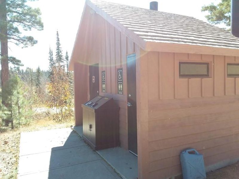
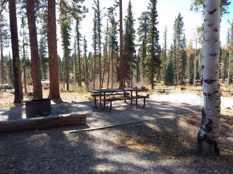
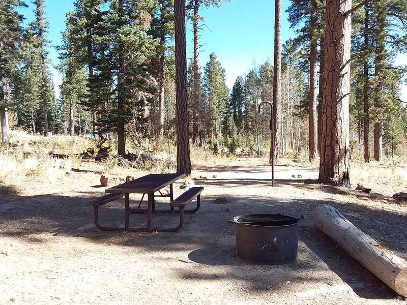
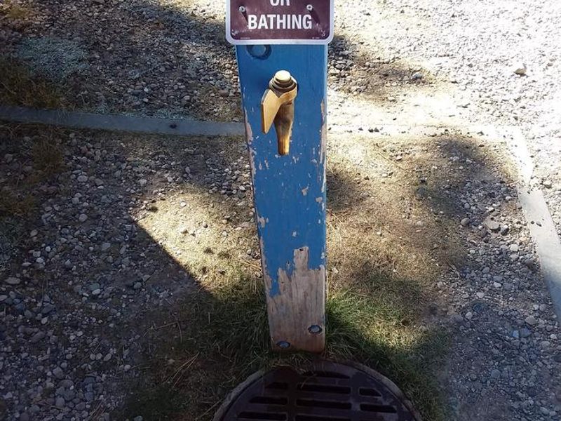
DeMotte Campground is a 38-site developed campground located on Arizona Highway 67, approximately 25 miles south of Jacob Lake and 7 miles north of the Grand Canyon National Park's North Rim entrance. The campground sits at high elevation on the Kaibab Plateau surrounded by spruce-fir and ponderosa pine forests, providing a cooler mountain climate during summer months. The campground accommodates tents, trailers, and small motor homes. Each site includes a picnic table and cooking grill. Vault toilets and potable water are available, though water is limited and RV tank filling is not permitted. There are no hookups, showers, or dump station on site. The area is home to diverse wildlife including the tassel-eared Kaibab squirrel, found nowhere else in the world. Bear activity is common in the area; proper food storage is mandatory. Checkout time is 2:00 PM and stays are limited to 14 consecutive nights.
Directions
From Kanab, UT: 40 miles south on US Route 89A to AZ State Route 67 at Jacob Lake, then 25 miles south on AZ 67 to the campground. From Bitter Springs intersection of US 89 and 89A: Take 89A north 55 miles to Jacob Lake, then south 25 miles on AZ 67.
Amenities
| Water | Yes |
| Fires Allowed | Yes |
| Toilets | Yes |
| Dump Station | No |
| Wifi | No |
| Pets Allowed | Yes |
| Showers | No |
| Electric Hookups | — |
| Water Hookups | — |
| Sewer Hookups | — |
| Camp Store | No |
| Price | $30 |
Vehicle
| Max RV Length | 40ft |
| Max Trailer Length | 40ft |
| Big Rig Friendly | No |
| Pull Through Sites | No |
Contact
| Phone | +1 (928) 643-7395 |
Cell Service
| AT&T | None |
| Verizon | None |
| T-Mobile | None |
Availability
Photos
Community Posts
No posts yet. Be the first to share your experience!