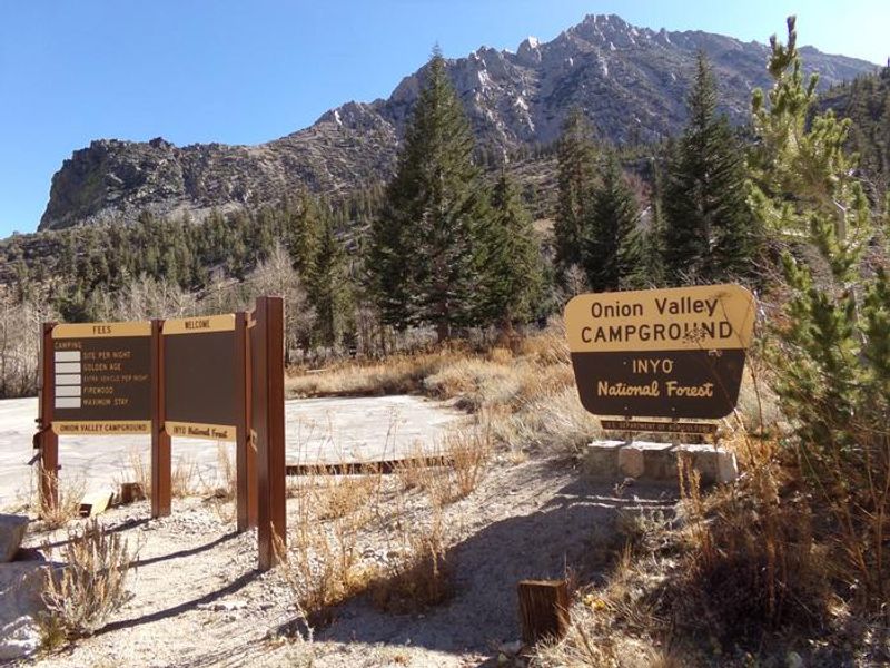
Onion Valley
Closed for winter. The campground typically opens in May and operates through mid-October, depending on snow conditions. Onion Valley Road opening depends on snow clearance by Inyo County. Reservations available via Recreation.gov until September 15; first-come, first-served thereafter.
High Wind Warning issued May 17 at 12:12AM PDT until May 18 at 5:00AM PDT by NWS Las Vegas NV
* WHAT...Northwest winds 25 to 35 mph with gusts between 50 and 60 mph. A few gusts to 70 mph are possible. * WHERE...White and Inyo Mountains, Eastern Sierra Slopes, Death Valley National Park, Owens Valley South, Owens Valley North, and Esmeralda and Central Nye County. * WHEN...From 11 AM this morning to 5 AM PDT Monday. * IMPACTS...Damaging winds will blow down trees and power lines. Widespread power outages are expected. Travel will be difficult, especially for high-profile vehicles.
Fireworks and Explosives are always Prohibited
Fireworks and explosives (including explosive targets) are always prohibited on national forest lands. The prohibition of fireworks and exploding targets on national forest system lands is part of a set of permanent fire safety regulations in the Code of Federal Regulations (CFR), listed below.…
Mammoth Scenic Loop Closure
Our partners are helping the Town of Mammoth Lakes do hazard tree mitigation along the Mammoth Scenic Road. Both gates on the Scenic Loop will be closed for approximately 33 days beginning May 6 due to critical forest health work in the Inyo Craters area.This isn’t just routine maintenance, this…
ANCIENT BRISTLECONE PINE AREA CLOSURE
To provide for public safety and the protection of resources within the Inyo National Forest.
Help Halt Golden Mussel Invasion
The non-native, highly invasive golden mussel was discovered in Sacramento-San Joaquin Delta in October 2024. Once established, they can affect flood control by reducing water flow and contribute to harmful algal blooms. Please contact the waterbody you plan to visit for latest information about…
Monache Meadows Area Seasonal Road Closure
To provide for public safety and protection of natural resources during snowy and muddy conditions.
Stay Limits, Parking, and Developed Recreation Site Use
This forest order was put in place to protect natural resources and promote public safety.
Reds Meadow Road Reconstruction Project
www.fs.usda.gov/r05/inyo/projects/reds-meadow-road-reconstruction
Wilderness Use Restrictions
This Forest Order prohibits recreating within the portions of the John Muir, Ansel Adams, Hoover, and Golden Trout Wildernesses located in the Inyo National Forest. Please click on the PDF version for all Exhibit maps B - G. The website will not allow for more JPG formats to be uploaded than what…
Mount Whitney Zone Access Restrictions
This forest order prohibits recreating in the Mount Whitney Zone to provide for public safety and protect natural resources.
Ansel Adams and John Muir Wilderness Campfire Restrictions
This forest order prohibits campfires in portions of Ansel Adams and John Muir Wilderness Areas that are located on the Inyo National Forest, as shown on the Exhibits.Please click on the PDF version for all Exhibit maps B - S. The website will not allow for more JPG formats to be uploaded than what…
Golden Trout and Hoover Wilderness Campfire Restrictions
This forest order prohibits campfires in portions of Golden Trout and Hoover Wilderness Areas that are located on the Inyo National Forest, as shown in the Exhibits.
Eastern Sierra Climate and Communities Resilience Project Area Closure
This forest order prohibits access to roads affected by the Eastern Sierra Climate and Communities Resilience Project to provide for public safety while contractors perform forest health and fuels reduction work surrounding the Town of Mammoth Lakes and beyond. The closure orders are dynamic and…
Hot Creek Closure Order
This Forest Order prohibits recreating in Hot Creek within the Mammoth Ranger District.
Goat Prohibition Order
This Forest Order prohibits possessing or storing a goat within the Inyo National Forest Goat Prohibition Area.
Mammoth Mill Site Area and Trail Closure
This Forest Order prohibits recreating, entering or being in the Mammoth Mill Site Closure Area and the Mammoth Stamp Mill Trail.
B&B Mine Closure Order
This Forest Order prohibits recreating within the B&B Mine and Mill Site Closure Area.
Food and Refuse Storage Restrictions
This Forest Order prohibits food and refuse in locations in Exhibits A and C-J, unless stored in a bear-resistant container. Food and refuse in locations shown in Exhibit B must be stored in a bear-resistant container OR counter-balanced at least 15 feet above the ground and 10 feet horizontally…
About
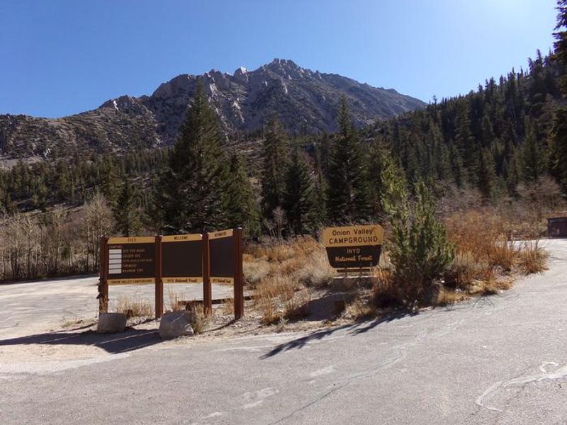
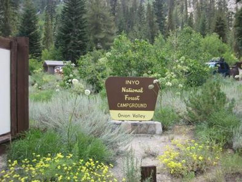
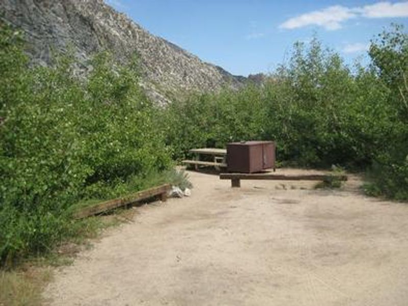
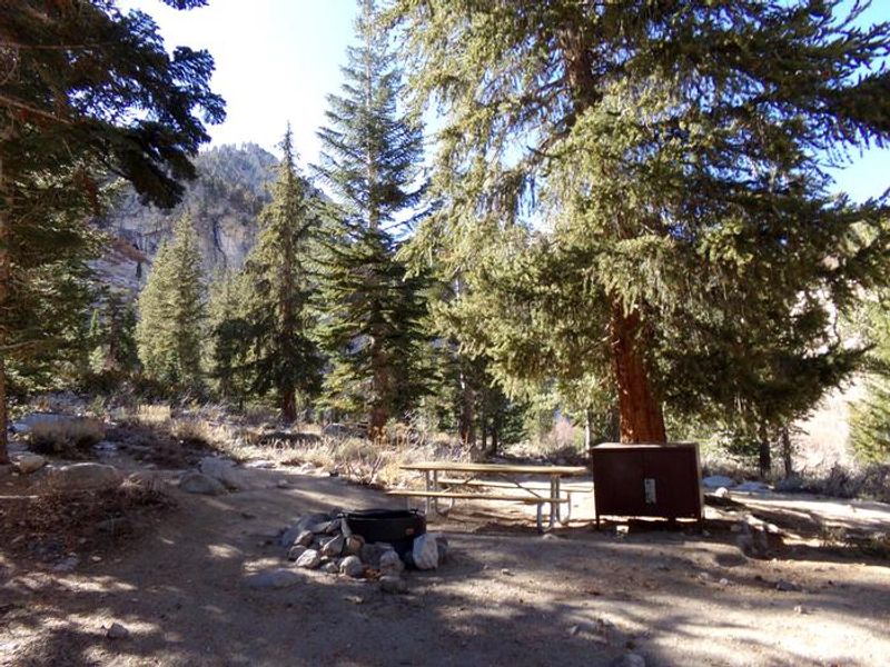
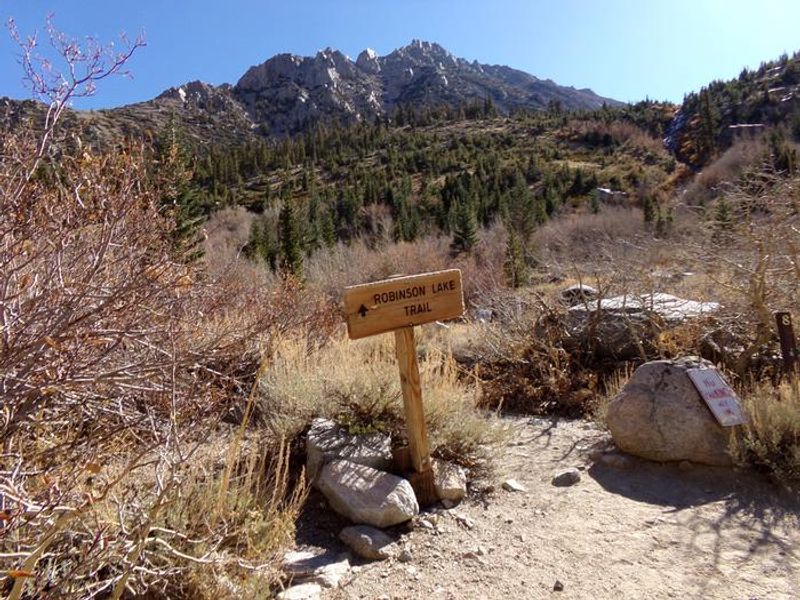
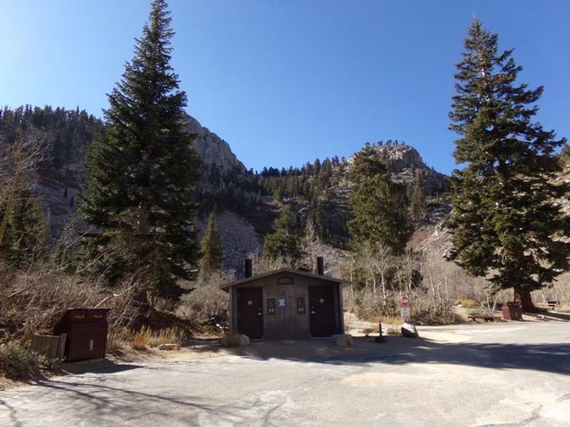
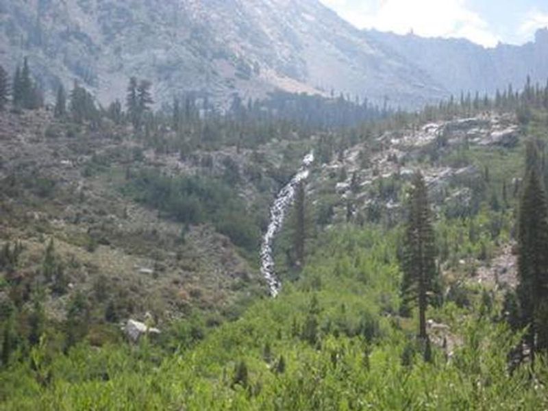
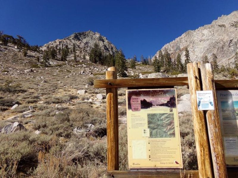
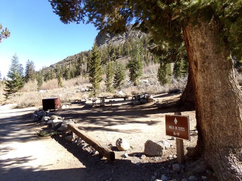
Onion Valley Campground occupies one of the most dramatic settings in the eastern Sierra Nevada, nestled at 9,600 feet amid rugged granite peaks at the end of Onion Valley Road west of Independence. The 29 campsites sit adjacent to a creek beneath lodgepole pines and aspens, with wildflowers coloring the landscape in early summer. This location makes it an essential staging area for backpackers heading into the John Muir Wilderness via Kearsarge Pass, which provides access to the Pacific Crest Trail and Sequoia-Kings Canyon backcountry. The campground operates seasonally, typically May through mid-October depending on snow conditions. Reservations are available through Recreation.gov until September 15, after which sites become first-come, first-served. The steep access road is not recommended for trailers; maximum vehicle length is 25 feet, and tent trailers are permissible. There is no potable water on-site, so campers must bring adequate supplies. Due to high bear activity throughout the Onion Valley area, bear-proof food storage lockers are provided at each site and their use is mandatory. Vault toilets and bear-proof trash receptacles are available. Firewood is sold in the campground. Anglers can fish for rainbow, brown, brook, and Alpers trout in Robinson Lake and the nearby creek.
Directions
From Highway 395 in Independence, turn west on Market Street which becomes Onion Valley Road. Follow for approximately 15 miles to the campground at 9,600 feet elevation. The road is steep and winding; trailers are not recommended.
Amenities
| Water | No |
| Fires Allowed | Yes |
| Toilets | Yes |
| Dump Station | — |
| Wifi | No |
| Pets Allowed | Yes |
| Showers | No |
| Electric Hookups | — |
| Water Hookups | — |
| Sewer Hookups | — |
| Camp Store | No |
| Price | $31 |
Vehicle
| Max RV Length | 25ft |
| Max Trailer Length | 25ft |
| Big Rig Friendly | No |
| Pull Through Sites | No |
Contact
| Phone | +1 (760) 876-6200 |
Cell Service
| AT&T | Yes |
| Verizon | Yes |
| T-Mobile | None |
Availability
Photos
Community Posts
No posts yet. Be the first to share your experience!