Tumwater Group Site
Closed indefinitely since September 2014 due to debris flow and flooding hazards from the Chiwaukum Fire. Infrastructure has deteriorated during the closure. No reopening date has been announced.
Heat Advisory issued July 21 at 10:05PM PDT until July 23 at 9:00PM PDT by NWS Spokane WA
* WHAT...Hot temperatures with daytime highs in the mid 90s to low 100s Wednesday and Thursday. This will pose a moderate to major risk of heat-related illness. * WHERE...Portions of North and North Central Idaho and Central, East Central, North Central, Northeast, and Southeast Washington. * WHEN...Until 9 PM PDT Thursday. * IMPACTS...Hot temperatures may cause heat illnesses. * ADDITIONAL DETAILS...Wednesday will likely be the hottest day with widespread moderate and major HeatRisk. Limited overnight relief expected across the lower elevations Wednesday and Thursday mornings with low temperatures in the mid 60s to mid 70s.
About
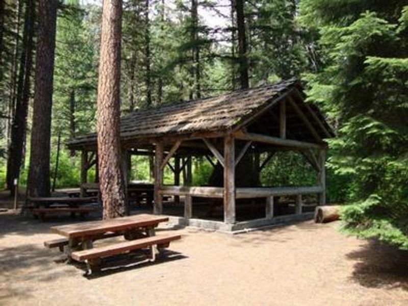
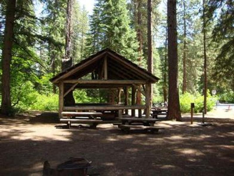
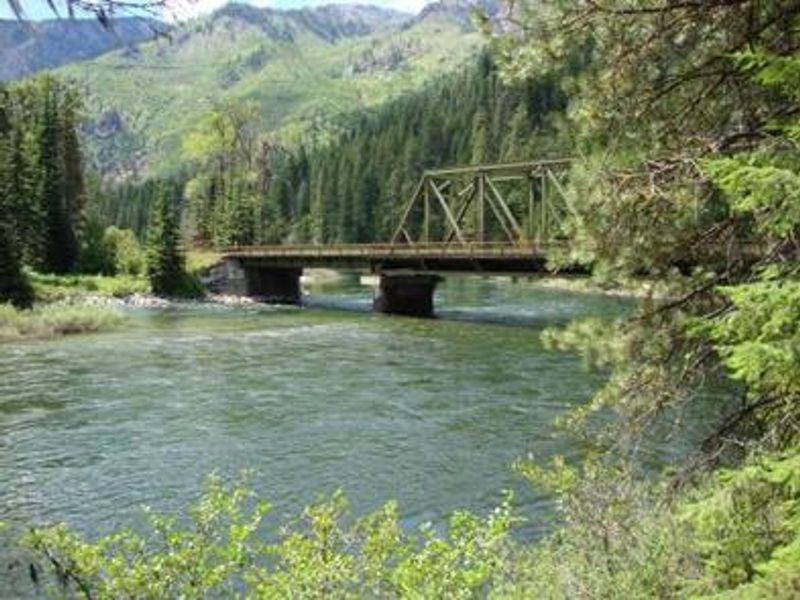
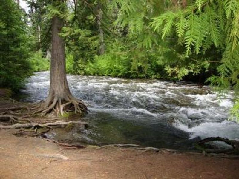
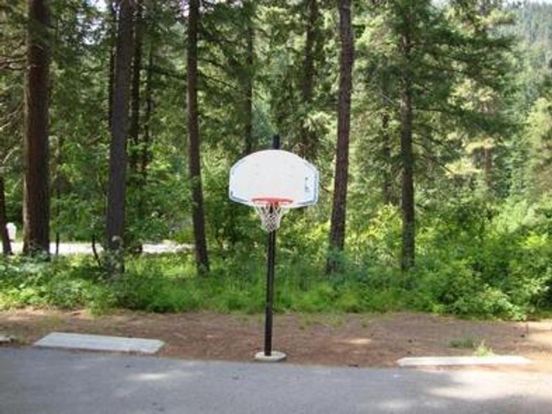
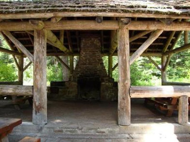
Tumwater Group Site sits along Highway 2 in scenic Tumwater Canyon, at the confluence of Chiwaukum Creek and the Wenatchee River in the Okanogan-Wenatchee National Forest. The area offered access to fishing for trout and salmon, hiking, and winter activities including skiing, snowmobiling, and tubing at nearby Sno-Parks. The group site could accommodate up to 70 people and 40 vehicles, with a maximum trailer length of 50 feet. Facilities included a group shelter with fireplace, basketball court, flush toilets, and potable water. The group site fee was $100 per night when operational. The campground was closed in September 2014 due to safety concerns from debris flows and flooding caused by the Chiwaukum Fire. During the extended closure, the sewage treatment system became inoperable, hazard trees accumulated, and other infrastructure deteriorated. As of January 2026, the closure remains in effect indefinitely while the Forest Service evaluates redesign and repair options.
Directions
From Leavenworth, take US-2 West for about 10 miles. The campground is on the right side of the highway. From the west, take Highway 2 east through Monroe and over Stevens Pass; the campground is approximately 20 miles east of the summit on the left.
Amenities
| Water | Yes |
| Fires Allowed | Yes |
| Toilets | Yes |
| Dump Station | — |
| Wifi | — |
| Pets Allowed | — |
| Showers | — |
| Electric Hookups | — |
| Water Hookups | — |
| Sewer Hookups | — |
| Camp Store | — |
| Price | $100 |
Vehicle
| Max RV Length | 25ft |
| Max Trailer Length | 25ft |
| Big Rig Friendly | No |
| Pull Through Sites | No |
Contact
| Phone | +1 (509) 548-2550 |
Cell Service
| AT&T | None |
| Verizon | None |
| T-Mobile | None |
Availability
Photos
Community Posts
No posts yet. Be the first to share your experience!