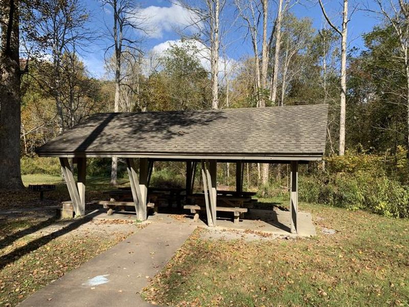
Sycamore Flats Picnic Shelter
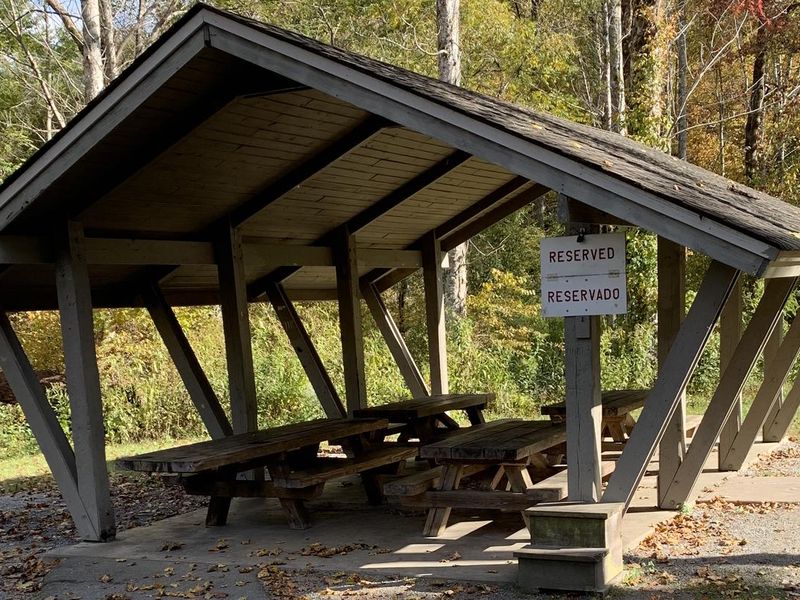
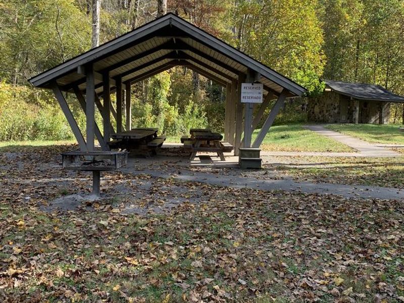
Open for day use only. Hours are 7am to 9pm. Overnight camping is not permitted. The shelter is reservable from April 16 through mid-November; first-come, first-served mid-November through April 15. Shelter reservation fee is $50.
Flood Warning issued October 11 at 5:24AM EDT until October 11 at 11:15AM EDT by NWS Greenville-Spartanburg SC
* WHAT...Flooding caused by excessive rainfall is expected. * WHERE...Henderson County in western North Carolina... Eastern Transylvania County in western North Carolina... * WHEN...Until 1115 AM EDT. * IMPACTS...Flooding of rivers, creeks, streams, and other low-lying and flood-prone locations is imminent or occurring. * ADDITIONAL DETAILS... - At 517 AM EDT, Doppler radar indicated heavy rain has recently departed Transylvania and most of Henderson County. Flooding is ongoing or expected to begin shortly in the warned area. Between 3 and 6 inches of rain have fallen, but only light additional rain is expected. Most of the flooding is due to run off from previous rainfall. Mud Creek in Hendersonville is in Minor Flood, and still rising. Common, deeper flooding of low-lying areas adjacent to Mud Creek is developing with lesser impacts to vulnerable property. More significant floodwaters are beginning to impact low-lying areas, including areas of William H. King Memorial Park and the Oklawaha Greenway, with inundation approximately 2-4 ft deep. Secondary roads and outbuildings may be experiencing flooding up to 1-2 ft deep. - Additional areas of Minor Flooding are expected to develop over the next 1-3 hours. Please obey all barricades and heed all evacuation orders from local Emergency Management officials. Only a few inches of water can strand your vehicle and only 6 inches of water can sweep your vehicle away. - Some locations that will experience flooding include... Hendersonville, Brevard, Mills River, Fletcher, Flat Rock, Etowah, Mountain Home, Laurel Park, Rosman and Dupont State Forest. - http://www.weather.gov/safety/flood
Flood Warning issued October 11 at 1:54AM EDT until October 12 at 10:00AM EDT by NWS Greenville-Spartanburg SC
...The National Weather Service in Greenville-Spartanburg has issued a Flood Warning for the following rivers in North Carolina... French Broad River at Grove Bridge Rd in Blantyre affecting Henderson and Transylvania Counties. * WHAT...Minor flooding is forecast. * WHERE...French Broad River at Grove Bridge Rd in Blantyre. * WHEN...From early this morning to Monday morning. * IMPACTS...At 16.0 feet, Minor Flood Stage. Farmland flooding continues on both sides of the French Broad River. Floodwaters begin to impact boat access areas at Grove Bridge Rd. and Crab Creek Rd. At 17.0 feet, Minor Flooding continues. Floodwaters continue to inundate farmland between the French Broad River and the old railroad bed. Floodwaters may start to inundate the shoulders of River Road near the Big Willow Road intersection. Floodwaters continue to impact boat access areas at Grove Bridge Rd. and Crab Creek Rd. * ADDITIONAL DETAILS... - At 1:30 AM EDT Sunday the stage was 15.0 feet and rising steadily. - Forecast...The river is expected to rise to a crest of 17.5 feet later today. It will then fall below Minor Flood Stage late this evening. - Minor Flood Stage is 16.0 feet. - http://www.weather.gov/safety/flood
Flood Watch issued October 10 at 10:47PM EDT until October 11 at 2:00PM EDT by NWS Greenville-Spartanburg SC
* WHAT...Flash flooding caused by excessive rainfall continues to be possible. * WHERE...In Northeast Georgia, the following counties: Elbert, Franklin, Habersham, Hart, Rabun and Stephens. In western North Carolina, the following counties: Avery, Buncombe, Burke, Caldwell, McDowell, Polk, Rutherford, Haywood, Henderson, Macon, Mitchell, Jackson, Transylvania and Yancey. In Upstate South Carolina, the following counties: Abbeville, Anderson, Central Greenville, Greater Oconee, Greater Pickens, Greenville, Greenwood, Laurens, Spartanburg, and Oconee. * WHEN...Through Sunday afternoon. * IMPACTS...Excessive runoff may result in flooding of rivers, creeks, streams, and other low-lying and flood-prone locations. Creeks and streams may rise out of their banks. Low-water crossings may be flooded. * ADDITIONAL DETAILS... - As the remnants of Isaias move northward into the lower Ohio Valley, periods of rain will continue. High rainfall rates will continue in short bursts through the overnight hours. By Sunday morning, total accumulations of generally 5 to 8 inches are expected along the southeast-facing Blue Ridge Escarpment, with 2 to 5 inches elsewhere in the watch area. - http://www.weather.gov/safety/flood
About
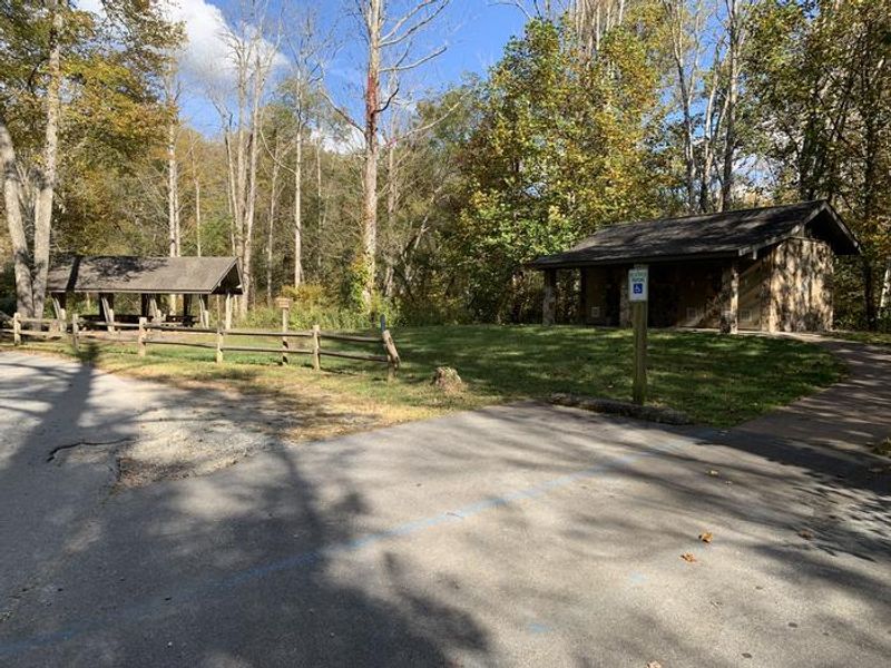
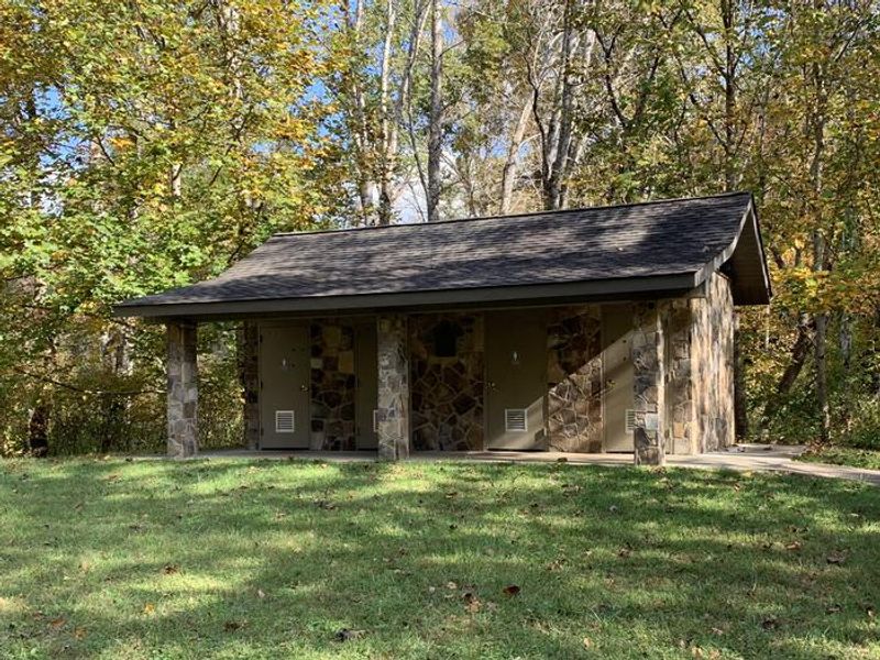
Sycamore Flats Picnic Shelter is a shaded day-use picnic area nestled in a bend of the Davidson River within Pisgah National Forest. The site was named for the distinctive sycamore trees that line the riverbanks and is surrounded by lush hardwood forest and rhododendron. The reservable shelter accommodates up to 40 people and includes four picnic tables and one grill. The broader picnic area features 40 tables with grills, two restrooms (one wheelchair accessible), and an accessible fishing pier. Popular activities include swimming, wading, trout fishing, and tubing on the Davidson River. Hours are 7am to 9pm; overnight camping is not permitted. The Pisgah Visitor Center is 1.5 miles up Highway 276 and offers interpretive displays, maps, and a gift shop. Nearby attractions include the Cradle of Forestry, Pisgah Fish Hatchery, and nearly 400 miles of hiking, biking, and equestrian trails throughout the forest.
Directions
Located along Highway 276 (Forest Heritage National Scenic Byway) approximately 1 mile from the intersection of Highway 280 and US 64 in Pisgah Forest, NC, and approximately 15 miles from the Blue Ridge Parkway.
Amenities
| Water | No |
| Fires Allowed | — |
| Toilets | Yes |
| Dump Station | No |
| Wifi | No |
| Pets Allowed | — |
| Showers | No |
| Electric Hookups | — |
| Water Hookups | — |
| Sewer Hookups | — |
| Camp Store | No |
| Price | $50 |
Vehicle
| Max RV Length | — |
| Max Trailer Length | — |
| Big Rig Friendly | — |
| Pull Through Sites | No |
Contact
| Phone | +1 (828) 877-3265 |
Cell Service
| AT&T | Yes |
| Verizon | Yes |
| T-Mobile | Yes |
Availability
Photos
Community Posts
No posts yet. Be the first to share your experience!