Swinging Bridge

Closed

The campground is currently closed for the season and reopens May 22, 2026. The operating season typically runs mid-May through late September, depending on snow conditions. Reservations available through Recreation.gov.

Weed Free Hay Order 04-2021-03

Prohibited by this order: Possessing, storing, or transporting non-pelletized hay, straw, or mulch in the Intermountain Region, unless it is certified as weed free by the state where the product originated.

Fireworks and Spark Arrestor Order 04-2021-01

Prohibited by this order: Possessing, discharging, or using any kind of firework or other pyrotechnic device. 36 CFR §261.52(t)Operating or using any internal or external combustion engine without a spark arresting device properly installed, maintained and in effective working order as described…

Explosives and Exploding Target Order 04-2021-02

This order prohibits the use of explosives and exploding targets on National Forest System lands within the Intermountain Region.

Rainbow Point Campground and Boat Access Closure

Rainbow Point Campground and Boat Access will be closed through Nov. 30, 2027 for public safety due to hazard trees and their removal.

Deer Point Road, Trail and Area Closure June 8 - Aug. 14, 2026

The purpose of this order is to protect public safety during timber harvest operations related to the Deer Point Stewardship Project. These closures are in effect from Monday at 6 a.m. through Friday at 6 p.m. (open on weekends) beginning June 8 through August 14, 2026.

National Forest System Road #304 Closure for Bridge Construction

The purpose of this order is to protect public and safety during bridge construction on Road 304.

National Forest System Road #456 Closure

National Forest System Road #456 (Golden Gate Road), located 2 miles south of Yellow Pine, ID, will be closed from May 29, 2026 at 10:00 AM through August 22, 2026, at 8:00 PM. The purpose of this closure order is to protect public safety during approved exploration drilling activities.

Pine Flats Campground Area and Road Closure

The purpose of this Order is to protect public safety during the timber falling operations of hazard trees in and around the Pine Flats Campground. This order is in effect from May 12 at 8:00 a.m. through June 30, 2026. This order will be rescinded if tree removal operations end early.

Grimes Creek Area Closure

To protect public safety and natural resources, it is prohibited to enter or be on the Described Area in Exhibit A.

Antelope & Hollywood Campgrounds Closed for Construction

The purpose of this Order is to protect public safety during construction and remediation of the Antelope and Hollywood Campgrounds. These campgrounds will be modernized to accommodate more RV camping, improved amenities, more campsites overall, and adding a toilet. Construction is expected to last…

Sage Hen Creek Campground & Boat Ramp, and Eastside Campground closed for construction

Sage Hen Creek and Eastside campgrounds, along with Sage Hen Creek Boat Ramp, will be closed through July 1, 2026 while construction and remediation activities occur to update these sites.

Atlanta Area Roads 268M & 268MX1 Closure

The purpose of this order is to protect public health, safety and natural resources along two short roadways associated with the community of Atlanta's transfer station.

Lava Fire Road Closure

Updated closure of National Forest System Road 625, and portions of NFSRs 653 and 624 due to safety hazards resulting from the 2024 Lava Fire. These routes are closed to motorized and mechanized travel, but open to foot and livestock use.

Public Safety Occupancy and Use on all Boise National Forest Lands

To protect public safety it is prohibited to: Park or leave a vehicle in violation of posted instructions. Be publicly nude. Entering any body of water in violation of Idaho State Law or county ordinance. Possessing or storing any materials containing nails, screws, or other metal hardware,…

Lowman Ranger District Dispersed Camping Area Closure

To protect undeveloped campsites from overuse and to let highly impacted areas to recover, it is prohibited to camp in unmarked locations in the Designated Area of the Lowman Ranger District.

William Pogue and Roaring River Trail Closure Order

Portions of the William Pogue and Roaring River Trails are closed.

South Fork Salmon Road Closure

To protect public safety and prevent potential resource damage during the spring thaw, it is prohibited to operate a motor vehicle that is more than 10,000 lbs on the steering axle and tire width less than 9 inches, or more than 300 lbs per inch of tire on all axles, from March 15 to June 1…

Rainbow Basin Occupancy and Use

To protect natural resources and public health and safety, it is prohibited to: Using a bicycle or motor vehicle on a Described Trail. Possessing a saddle, pack, or draft animal. Possessing or operating a motorboat. Possessing or transporting any motor or mechanical device capable of propelling…

Occupancy and Use

Details camping stay restrictions for more than 14 days during any 30-day period throughout the year.

Wilson Creek Trail System Temporary Closure to Motor Vehicle Use

To protect big game during critical life stages, it is prohibited to use any type of motor vehicle on the Restricted Trails from Oct. 1 to June 15.

About

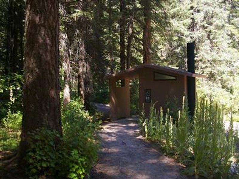
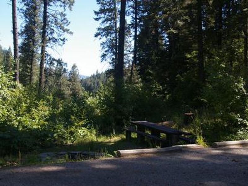
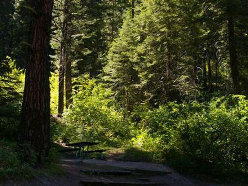
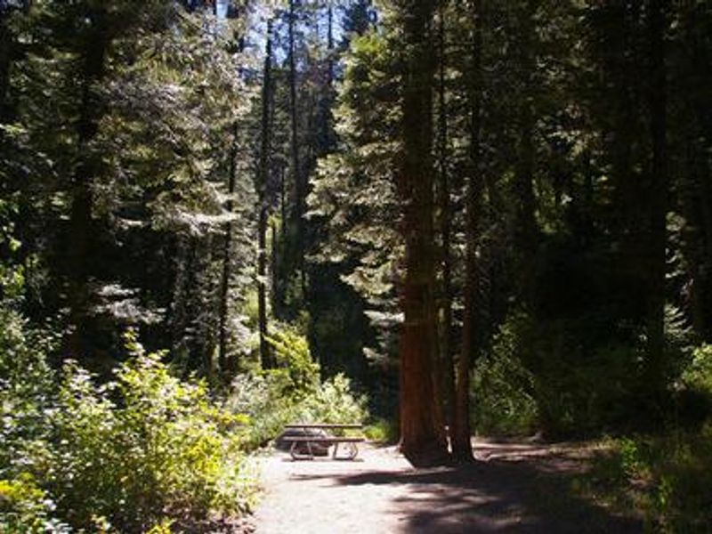
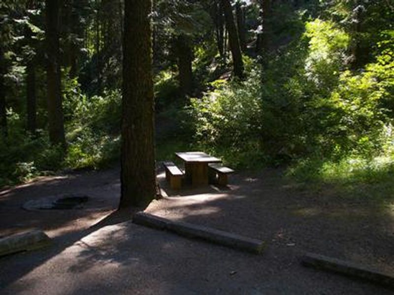
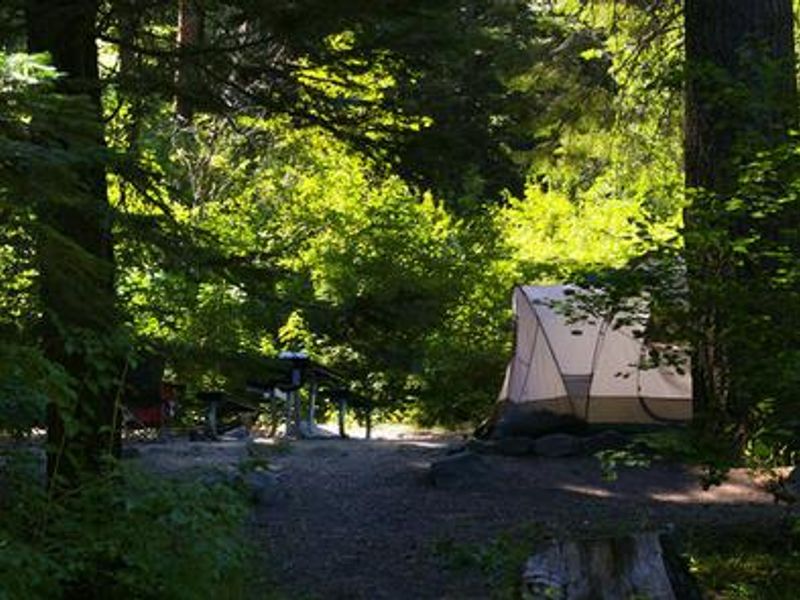
Swinging Bridge Campground is located 10 miles north of Banks, Idaho along State Highway 55 at an elevation of 4,000 feet. The campground occupies a scenic canyon position just above the highway, with the North Fork Payette River flowing nearby. The surrounding mountains are forested with a mix of Ponderosa and lodgepole pines, providing plentiful shade throughout most of the campground. The North Fork Payette River is renowned as a destination for expert kayaking and extreme whitewater. Additional whitewater rafting opportunities exist nearby on the Main and South Fork sections of the Payette River. Anglers will find good to excellent fishing for whitefish and rainbow trout. Summer temperatures typically reach 80-90 degrees during the day with cooler nights. The campground offers 7 single-family sites with paved roads and parking spurs. Each site includes a picnic table and campfire ring. Vault toilets and potable water are provided. Sites accommodate vehicles up to 30 feet with back-in configuration. Reservations are available through Recreation.gov.

Directions

From Horseshoe Bend, Idaho, take State Route 55 north for 21.5 miles to the campground sign. Turn left after the sign into the campground on the west side of the highway.

Amenities

Water Yes
Fires Allowed Yes
Toilets Yes
Dump Station No
Wifi
Pets Allowed
Showers No
Electric Hookups
Water Hookups
Sewer Hookups
Camp Store
Price $18

Vehicle

Max RV Length 40ft
Max Trailer Length 40ft
Big Rig Friendly No
Pull Through Sites No

Contact

Phone +1 (541) 351-1182

Cell Service

AT&T None
Verizon None
T-Mobile None

Availability

Photos

Community Posts

No posts yet. Be the first to share your experience!