Stuart Recreation Area
Open mid-April through Columbus Day weekend in October. Reservations accepted via Recreation.gov 5-360 days in advance; some sites are first-come, first-served. Gates locked 9 p.m. to 7 p.m. Maximum 14-day stay. The recreation area may flood during high water events.
Wind Advisory issued October 10 at 11:49AM EDT until October 11 at 11:00AM EDT by NWS Charleston WV
* WHAT...Southeast winds 20 to 30 mph with gusts up to 50 mph expected. * WHERE...Portions of southwest Virginia and northeast, southeast, and southern West Virginia. * WHEN...From 5 PM this afternoon to 11 AM EDT Sunday. * IMPACTS...Gusty winds will blow around unsecured objects. Tree limbs could be blown down and a few power outages may result. * ADDITIONAL DETAILS...A strong east to southeasterly wind field aloft associated with the remnants of Isaias will move over the region this afternoon into Sunday. Interaction with the higher terrain will help to transport these higher wind speeds to the surface in a sporadic fashion. The strongest winds will be observed along ridgelines and areas favored for enhanced downslope flow.
Interagency Passes
Interagency Passes are available for purchase at our Welcome Center Monday through Saturday between the hours of 8:00am and 4:30pm. We recommend calling our front desk at 815-423-6370 prior to your arrival to make sure a qualified staff member is present to distribute passes.Our Welcome Center…
Henslow Trail Bridge Closures
Henslow Trail is rerouted onto Baseline Rd., Schoolhouse Rd., and South Patrol Rd. due to bridge closures. There is currently no timetable for the repairs to be completed. Please follow all signage and stay away from the bridges. Contact the Midewin NTP Visitor Center at 815-423-6370 with any…
About
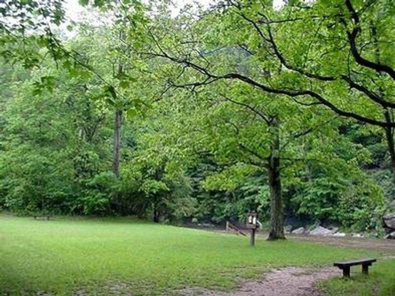
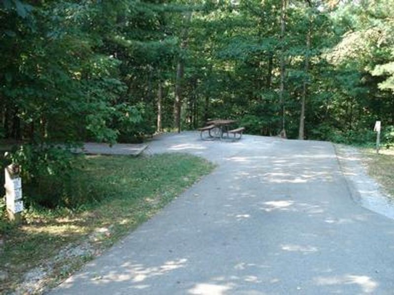
Stuart Recreation Area sits in a scenic bend of the Shavers Fork River within the Allegheny Mountains of West Virginia. Originally constructed by the Civilian Conservation Corps in the 1930s, the campground offers 26 camping units (25 single sites and 1 double site) plus a group site accommodating up to 40 people. All standard campsites feature electric hookups, fire rings, lantern posts, picnic tables, and paved spurs. Facilities include a six-unit flush restroom with four shower units, vault toilets, drinking water, and an RV dump station. A recently renovated historic cabin is also available for rental. Three day-use pavilions and a 14-acre field with river beach access serve day visitors. The Shavers Fork River is regularly stocked with trout for catch-and-release fishing (state license and stamps required), and river swimming is popular in summer. The 2-mile River Loop Hiking Trail offers opportunities for birdwatching and wildlife viewing. The town of Elkins is a 14-minute drive away and hosts the annual Mountain State Forest Festival each October.
Directions
From Elkins, West Virginia: Take Highway 219 to Highway 33. Travel east for approximately 4 miles, turn north on old Route 33 and travel for 2 miles. Turn left at Highway 6 (at the Stuart Recreation Area directional sign) and drive 0.25 miles to entrance.
Amenities
| Water | Yes |
| Fires Allowed | Yes |
| Toilets | Yes |
| Dump Station | Yes |
| Wifi | — |
| Pets Allowed | Yes |
| Showers | Yes |
| Electric Hookups | Yes |
| Water Hookups | No |
| Sewer Hookups | No |
| Camp Store | — |
| Price | $33 - $130 |
Vehicle
| Max RV Length | 99ft |
| Max Trailer Length | 99ft |
| Big Rig Friendly | — |
| Pull Through Sites | No |
Contact
| Phone | +1 (304) 636-5070 |
Cell Service
| AT&T | Yes |
| Verizon | None |
| T-Mobile | None |
Availability
Photos
Community Posts
No posts yet. Be the first to share your experience!