Sheepshead Picnic Area
Closed for the season. The site operates mid-June through Labor Day weekend. Outside this window, the area may be accessible but gates are locked and water/trash services are unavailable.
Northern Region Camping & Target Restrictions, Pallet Prohibition
This order defines the maximum length of occupation at a single location or cumulatively at any number of locations within a calendar year, within the states of Montana, North Dakota, South Dakota, and Idaho
Weed Free Forage & Mulch Products Order for the Northern Region
It is illegal to possess, store or transport straw, hay, grain, seed or other forage or mulch products on Forest Service lands without documentation that the product is certified as “weed free” by a state certification process that meets or exceeds the North American Weed Free Forage standards.
R1-2023-02 - NCDE Food and Wildlife Attractant Storage Order
Northern Continental Divide Ecosystem Food/Wildlife Attractant Storage Order for the Flathead, Lolo, Kootenai, Helena-Lewis and Clark, and Beaverhead-Deerlodge National Forests within the Northern Continental Divide Ecosystem.
About
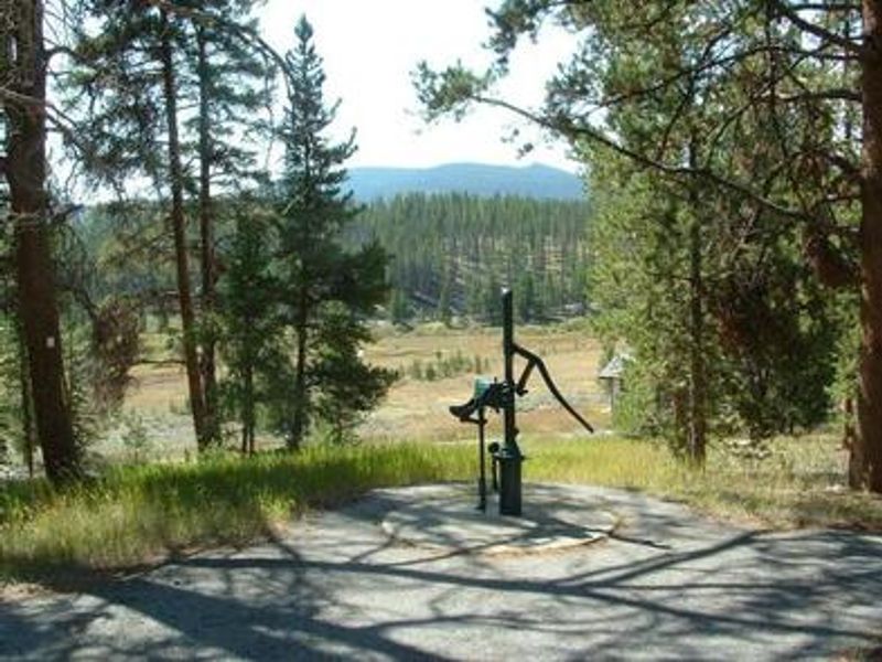
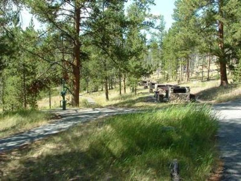
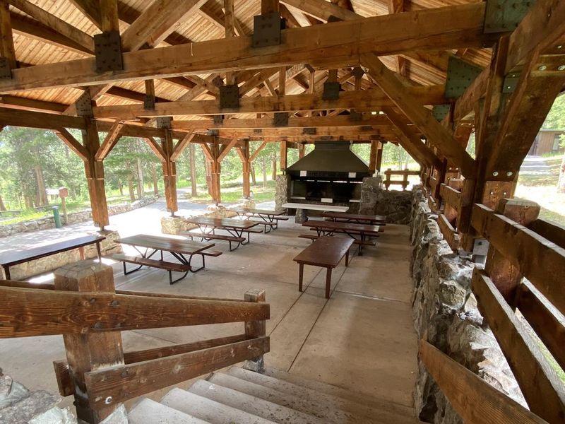
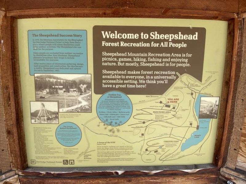
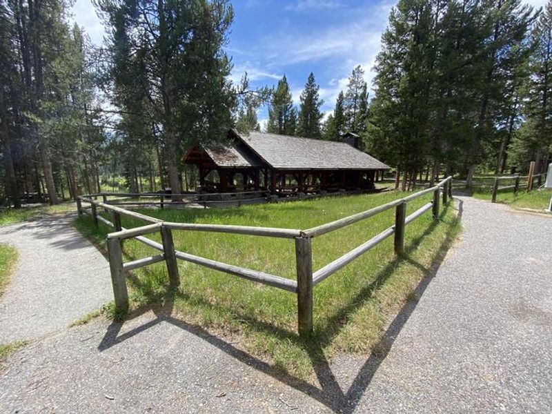
Sheepshead Recreation Area is a day-use picnic facility in the Beaverhead-Deerlodge National Forest, situated about 20 miles north of Butte near the Continental Divide National Scenic Trail. The site features two pavilions overlooking Maney Lake and Sheepshead Mountain, available for reservation for group gatherings including weddings, family reunions, and corporate events. The pavilions accommodate up to 200 people and include picnic tables, barbecue grills, and potable water. No electricity is available on-site, so groups requiring power must bring their own generator. Recreational facilities include volleyball courts, horseshoe pits, a ball field, nature trails, and paved walking paths. Vault toilets and trash receptacles are provided. This is not a traditional campground. Overnight use is not standard and may only be granted with prior approval for multi-day pavilion reservations. Contact the Butte Ranger District for overnight use inquiries.
Directions
From Butte, take I-15/I-90 east for approximately 1 mile. Merge onto I-15 north and continue for approximately 12 miles. Take the Elk Park exit (no. 138) and drive west on Forest Service Road #442 (Lowland Creek Road) for approximately 6 miles. Turn right onto Forest Service Road #9485 and continue for approximately 2 miles. Turn left at the junction (Freedom Point) and drive approximately 1/8 mile; the site is on the right. Gravel road suitable for passenger vehicles.
Nearby Campgrounds
Location
Amenities
| Water | Yes |
| Fires Allowed | — |
| Toilets | Yes |
| Dump Station | No |
| Wifi | No |
| Pets Allowed | — |
| Showers | No |
| Electric Hookups | — |
| Water Hookups | — |
| Sewer Hookups | — |
| Camp Store | No |
| Price | $75 - $200 |
Vehicle
| Max RV Length | — |
| Max Trailer Length | — |
| Big Rig Friendly | — |
| Pull Through Sites | No |
Contact
| scott.forman@usda.gov | |
| Phone | +1 (406) 494-2147 |
Cell Service
| AT&T | Yes |
| Verizon | None |
| T-Mobile | Yes |
Availability
Photos

Community Posts
No posts yet. Be the first to share your experience!