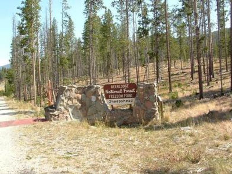
Freedom Point Picnic Area
Closed for the season. Opens in early to mid-June and operates through Labor Day weekend. Reservations are made through Recreation.gov. Overnight use requires prior approval from the Butte Ranger District.
Northern Region Camping & Target Restrictions, Pallet Prohibition
This order defines the maximum length of occupation at a single location or cumulatively at any number of locations within a calendar year, within the states of Montana, North Dakota, South Dakota, and Idaho
Weed Free Forage & Mulch Products Order for the Northern Region
It is illegal to possess, store or transport straw, hay, grain, seed or other forage or mulch products on Forest Service lands without documentation that the product is certified as “weed free” by a state certification process that meets or exceeds the North American Weed Free Forage standards.
R1-2023-02 - NCDE Food and Wildlife Attractant Storage Order
Northern Continental Divide Ecosystem Food/Wildlife Attractant Storage Order for the Flathead, Lolo, Kootenai, Helena-Lewis and Clark, and Beaverhead-Deerlodge National Forests within the Northern Continental Divide Ecosystem.
About
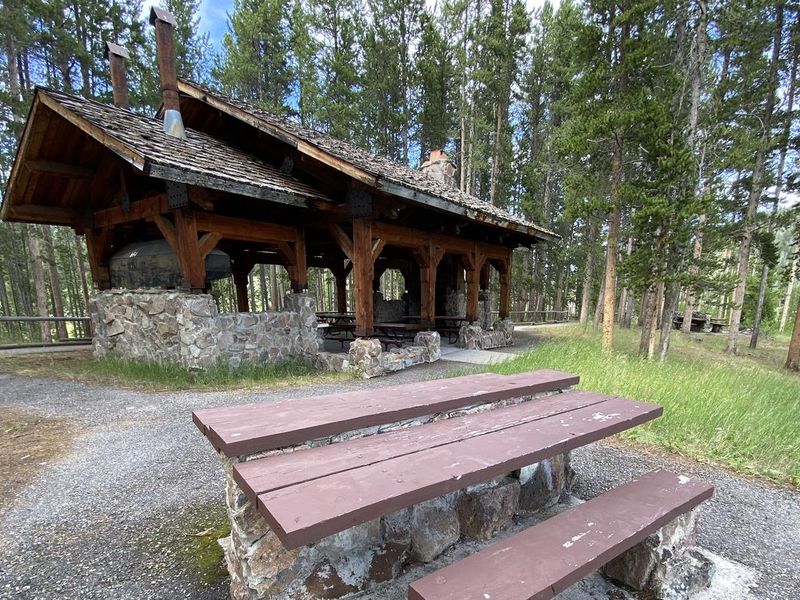
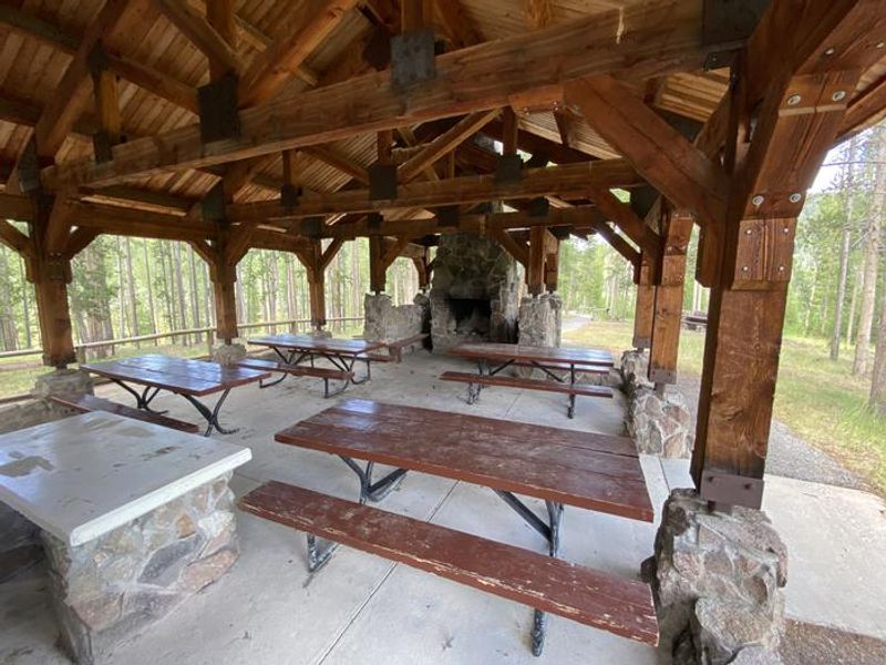
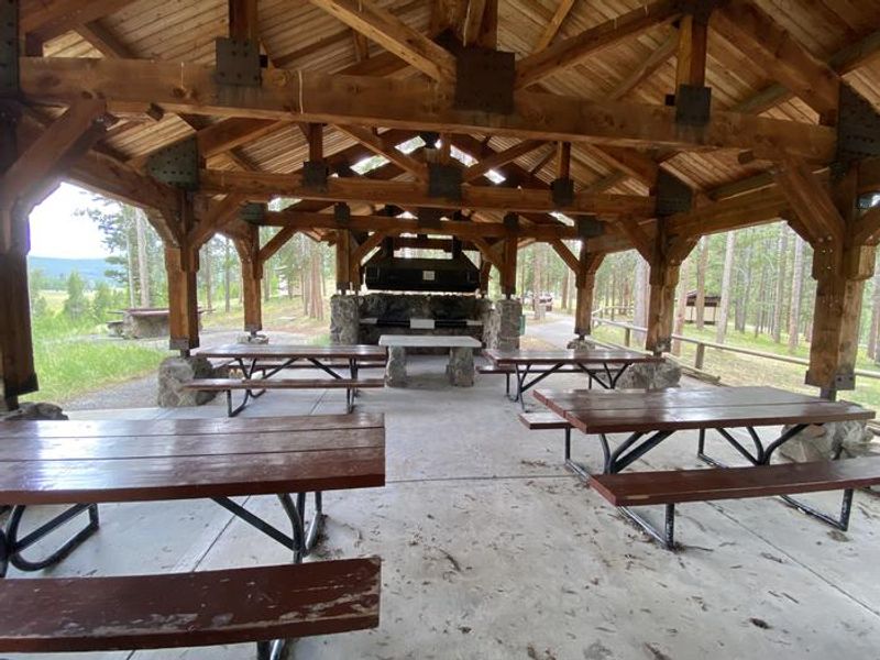
Freedom Point Picnic Area is a group day-use facility located in the Beaverhead-Deerlodge National Forest, approximately 20 miles north of Butte, Montana. The site centers around a covered pavilion that can seat up to 50 people, with additional picnic tables nearby to accommodate larger groups of up to 100. The facility provides barbecue grills, potable water, and vault toilets. There is no electricity; visitors needing power must bring a generator. The site offers several recreational amenities including horseshoe pits, volleyball courts, a ball field, nature trails, and a paved walking trail. Note that volleyball nets and horseshoes are not provided. This is primarily a day-use facility. Overnight camping is not standard; it may only be granted with prior approval from the Butte Ranger District for reservations lasting 2 or more days. The facility cannot accommodate RVs or trailers. All pavilion tables must be returned to their original locations and trash must be disposed of in the provided receptacles before leaving.
Directions
From Butte, take I-15/I-90 east for approximately 1 mile. Merge onto I-15 north and continue for approximately 12 miles. Take the Elk Park exit (no. 138) and drive west on Forest Service road #442 (Lowland Creek Road) for approximately 6 miles. Turn right onto Forest Service road #9485 and continue for approximately 2 miles. Turn right at the junction (Freedom Point) and drive approximately 1/8 mile. The road is a gravel road suitable for passenger vehicle access.
Amenities
| Water | Yes |
| Fires Allowed | — |
| Toilets | Yes |
| Dump Station | No |
| Wifi | No |
| Pets Allowed | — |
| Showers | No |
| Electric Hookups | — |
| Water Hookups | — |
| Sewer Hookups | — |
| Camp Store | No |
| Price | $50 |
Vehicle
| Max RV Length | — |
| Max Trailer Length | — |
| Big Rig Friendly | No |
| Pull Through Sites | No |
Contact
| scott.forman@usda.gov | |
| Phone | +1 (406) 494-2147 |
Cell Service
| AT&T | None |
| Verizon | None |
| T-Mobile | None |
Availability
Photos
Community Posts
No posts yet. Be the first to share your experience!