Mt Terrill Guard Station
Currently closed for the season. Opens mid-June through October. Reservations via Recreation.gov required; walk-up use not permitted.
Flood Watch issued July 20 at 12:15PM MDT until July 22 at 3:00AM MDT by NWS Salt Lake City UT
* WHAT...Flash flooding caused by excessive rainfall is possible. * WHERE...A portion of Utah, including the following areas, Castle Country, Central Mountains, Eastern Juab/Millard Counties, San Rafael Swell, Sanpete Valley, Sevier Valley, Wasatch Plateau/Book Cliffs, Western Millard and Juab Counties, Bryce Canyon Country, Capitol Reef National Park and Vicinity, Glen Canyon Recreation Area/Lake Powell, South Central Utah, Southern Mountains, Upper Sevier River Valleys, Western Canyonlands, Lower Washington County, Southwest Utah and Zion National Park. This includes recent burn scars such as Cottonwood, Silver King, Forsyth, France Canyon, Monroe Canyon. * WHEN...From Tuesday afternoon through late Tuesday night. * IMPACTS...Excessive rainfall may result in flooding of slot canyons, normally dry washes, slick rock areas, recent burn scars including Forsyth, France Canyon, Cottonwood, Silver King, and Monroe Canyon, and other low-lying and flood-prone locations. Flooding may occur in poor drainage and urban areas. * ADDITIONAL DETAILS... - http://www.weather.gov/safety/flood
Weed Free Hay Order 04-2021-03
Prohibited by this order: Possessing, storing, or transporting non-pelletized hay, straw, or mulch in the Intermountain Region, unless it is certified as weed free by the state where the product originated.
Fireworks and Spark Arrestor Order 04-2021-01
Prohibited by this order: Possessing, discharging, or using any kind of firework or other pyrotechnic device. 36 CFR §261.52(t)Operating or using any internal or external combustion engine without a spark arresting device properly installed, maintained and in effective working order as described…
About
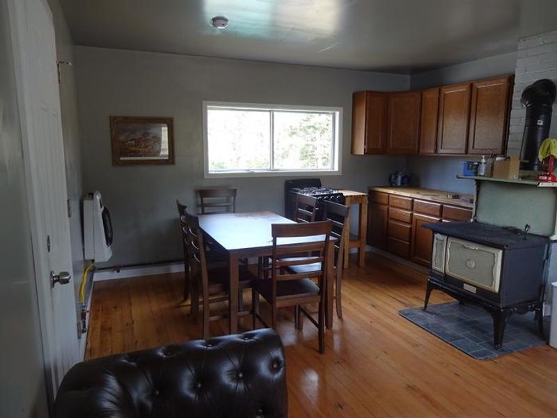
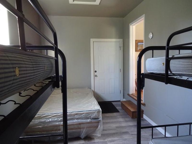
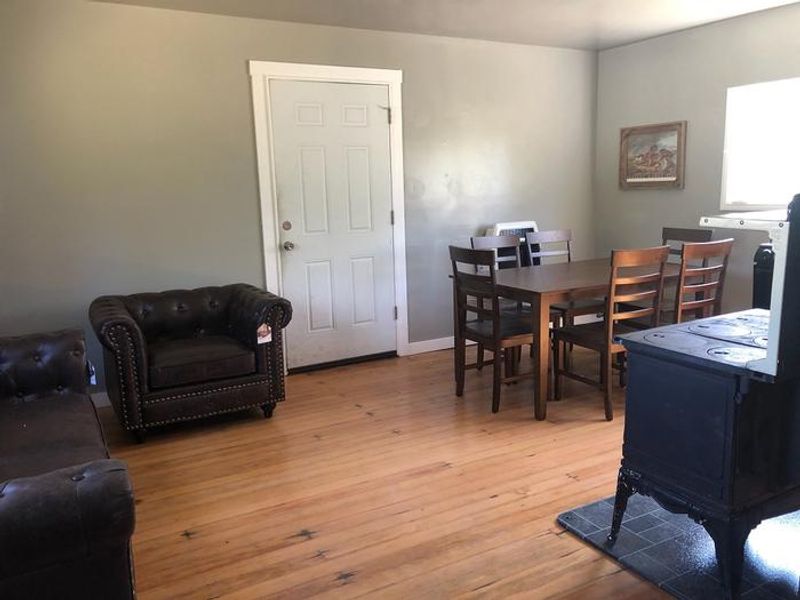
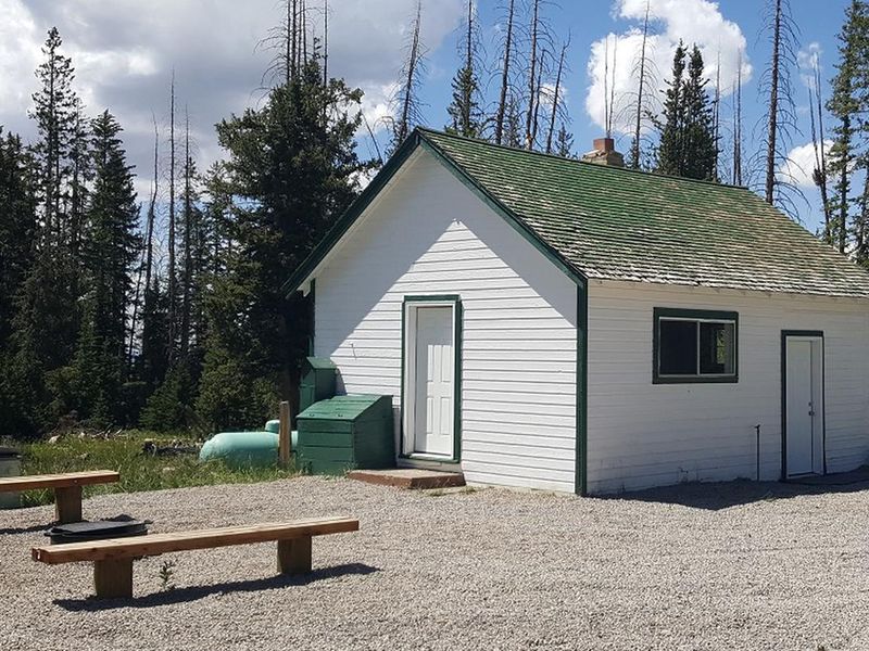
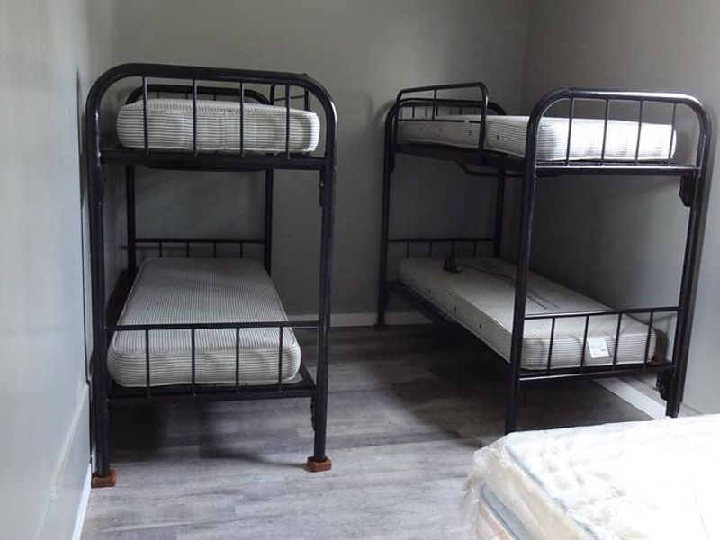
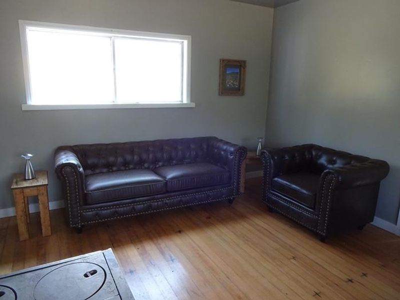
Mt Terrill Guard Station is a historic two-room cabin situated on a high-elevation meadow at 9,800 feet in the Fishlake National Forest, about 30 miles southeast of Salina, Utah. The cabin provides rustic accommodations with one queen bed and two sets of bunk beds sleeping up to six people inside, though up to 50 guests can be accommodated with tents or RVs outside. Interior amenities include a wood stove for heat, propane range (no oven), propane heater, kitchen table and chairs, couch, and countertop. No electricity or running water is available. The guard station serves as an excellent base camp for a variety of recreational activities. Johnson Reservoir is 7 miles away and Fish Lake is 15 miles south, both offering fishing opportunities. OHV trails, hiking, mountain biking, and equestrian routes are accessible from the area. The surrounding meadow blooms with wildflowers in July, and wildlife viewing for elk and deer is common. Big game hunting in fall is also popular. Mt Terrill peak rises to 11,547 feet to the east. Due to the high elevation, guests should prepare for all weather conditions including cool summer nights. Visitors must bring their own water, bedding, dishes, utensils, cookware, and battery-operated lights. All trash must be packed out and food properly stored in bear-proof containers.
Directions
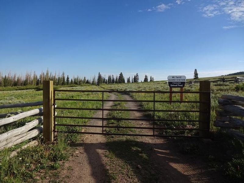
From Salina, travel about 7 miles east on Interstate 70 to Exit 63 (Gooseberry). Turn south on the paved Gooseberry Road #640 and continue for approximately 22 miles. The Mt Terrill Guard Station is on the right, with a quarter-mile gravel access road leading to the cabin.
Amenities
| Water | No |
| Fires Allowed | Yes |
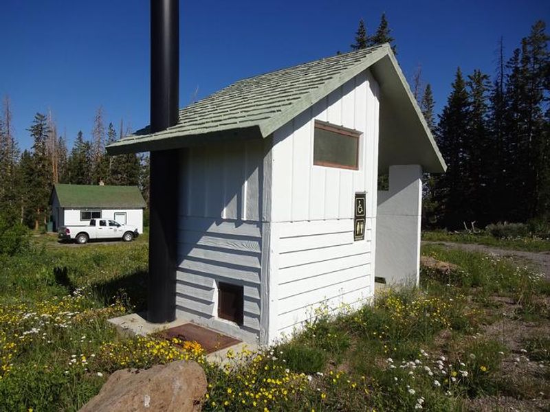
| Toilets | Yes |
| Dump Station | No |
| Wifi | No |
| Pets Allowed | No |
| Showers | No |
| Electric Hookups | — |
| Water Hookups | — |
| Sewer Hookups | — |
| Camp Store | No |
| Price | $50 |
Vehicle
| Max RV Length | — |
| Max Trailer Length | — |
| Big Rig Friendly | — |
| Pull Through Sites | No |
Contact
| Phone | +1 (435) 896-9233 |
Cell Service
| AT&T | Yes |
| Verizon | None |
| T-Mobile | None |
Useful Links
| View on Recreation.gov | |
| Fishlake NF Mt Terrill Page |
Availability
Photos
Community Posts
No posts yet. Be the first to share your experience!