USA 250 Shirt →
MILLERS FERRY CAMPGROUND

Millers Ferry Campground

Open

Open for camping. Reservations available through Recreation.gov. Check-in 4 p.m., check-out 3 p.m.

Tropical Cyclone Local Statement issued July 21 at 10:43AM CDT by NWS Mobile AL

10:43 AM — 6:45 PM

HLSMOB This product covers portions of southwest Alabama...northwest Florida...south central Alabama...and inland southeast Mississippi. **TROPICAL STORM BERTHA WILL BRING COASTAL AND OFFSHORE IMPACTS LATER TODAY THROUGH WEDNESDAY MORNING** NEW INFORMATION --------------- * CHANGES TO WATCHES AND WARNINGS: - The Storm Surge Watch has been cancelled for Baldwin Coastal and Mobile Coastal - The Tropical Storm Watch has been upgraded to a Tropical Storm Warning for Escambia Coastal, Okaloosa Coastal, and Santa Rosa Coastal * CURRENT WATCHES AND WARNINGS: - A Tropical Storm Warning is in effect for Baldwin Central, Baldwin Coastal, Escambia Coastal, Mobile Central, Mobile Coastal, Okaloosa Coastal, and Santa Rosa Coastal * STORM INFORMATION: - About 140 miles southeast of Mobile AL or about 100 miles south-southeast of Pensacola FL - 29.3N 86.3W - Storm Intensity 60 mph - Movement North-northwest or 345 degrees at 3 mph SITUATION OVERVIEW ------------------ Tropical Storm Bertha continues to move very slowly to the northwest. A general northwest to west- northwest motion is expected today into tonight with the center of Bertha moving into the offshore Gulf waters of northwest Florida and Alabama this afternoon and into tonight. The storm will move further west and out of the local area during the day on Wednesday. While some slight strengthening is possible over the next 12 hours, Bertha is likely to weaken some on its closest approach to the local area. Primary impacts from Bertha remain focused near the coastline and over the Gulf waters. Dangerous surf and beach conditions are expected. A high risk of deadly rip currents is in effect through much of the week. A High Surf Warning remains in effect due to surf building to 8 to 11 feet along the Gulf beaches, reaching peak heights tonight into early Wednesday morning. These large breaking waves will result in minor beach erosion, along with flooding of vulnerable areas of the west end of Dauphin Island and the Ft. Pickens area of Gulf Islands National Seashore. Coastal Flood Warnings are now in effect for the Alabama coast and portions of the northwest FL coast. Coastal flooding will bring 1 to 3 feet of inundation along the Alabama and Florida coasts, coinciding with high tide Wednesday morning. Due to the sheared nature of the storm, most of the heavy rainfall will remain well south across the open Gulf. However, locally heavy rainfall cannot be ruled out in any rainbands that approach the coast. POTENTIAL IMPACTS ----------------- * OTHER COASTAL HAZARDS: Dangerous surf and beach conditions are expected. A high risk of deadly rip currents continues through much of the week. Surf builds to 8-11 feet tonight through Wednesday. * SURGE: Protect against locally hazardous surge having possible limited impacts across coastal Alabama and coastal Florida. Potential impacts in this area include: - Localized inundation with storm surge flooding mainly along immediate shorelines and in low-lying spots, or in areas farther inland near where higher surge waters move ashore. - Sections of near-shore roads and parking lots become overspread with surge water. Driving conditions dangerous in places where surge water covers the road. - Moderate beach erosion. Heavy surf also breaching dunes, mainly in usually vulnerable locations. Strong rip currents. - Minor to locally moderate damage to marinas, docks, boardwalks, and piers. A few small craft broken away from moorings. Elsewhere across portions of southwest Alabama...south central Alabama...and inland southeast Mississippi., little to no impact is anticipated. * WIND: Protect against hazardous wind having possible limited impacts across the immediate coastal areas of Alabama and the western Florida Panhandle. Potential impacts in this area include: - Damage to porches, awnings, carports, sheds, and unanchored mobile homes. Unsecured lightweight objects blown about. - Many large tree limbs broken off. A few trees snapped or uprooted, but with greater numbers in places where trees are shallow rooted. Some fences and roadway signs blown over. - A few roads impassable from debris, particularly within urban or heavily wooded places. Hazardous driving conditions on bridges and other elevated roadways. - Scattered power and communications outages. Elsewhere across portions of southwest Alabama...northwest Florida...south central Alabama...and inland southeast Mississippi., little to no impact is anticipated. * FLOODING RAIN: Protect against locally hazardous rainfall flooding having possible limited impacts across coastal Alabama and the western Florida Panhandle. Potential impacts include: - Localized rainfall flooding may prompt a few evacuations. - Rivers and tributaries may quickly rise with swifter currents. Small streams, creeks, canals, and ditches may become swollen and overflow in spots. - Flood waters can enter a few structures, especially in usually vulnerable spots. A few places where rapid ponding of water occurs at underpasses, low-lying spots, and poor drainage areas. Several storm drains and retention ponds become near-full and begin to overflow. Some brief road and bridge closures. Elsewhere across portions of southwest Alabama...northwest Florida...south central Alabama...and inland southeast Mississippi., little to no impact is anticipated. PRECAUTIONARY/PREPAREDNESS ACTIONS ---------------------------------- * EVACUATIONS: Follow the advice of local officials. * OTHER PREPAREDNESS INFORMATION: Now is the time to complete preparations in accordance with your emergency plan. If you are a visitor, be sure to know the name of the city or town in which you are staying and the name of the county in which it resides. Listen for these locations in local news updates. Pay attention for instructions from local authorities. Closely monitor weather.gov, NOAA Weather radio or local news outlets for official storm information. Be ready to adapt to possible changes to the forecast. Ensure you have multiple ways to receive weather warnings. * ADDITIONAL SOURCES OF INFORMATION: - For the latest detailed evacuation and shelter information...please refer to your local emergency management agency at the phone number or website listed below. - Coastal Alabama: - Baldwin County: 251-972-6807 or www.baldwincountyal.gov/departments/EMA - Mobile County: 251-460-8000 or mobilecountyema.gov - Northwest Florida: - Escambia County: 850-471-6400 or myescambia.com/beready - Santa Rosa County: 850-983-5360 www.santarosa.fl.gov/emergency - Okaloosa County: 850-651-7150 or myokaloosa.com/emergency-management - For information on appropriate preparations see ready.gov - For additional disaster preparedness information see redcross.org NEXT UPDATE ----------- The next local statement will be issued by the National Weather Service in Mobile AL around 4 PM CDT, or sooner if conditions warrant.

About

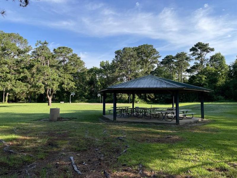
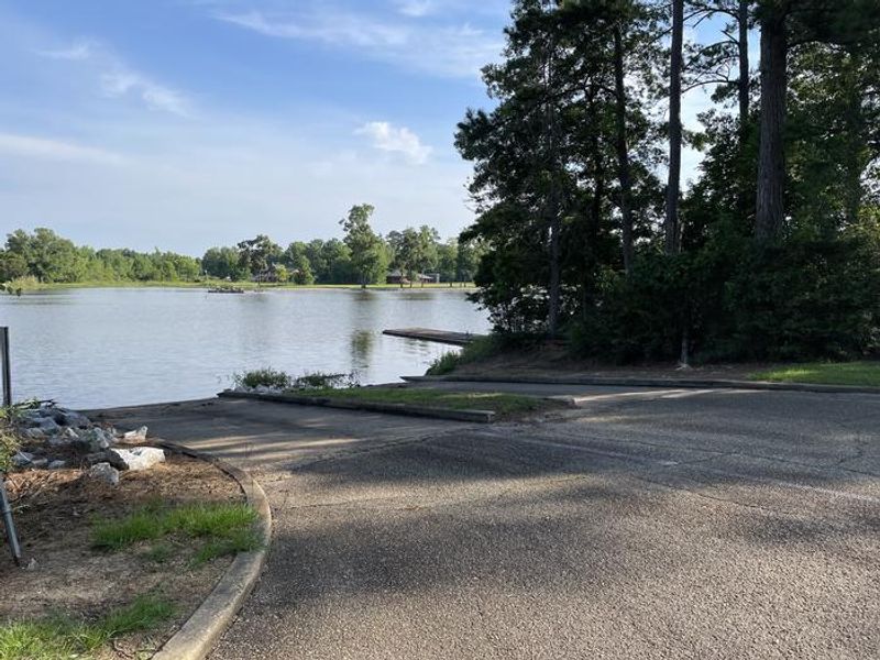
Millers Ferry Campground occupies a prime location on Dannelly Reservoir, a 27-square-mile impoundment of the Alabama River with over 500 miles of shoreline. Managed by the U.S. Army Corps of Engineers, the campground caters to both tent campers and RVers with 42 family sites, all equipped with 50-amp electric and water hookups. Flush toilets, hot showers, drinking water, laundry facilities, and a dump station round out the amenities. The reservoir is renowned for bass, crappie, bluegill, and catfish fishing, and the campground provides a boat ramp, fishing dock, and fish cleaning stations. A playground keeps younger visitors entertained. The surrounding Black Prairie Belt features rolling grasslands interspersed with hardwood and pine forests, offering habitat for whitetail deer and wild turkeys that draw bow hunters in season. Reservations are handled through Recreation.gov. Check-in is at 4 p.m. and check-out at 3 p.m. The campground has a mix of back-in and pull-through sites, with some accommodating vehicles up to 83 feet and many shoreline sites positioned close to the water.

Directions

From Camden, Alabama, take State Route 28 northwest for 12 miles. Turn right before the Lee Long Bridge and follow signs into the campground.

Amenities

Water Yes
Fires Allowed Yes
Toilets Yes
Dump Station Yes
Wifi
Pets Allowed Yes
Showers Yes
Electric Hookups Yes
Water Hookups Yes
Sewer Hookups No
Camp Store
Price $26

Vehicle

Max RV Length 100ft
Max Trailer Length 100ft
Big Rig Friendly Yes
Pull Through Sites No

Contact

Phone +1 (334) 682-4191

Cell Service

AT&T Yes
Verizon Yes
T-Mobile None

Availability

Photos

MILLERS FERRY CAMPGROUND
MILLERS FERRY CAMPGROUND RAMP

Community Posts

No posts yet. Be the first to share your experience!