Middle St. Croix
Open year-round. All 57 primitive campsites are free and available first-come, first-served. No permit is required for this section. No drinking water is available; campers must bring their own. Three-night stay limit per site.
About
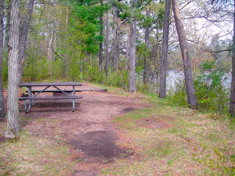
Middle St. Croix is part of the St. Croix National Scenic Riverway, a National Park Service unit protecting over 200 miles of the St. Croix and Namekagon rivers. This section features 57 primitive, Leave No Trace campsites along the St. Croix River corridor from Riverside Landing downstream to Highway 8 at St. Croix Falls-Taylors Falls. The free campsites are designated with brown camping signs and metal fire rings. Sites operate on a first-come, first-served basis with no reservations or permits required. Each designated site includes a metal fire ring, and most have picnic tables. Primitive pit toilets are located near campsites. Drinking water is not available; campers must bring their own supply. Many sites are only accessible from the water, making this ideal for canoe and kayak camping trips. Camping is limited to three consecutive nights per site, with a maximum of 8 people and 3 tents at individual sites. Group sites accommodate up to 10 people and 6 tents. Quiet hours are 10:00 pm to 6:00 am. Campfires are permitted only in the provided metal fire rings. Dead and down wood may be collected from shoreline areas but not from islands. Firewood from more than 25 miles away is prohibited to prevent invasive species spread.
Directions
Middle St. Croix directions and information are available at https://www.nps.gov/sacn/planyourvisit/middlestcroix.htm. Sites are located on the St. Croix River between Riverside Landing and Highway 8 at St. Croix Falls-Taylors Falls.
Amenities
| Water | No |
| Fires Allowed | Yes |
| Toilets | Yes |
| Dump Station | No |
| Wifi | No |
| Pets Allowed | Yes |
| Showers | No |
| Electric Hookups | — |
| Water Hookups | — |
| Sewer Hookups | — |
| Camp Store | — |
| Price | $0 |
Vehicle
| Max RV Length | — |
| Max Trailer Length | — |
| Big Rig Friendly | No |
| Pull Through Sites | No |
Contact
| sacn_info@nps.gov | |
| Phone | +1 (715) 483-2274 |
Cell Service
| AT&T | None |
| Verizon | Yes |
| T-Mobile | Yes |
Photos

Community Posts
No posts yet. Be the first to share your experience!