Middle Delaware National Scenic & Recreational River Primitive Campsites
Open for the 2026 season as of April 17. Reservations required via Recreation.gov. One-night-per-zone limit applies. Parking at river launches requires separate registration and a $10 daily fee from April 15 through mid-October.
About
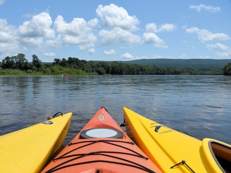
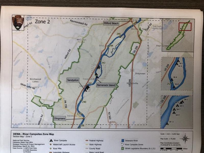
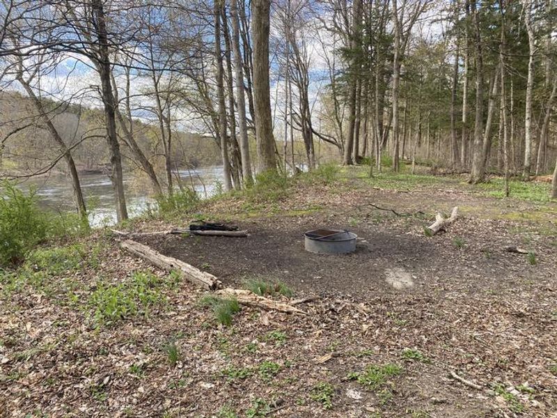
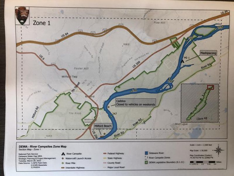
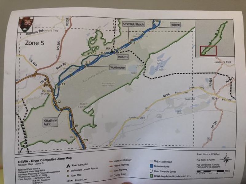
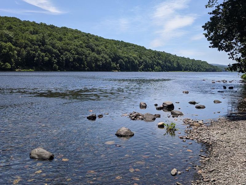
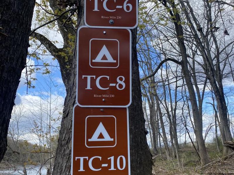
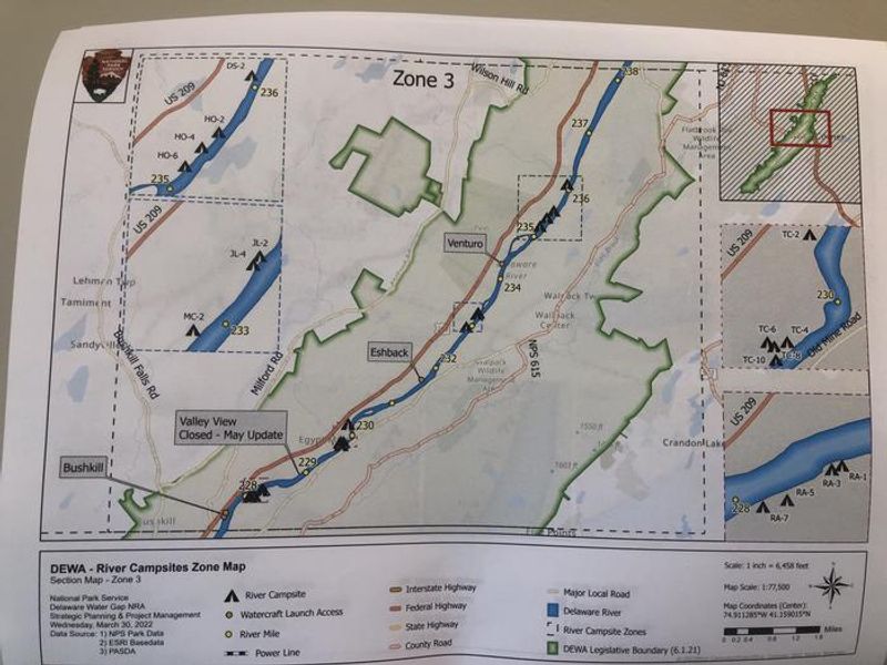
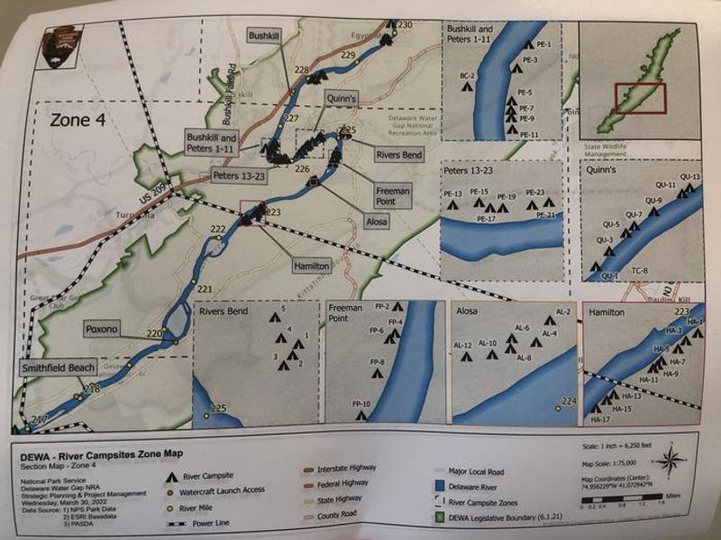
These 62 primitive campsites stretch along the banks of the Delaware River within Delaware Water Gap National Recreation Area, accessible only by water. The park divides the river corridor into five zones: Northern Boundary to Milford Beach, Milford Beach to Dingmans, Dingmans to Bushkill, Bushkill to Smithfield Beach, and Smithfield Beach to Kittatinny Point. Campers reserve a zone permit, then choose any available site within that zone upon arrival. The sites are truly primitive, situated under hardwood trees along the riverbank. Each site has a fire ring for campfires using only dead and downed wood. Toilet facilities vary by location, with some sites having pit toilets, composting toilets, or porta-johns. There is no potable water, and campers must pack out all trash including food waste. Human waste must be buried at least 6 inches deep and 300 feet from water. Camping is limited to one night per zone, so multi-night trips require moving to a new zone each day. Sites accommodate up to 10 people and 5 tents, with tents positioned within 50 feet of the fire grate. Minimum paddle distances of 14 river miles apply for one-night trips. Glass containers are prohibited, and quiet hours are 10 PM to 6 AM.
Directions
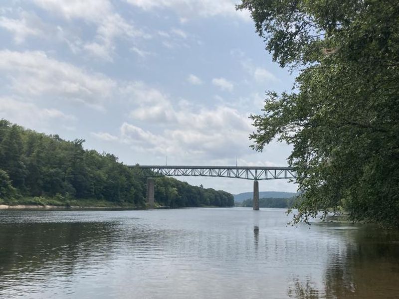
Access is by water only via various launch points along the Delaware River within Delaware Water Gap National Recreation Area. Consult the zone map to ensure entry upriver of your reserved camping zone. Common launches include Milford Beach, Dingmans Ferry, Bushkill, and Smithfield Beach.
Nearby Campgrounds
Amenities
| Water | No |
| Fires Allowed | Yes |
| Toilets | Yes |
| Dump Station | No |
| Wifi | No |
| Pets Allowed | Yes |
| Showers | No |
| Electric Hookups | — |
| Water Hookups | — |
| Sewer Hookups | — |
| Camp Store | No |
| Price | $16 |
Vehicle
| Max RV Length | — |
| Max Trailer Length | — |
| Big Rig Friendly | No |
| Pull Through Sites | No |
Contact
| Phone | +1 (570) 426-2452 |
Cell Service
| AT&T | None |
| Verizon | None |
| T-Mobile | None |
Availability
Photos
Community Posts
No posts yet. Be the first to share your experience!