Lost Johnny Point Campground
Closed for the season. The campground typically opens mid to late May and operates through mid-September, weather permitting. Both reservable and first-come-first-served sites are available once open.
Northern Region Camping & Target Restrictions, Pallet Prohibition
This order defines the maximum length of occupation at a single location or cumulatively at any number of locations within a calendar year, within the states of Montana, North Dakota, South Dakota, and Idaho
Weed Free Forage & Mulch Products Order for the Northern Region
It is illegal to possess, store or transport straw, hay, grain, seed or other forage or mulch products on Forest Service lands without documentation that the product is certified as “weed free” by a state certification process that meets or exceeds the North American Weed Free Forage standards.
R1-2023-02 - NCDE Food and Wildlife Attractant Storage Order
Northern Continental Divide Ecosystem Food/Wildlife Attractant Storage Order for the Flathead, Lolo, Kootenai, Helena-Lewis and Clark, and Beaverhead-Deerlodge National Forests within the Northern Continental Divide Ecosystem.
About
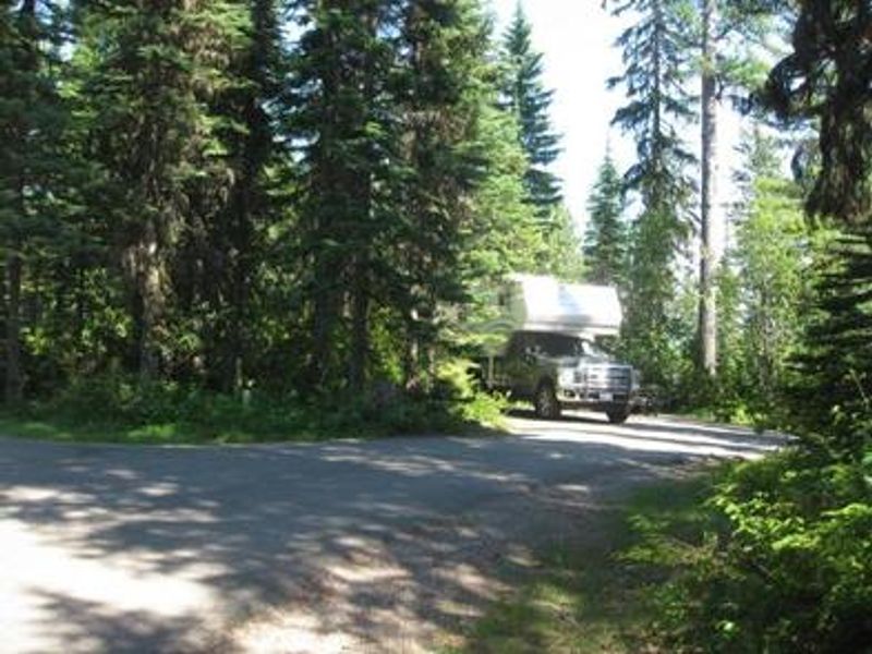
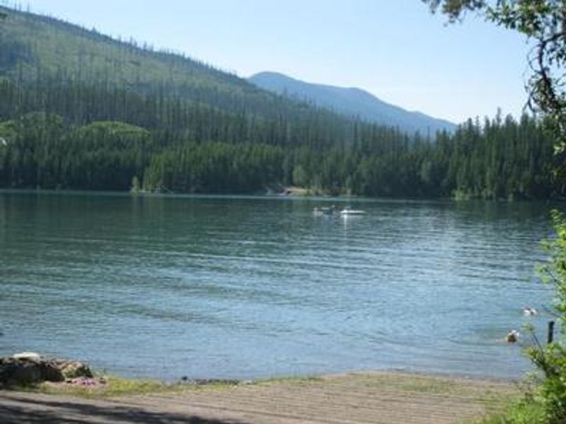
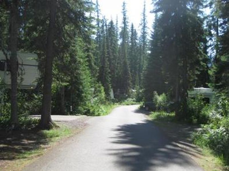
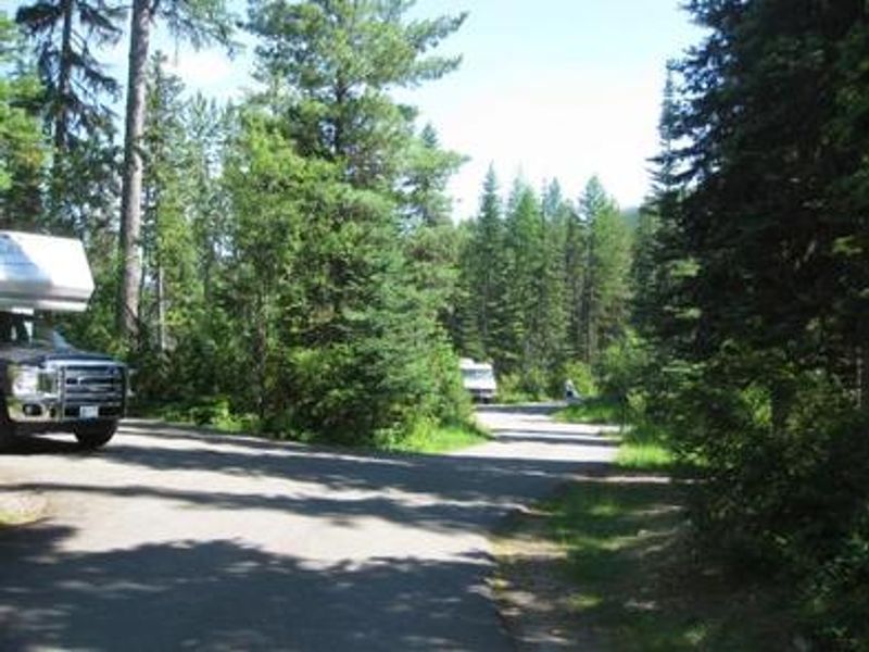
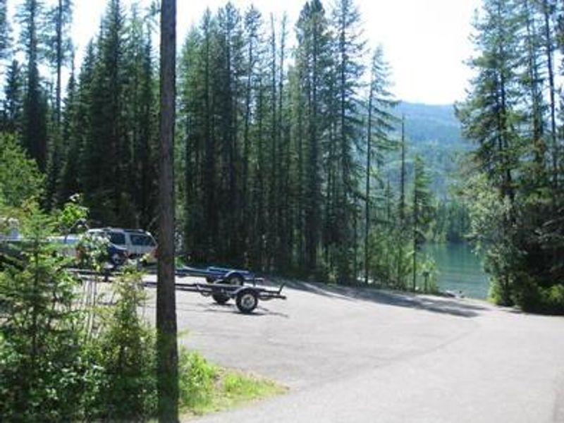
Lost Johnny Point Campground is situated on the massive Hungry Horse Reservoir, high in the Rocky Mountains west of the Continental Divide and just south of the Canadian border. The reservoir was dammed to provide hydroelectric power and flood control, creating the 10th highest dam in the United States. The surrounding forest is home to lynx, grizzly bear, and bull trout, making it a premier destination for wildlife enthusiasts. The campground features 21 sites spread along the reservoir shoreline, each equipped with a picnic table and fire ring with grill. Paved campground roads and parking spurs accommodate both tent and RV camping, though trailers are limited to 22 feet maximum. Drinking water is available from a hand pump (jug-fill only), and accessible vault toilets are provided throughout. Boating is exceptionally popular here, with a concrete boat ramp directly accessible from the campground. Anglers target cutthroat trout in the reservoir, while swimmers enjoy the mountain lake waters during warmer months. The proximity to Glacier National Park makes this an excellent basecamp for exploring the broader region.
Directions
Turn off U.S. Highway 2 at milepost 144 and follow the West Side Hungry Horse Reservoir Road (Forest Road #895) across Hungry Horse Dam. The campground is 6 miles south of the dam on paved road.
Amenities
| Water | Yes |
| Fires Allowed | Yes |
| Toilets | Yes |
| Dump Station | No |
| Wifi | No |
| Pets Allowed | — |
| Showers | No |
| Electric Hookups | — |
| Water Hookups | — |
| Sewer Hookups | — |
| Camp Store | No |
| Price | $22 - $44 |
Vehicle
| Max RV Length | 49ft |
| Max Trailer Length | 49ft |
| Big Rig Friendly | No |
| Pull Through Sites | No |
Contact
| partingwatersadvinc817@gmail.com | |
| Phone | +1 (406) 752-7924 |
Cell Service
| AT&T | Yes |
| Verizon | None |
| T-Mobile | None |
Availability
Photos
Community Posts
No posts yet. Be the first to share your experience!