Riverside Campground
Closed for the season. Opens around May 22, 2026 and operates through mid-September, weather permitting. Reservations available through Recreation.gov. Food storage order in effect; firewood movement restrictions apply.
Northern Region Camping & Target Restrictions, Pallet Prohibition
This order defines the maximum length of occupation at a single location or cumulatively at any number of locations within a calendar year, within the states of Montana, North Dakota, South Dakota, and Idaho
Weed Free Forage & Mulch Products Order for the Northern Region
It is illegal to possess, store or transport straw, hay, grain, seed or other forage or mulch products on Forest Service lands without documentation that the product is certified as “weed free” by a state certification process that meets or exceeds the North American Weed Free Forage standards.
R1-2023-02 - NCDE Food and Wildlife Attractant Storage Order
Northern Continental Divide Ecosystem Food/Wildlife Attractant Storage Order for the Flathead, Lolo, Kootenai, Helena-Lewis and Clark, and Beaverhead-Deerlodge National Forests within the Northern Continental Divide Ecosystem.
About
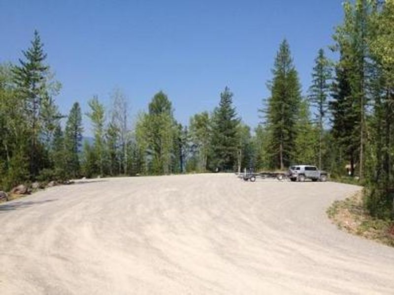
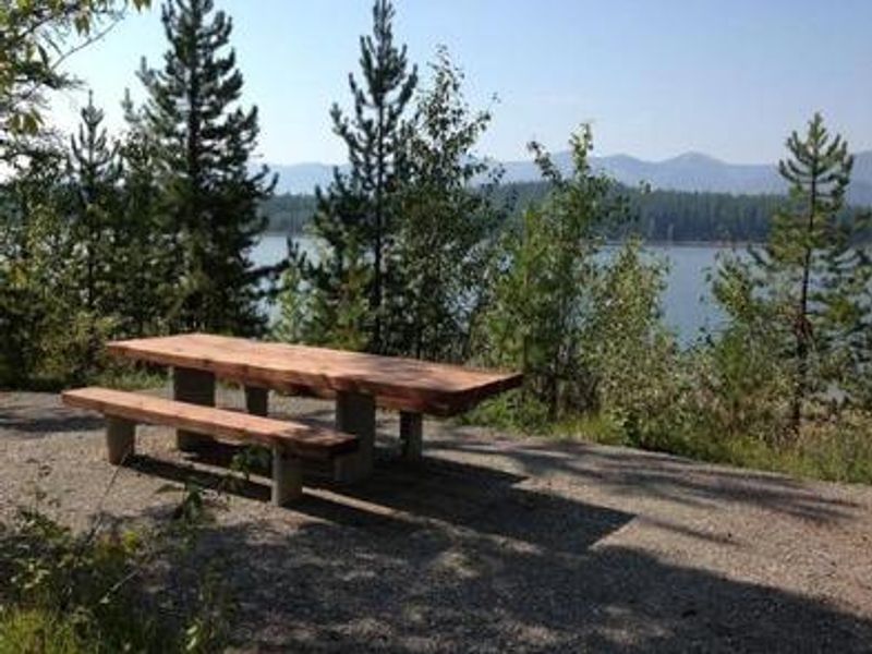
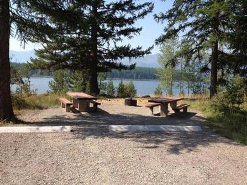
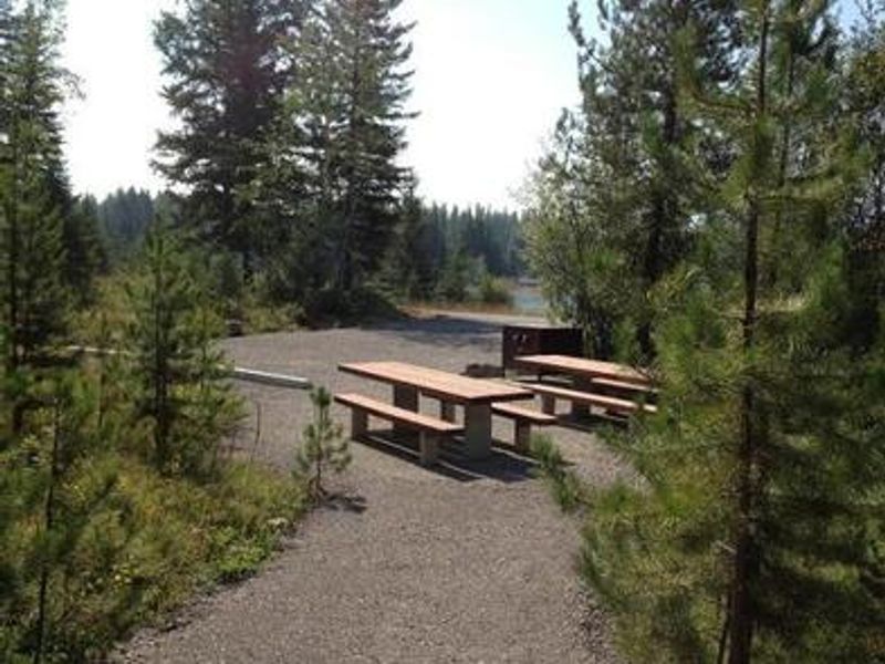
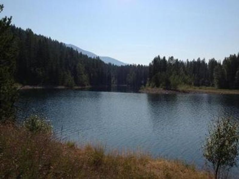
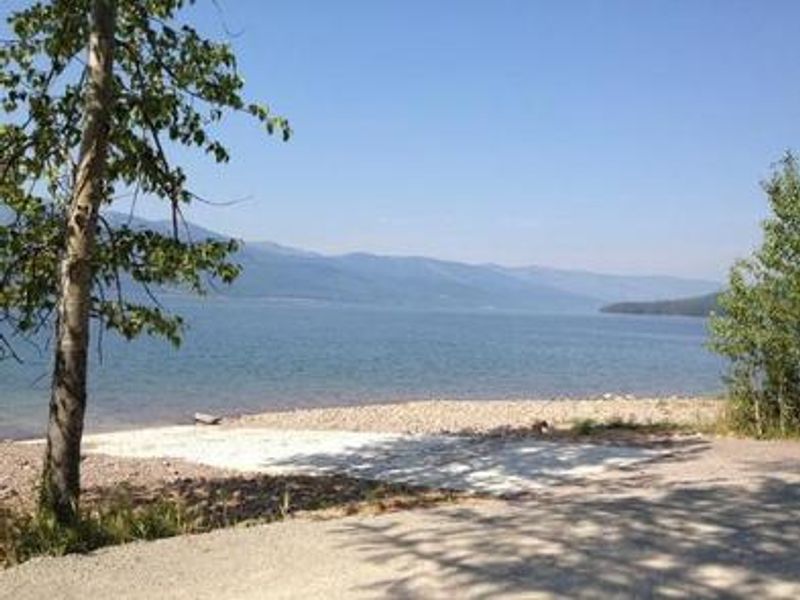
Riverside Campground is located high in the Rocky Mountains on the eastern shore of Hungry Horse Reservoir, less than 30 miles from the Continental Divide. The reservoir, formed by the 10th highest dam in the United States, provides a stunning backdrop of towering mountain peaks. The campground offers 3 campsites with fire rings equipped with grills and picnic tables at each site. A concrete boat ramp is accessible directly from the campground, making it popular for boating on the massive 27,750-acre reservoir. Anglers can expect to catch cutthroat trout, and the area supports big game hunting in season. Swimming is also popular during summer months. The campground is managed by Flathead Valley Campgrounds during the summer season. No potable water or trash service is available at this facility. Drinking water can be obtained 1 mile south at Murray Bay Campground. The East Side Reservoir Road is paved for only the first 3 miles from Martin City, with the remaining 17 miles being gravel.
Directions
From Martin City, Montana, turn off Highway 2 and continue on the main road through town heading south. This road becomes East Side Reservoir Road and is paved for the first 3 miles. Continue for about 20 miles to the campground.
Amenities
| Water | No |
| Fires Allowed | Yes |
| Toilets | Yes |
| Dump Station | No |
| Wifi | No |
| Pets Allowed | — |
| Showers | No |
| Electric Hookups | — |
| Water Hookups | — |
| Sewer Hookups | — |
| Camp Store | No |
| Price | $150 |
Vehicle
| Max RV Length | 50ft |
| Max Trailer Length | 50ft |
| Big Rig Friendly | — |
| Pull Through Sites | No |
Contact
| Phone | +1 (406) 752-7924 |
Cell Service
| AT&T | None |
| Verizon | None |
| T-Mobile | None |
Availability
Photos
Community Posts
No posts yet. Be the first to share your experience!