Lost Creek
The campground is currently closed for the season. Opens May 22, 2026. Reservations available through Recreation.gov.
Air Quality Alert issued July 21 at 1:30PM PDT by NWS Portland OR
Oregon Department of Environmental Quality has issued an Air Quality Advisory, which is IN EFFECT UNTIL 6 PM PDT WEDNESDAY. An Air Quality Advisory for Smoke has been issued for Clackamas County. An Air Quality Advisory for Ozone has been issued for the Portland-Metro Area and around Salem. Wildfires burning in the region combined with forecasted conditions will cause air quality to reach unhealthy levels due to smoke and ozone at times through 6 PM Wednesday. Pollutants in smoke can cause burning eyes, runny nose, aggravate heart and lung diseases, and aggravate other serious health problems. Limit outdoor activities and keep children indoors if it is smoky. Please follow medical advice if you have a heart or lung condition. More information about air quality can be found at: www.oregon.gov/DEQ
Alcohol Prohibitions
This Order describes acts that are prohibited upon lands, roads and trails within the National Forest System administered by the Forest Service Pacific Northwest Region in regards to alcoholic beverages.
Aquatic Invasive Species
This Order prohibits 1) possessing, storing, or transporting any aquatic invasive animal species AND 2) prohibits possessing, storing, or transporting any aquatic or riparian invasive plant species - on National Forest System lands in the Pacific Northwest Region as specified in the Order.
About
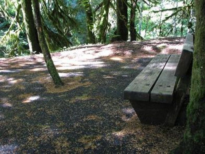
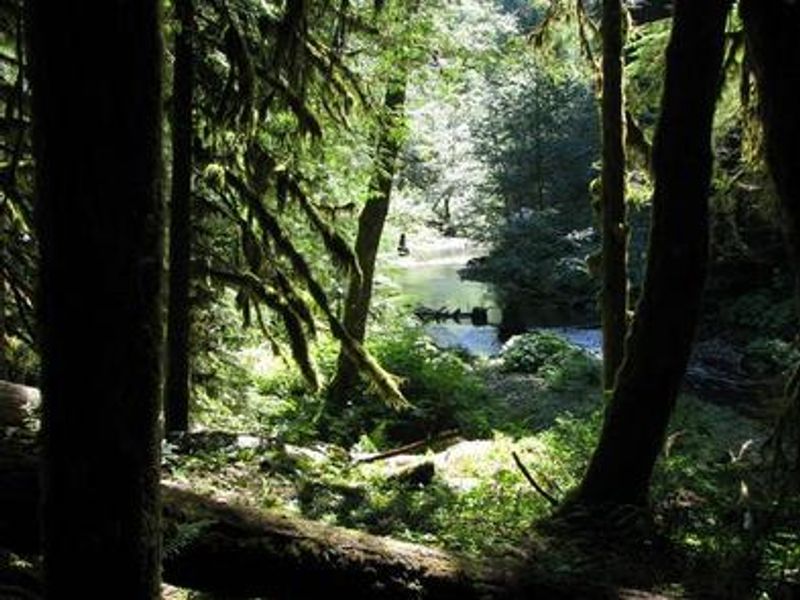
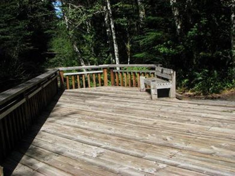
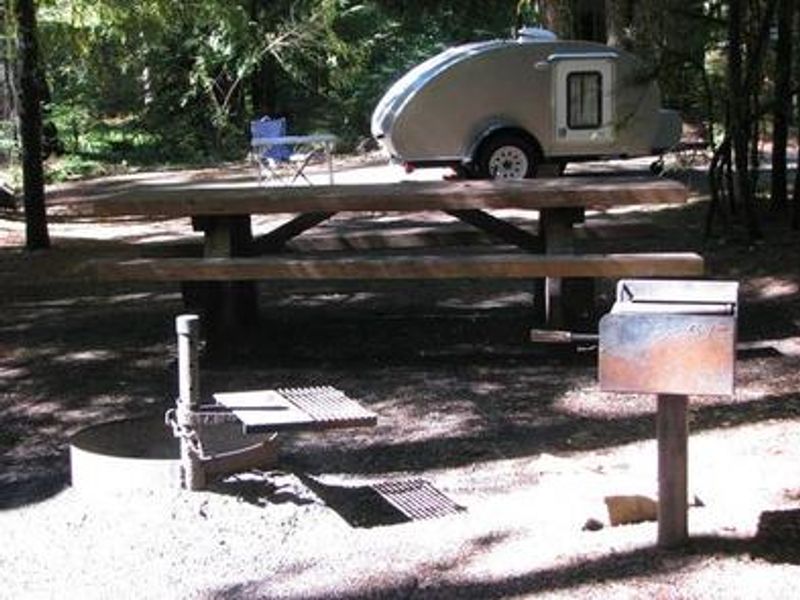
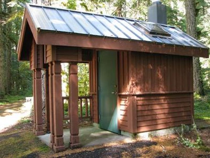
Lost Creek Campground is one of the most accessible campgrounds in Mount Hood National Forest, designed entirely barrier-free with ADA-accessible campsites, vault toilets, and a paved nature trail that winds through the area. The campground sits at approximately 2,600 feet elevation in the Old Maid Flat area, situated on one of the largest pyroclastic volcanic mudflows from Mt. Hood's "Old Maid" eruption in the 1700s. The campground features 10 standard nonelectric sites, 4 walk-to sites, and 2 yurts, all shaded by towering evergreens with moss-covered ground providing privacy between sites. Each site includes a picnic table and campfire ring with grill. Potable water is available from a hand pump. A 22-foot vehicle length limit applies. Nearby recreation includes the accessible Lost Creek Nature Trail explaining the area's volcanic geology, and the trailhead for spectacular Ramona Falls via a 7.1-mile hike along the Sandy River. Anglers can fish for steelhead year-round, Coho salmon in fall, and Chinook salmon from February through October.
Directions
From Portland, take Highway 26 approximately 30 miles to Zigzag. Turn left onto Lolo Pass Road (County Road 18/Forest Road 18) for 4 miles. Turn right onto Forest Road 1825 for 2.75 miles to the campground.
Amenities
| Water | Yes |
| Fires Allowed | Yes |
| Toilets | Yes |
| Dump Station | — |
| Wifi | — |
| Pets Allowed | — |
| Showers | No |
| Electric Hookups | — |
| Water Hookups | — |
| Sewer Hookups | — |
| Camp Store | — |
| Price | $26 |
Vehicle
| Max RV Length | 40ft |
| Max Trailer Length | 40ft |
| Big Rig Friendly | No |
| Pull Through Sites | No |
Contact
| Phone | +1 (503) 622-3191 |
Cell Service
| AT&T | None |
| Verizon | None |
| T-Mobile | None |
Availability
Photos
Community Posts
No posts yet. Be the first to share your experience!