Tollgate
Open for the 2026 season from May 8 through September 30. Sites operate first-come-first-served and are also reservable through Recreation.gov. Fire restrictions may be imposed during hot, dry weather. Maximum vehicle length is 16 feet.
Air Quality Alert issued July 21 at 1:30PM PDT by NWS Portland OR
Oregon Department of Environmental Quality has issued an Air Quality Advisory, which is IN EFFECT UNTIL 6 PM PDT WEDNESDAY. An Air Quality Advisory for Smoke has been issued for Clackamas County. An Air Quality Advisory for Ozone has been issued for the Portland-Metro Area and around Salem. Wildfires burning in the region combined with forecasted conditions will cause air quality to reach unhealthy levels due to smoke and ozone at times through 6 PM Wednesday. Pollutants in smoke can cause burning eyes, runny nose, aggravate heart and lung diseases, and aggravate other serious health problems. Limit outdoor activities and keep children indoors if it is smoky. Please follow medical advice if you have a heart or lung condition. More information about air quality can be found at: www.oregon.gov/DEQ
Alcohol Prohibitions
This Order describes acts that are prohibited upon lands, roads and trails within the National Forest System administered by the Forest Service Pacific Northwest Region in regards to alcoholic beverages.
Aquatic Invasive Species
This Order prohibits 1) possessing, storing, or transporting any aquatic invasive animal species AND 2) prohibits possessing, storing, or transporting any aquatic or riparian invasive plant species - on National Forest System lands in the Pacific Northwest Region as specified in the Order.
About
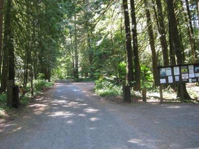
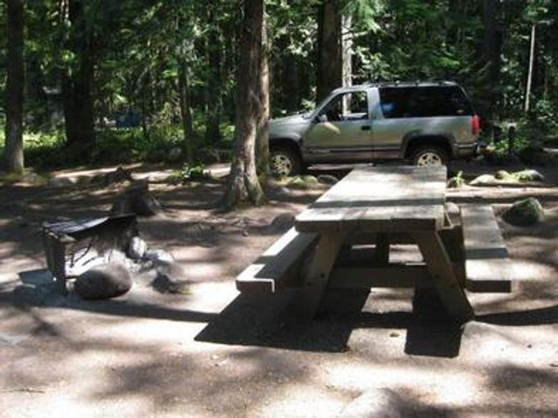
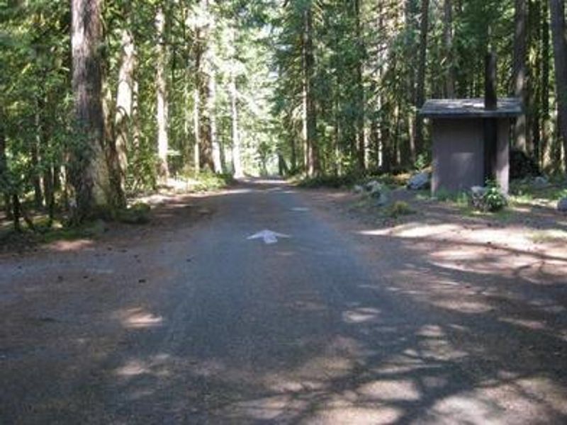
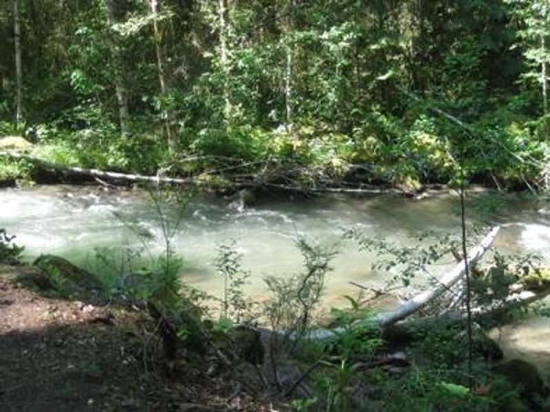
Tollgate Campground is one of the most convenient Mt. Hood camping options from Portland, located just 32 miles southeast via Highway 26 near the community of Rhododendron. The campground occupies a scenic spot on the north bank of the Zigzag River at approximately 2,100 feet elevation, surrounded by Douglas fir and cedar trees in a humid forest environment. Built by the Civilian Conservation Corps, Tollgate features 14 sites including 10 tent-only sites, 3 standard nonelectric sites, and a group picnic shelter accommodating up to 30 people. Each site includes a picnic table and fire ring with grill. Historic CCC features like rock fireplaces remain intact. A replica of the original Barlow Road tollgate, used by Oregon Trail travelers from 1879 to 1919, stands just east of the campground. The campground serves as a base for exploring Mt. Hood's trail network. The nearly 10-mile Pioneer Bridle Trail passes through, open to hiking, mountain biking, and horseback riding. The nearby Zigzag River and Camp Creek offer catch-and-release fishing for small trout and whitefish. The town of Zigzag is 2.5 miles away with lodging, restaurants, and shops.
Directions
From Portland, travel southeast on Highway 26 for approximately 32 miles. From Sandy, travel southeast on Highway 26 for about 25 miles; the campground is on the right side of the road.
Amenities
| Water | Yes |
| Fires Allowed | Yes |
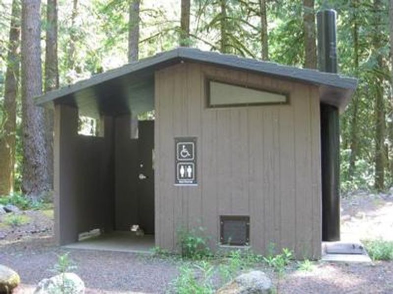
| Toilets | Yes |
| Dump Station | — |
| Wifi | — |
| Pets Allowed | — |
| Showers | No |
| Electric Hookups | — |
| Water Hookups | — |
| Sewer Hookups | — |
| Camp Store | — |
| Price | $30 - $60 |
Vehicle
| Max RV Length | 40ft |
| Max Trailer Length | 40ft |
| Big Rig Friendly | No |
| Pull Through Sites | No |
Contact
| Phone | +1 (503) 622-3191 |
Cell Service
| AT&T | None |
| Verizon | Yes |
| T-Mobile | None |
Availability
Photos
Community Posts
No posts yet. Be the first to share your experience!