Lake Powhatan Glamping
Open year-round with limited services from November through March. The swimming beach operates Memorial Day through Labor Day, 10 a.m. to 8 p.m. Reservations required through Recreation.gov. Check-in is 6:00 p.m., check-out is 10:00 a.m. Fire danger in Pisgah National Forest is currently high.
Flood Watch issued October 10 at 10:47PM EDT until October 11 at 2:00PM EDT by NWS Greenville-Spartanburg SC
* WHAT...Flash flooding caused by excessive rainfall continues to be possible. * WHERE...In Northeast Georgia, the following counties: Elbert, Franklin, Habersham, Hart, Rabun and Stephens. In western North Carolina, the following counties: Avery, Buncombe, Burke, Caldwell, McDowell, Polk, Rutherford, Haywood, Henderson, Macon, Mitchell, Jackson, Transylvania and Yancey. In Upstate South Carolina, the following counties: Abbeville, Anderson, Central Greenville, Greater Oconee, Greater Pickens, Greenville, Greenwood, Laurens, Spartanburg, and Oconee. * WHEN...Through Sunday afternoon. * IMPACTS...Excessive runoff may result in flooding of rivers, creeks, streams, and other low-lying and flood-prone locations. Creeks and streams may rise out of their banks. Low-water crossings may be flooded. * ADDITIONAL DETAILS... - As the remnants of Isaias move northward into the lower Ohio Valley, periods of rain will continue. High rainfall rates will continue in short bursts through the overnight hours. By Sunday morning, total accumulations of generally 5 to 8 inches are expected along the southeast-facing Blue Ridge Escarpment, with 2 to 5 inches elsewhere in the watch area. - http://www.weather.gov/safety/flood
Flash Flood Warning issued October 10 at 10:08PM EDT until October 11 at 4:15AM EDT by NWS Greenville-Spartanburg SC
FFWGSP The National Weather Service in Greenville-Spartanburg has issued a * Flash Flood Warning for... Southeastern Buncombe County in western North Carolina... Northeastern Henderson County in western North Carolina... Northwestern Rutherford County in western North Carolina... * Until 415 AM EDT Sunday. * At 1008 PM EDT, Rounds of torrential rainfall have impacted the upper Broad/Rocky Broad River watershed, including over Lake Lure. Storm-total rainfall of the 3-4 inches have fallen over the past 12 hours prior to this torrential rainfall, but another 1-2 inches of rain have fallen over the past couple of hours. This rainfall over saturated soils is causing more significant rises to develop along the Rocky Broad River and associated tributaries. The streamgauge on the Rocky Broad River near Bat Cave has just exceeded Minor Flood Stage of 7.5 feet and is expected to continue to rise to 8-8.5 feet before slowing or cresting. High flows along the Rocky Broad River into Chimney Rock will result in flooding of US 64/74 (Main St) near Dogwood RV Park. Additional areas of Minor flooding are expected to develop over the next 1-2 hours. Please obey all barricades and heed all evacuation orders from local Emergency Management officials. HAZARD...Flash flooding caused by thunderstorms. SOURCE...Radar indicated. IMPACT...Expect flash flooding of low-lying areas near streams, including parks, trails, low-water crossings, boat- access areas, and campgrounds. Low-lying roadways are likely to be flooded. An isolated landslide or two cannot be ruled out. * Some locations that may experience flash flooding include... Lake Lure, Chimney Rock Village, Chimney Rock State Park, Bat Cave, Gerton, and Shingle Hollow.
Flood Advisory issued October 10 at 11:29AM EDT until October 12 at 2:00PM EDT by NWS Greenville-Spartanburg SC
...The Flood Advisory continues for the following rivers in North Carolina... French Broad River Near at Old Fanning Bridge Rd, 3 W Fletcher affecting Henderson and Buncombe Counties. .Tropical rain showers will continue to overspread the mountains through tonight becoming increasingly heavy, leading to excessive runoff and rises on streams within the upper French Broad River watershed. Storm-total rainfall of 4-8 inches is expected, with isolated 8-10 inches possible within the upper French Broad River watershed, generally upstream of Etowah. The highest totals will occur along the Tanassee and Pisgah ridges, with lesser amounts within the upper French Broad River valley. Additionally, 4-6 inches of rainfall are expected within the Mud Creek watershed in Henderson County, which is a primary tributary of the French Broad River above Fletcher. While there continues to be some uncertainty regarding the exact location, timing, and amounts of the heaviest rainfall, there is enough confidence in the current forecast that out-of-bank conditions are likely for the upper French Broad River. This rise above Action Stage will result in nuisance, relatively shallow flooding of low-lying areas adjacent to the French Broad River, including farmland, woodlands, low-lying secondary roads, greenways, parks, and other flood-prone locations. More significant rises along the French Broad River are possible, and those with interests along the river are encouraged to stay weather aware and up-to-date on the latest stream levels and forecasts at https://water.noaa.gov/wfo/GSP. Current reasonable worst-case scenarios are posted in the ADDITIONAL DETAILS sections below. Forecast crests above Minor Flood Stage may result in the River Flood Advisories being upgraded to River Flood Warnings. * WHAT...Flooding caused by excessive rainfall continues. * WHERE...French Broad River near at Old Fanning Bridge Rd, 3 W Fletcher. * WHEN...Until Monday afternoon. * IMPACTS...At 10.0 feet, Action/Advisory Stage. The French Broad River has exceeded bankfull at the gauge site. Isolated farmland flooding is beginning across the French Broad River Valley from Etowah downstream to Avery Creek upstream of the gauge site. * At 11.5 feet, Action Stage Flooding continues. Butler Bridge Rd. is inundated with up to 6 inches of floodwaters from the French Broad River, forcing road closure. * ADDITIONAL DETAILS... - At 10:30 AM EDT Saturday the stage was 3.8 feet and rising. - Bankfull stage is 10.0 feet. - Forecast...The river is expected to rise to a crest of 10.6 feet early tomorrow afternoon. A crest closer to 12 feet is possible. A reasonable worst-case crest above Minor Flood Stage below 15 feet cannot be ruled out. - Action stage is 10.0 feet. - Flood stage is 13.0 feet. - http://www.weather.gov/safety/flood
About
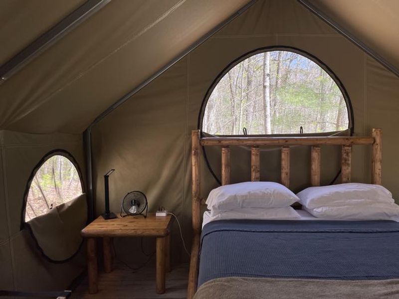
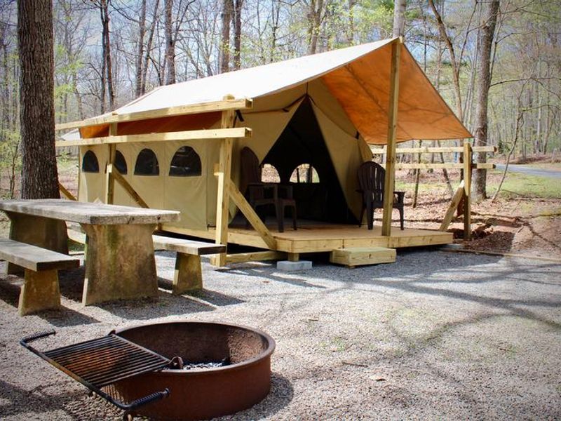
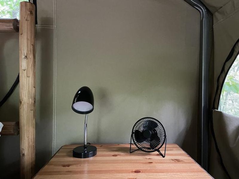
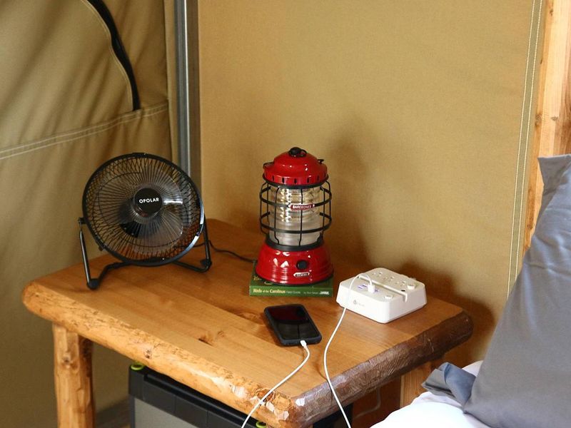
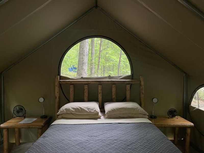
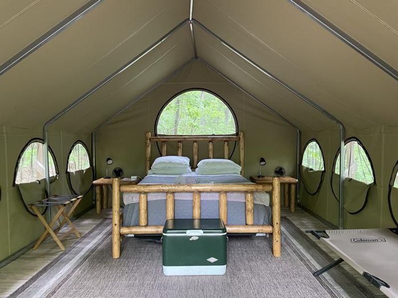
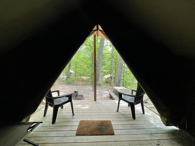
Located in the Pisgah National Forest at 2,200 feet elevation, Lake Powhatan Glamping provides an upscale camping experience on the banks of Lake Powhatan. The 12 fully furnished canvas platform tents are situated in the Hardtimes Loop, offering a woodland setting with easy access to the lake's sandy swimming beach, fishing, and extensive trail networks for hiking and mountain biking. Each glamping site includes a 12x16-foot weatherproof canvas wall tent with a queen bed, linens, towels, foldable cot, bedside table, and a covered front porch with chairs. Sites also feature picnic tables, fire rings with grills, lantern posts, and a charging station with approximately 1000Wh capacity for phones and small electronics. Shared bathhouse facilities provide flush toilets and hot showers. The campground is conveniently located near Asheville's cultural attractions, breweries, restaurants, and the Blue Ridge Parkway. Nearby destinations include Sliding Rock, Looking Glass Falls, the North Carolina Arboretum, and Biltmore Estate. The area is black bear territory, and bear boxes are provided for food storage.
Directions
From Asheville, take I-26 to exit 33. Go south approximately 2 miles on State Route 191 to the Lake Powhatan Recreation Area sign. Turn right and follow signs to the campground.
Nearby Campgrounds
Amenities
| Water | Yes |
| Fires Allowed | Yes |
| Toilets | Yes |
| Dump Station | No |
| Wifi | — |
| Pets Allowed | Yes |
| Showers | Yes |
| Electric Hookups | — |
| Water Hookups | — |
| Sewer Hookups | — |
| Camp Store | Yes |
| Price | $100 - $130 |
Vehicle
| Max RV Length | — |
| Max Trailer Length | — |
| Big Rig Friendly | No |
| Pull Through Sites | No |
Contact
| info@pisgahcampgrounds.com | |
| Phone | +1 (828) 552-8040 |
Cell Service
| AT&T | None |
| Verizon | Yes |
| T-Mobile | None |
Useful Links
| View on Recreation.gov | |
| USFS Lake Powhatan Campground |
Availability
Photos



Community Posts
No posts yet. Be the first to share your experience!