Knob Noster State Park Campground
Open year-round. Sites 1-25 operate through winter with electric hookups and frost-free water spigots. Sites 30-71 are seasonal, April 15 through October 31. Off-season (November 1 through April 14), showers and water are turned off in the seasonal loop. Camping limited to 15 days within any 30-consecutive-day period.
About
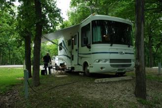
Knob Noster State Park Campground sits within 3,567 acres of Ozark-border woodland in west-central Missouri. The campground consists of two main loops: sites 1-25 remain open year-round with 50-amp electric service and frost-free water spigots, while sites 30-71 operate seasonally from April 15 through October 31 with 30-amp service. Full-hookup sites with sewer, electric, and water connections are also available. Modern restrooms with hot showers serve the seasonal loop, and vault toilets provide additional facilities throughout. The park offers two small lakes stocked with bass, bluegill, and channel catfish. Over 20 miles of trails accommodate hikers, equestrians, and mountain bikers across rolling terrain. The McAdoo Trail provides access to two backcountry campsites. A visitor center houses nature exhibits, and the Lil' Forest Amphitheater hosts interpretive programs. Two organized group camps (Bobwhite and Shawnee) with sleeping cabins, dining lodges, and swimming pools serve larger gatherings. Recent renovations completed in April 2026 upgraded 20 campsites (now numbered 26-60) with 50-amp electrical service and added a new pit latrine facility. Reservations can be made up to 12 months in advance through the Missouri State Parks reservation system.
Directions
From the junction of US 50 and Highway 23, travel 2 miles south on Highway 23 to reach the park entrance.
Amenities
| Water | Yes |
| Fires Allowed | Yes |
| Toilets | Yes |
| Dump Station | Yes |
| Wifi | — |
| Pets Allowed | Yes |
| Showers | Yes |
| Electric Hookups | Yes |
| Water Hookups | Yes |
| Sewer Hookups | Yes |
| Camp Store | — |
| Price | $10 - $52 |
Vehicle
| Max RV Length | 68ft |
| Max Trailer Length | — |
| Big Rig Friendly | — |
| Pull Through Sites | No |
Contact
| Phone | +1 (660) 563-2463 |
Cell Service
| AT&T | Yes |
| Verizon | Yes |
| T-Mobile | Yes |
Availability
Photos
Community Posts
No posts yet. Be the first to share your experience!