USA 250 Shirt →
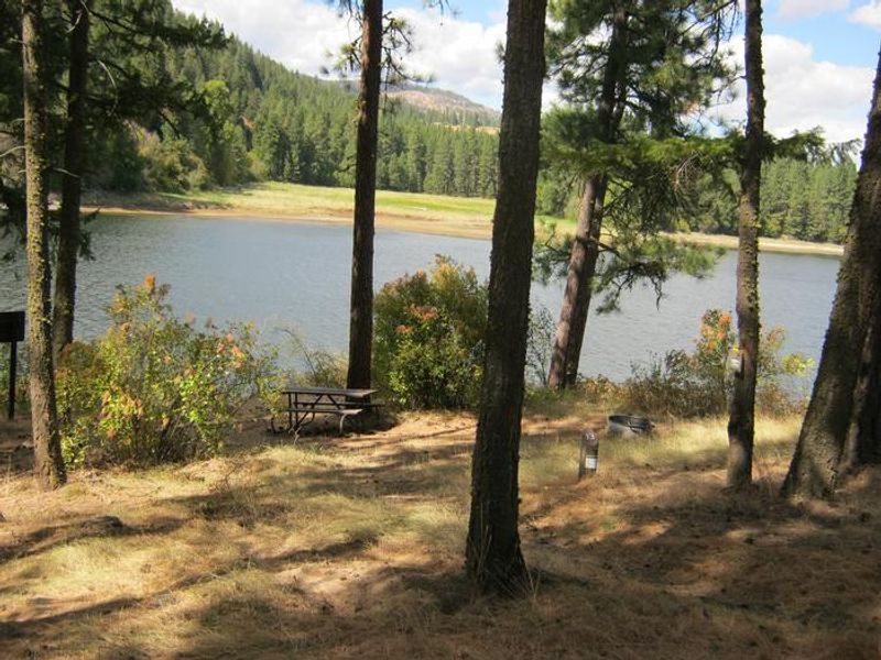
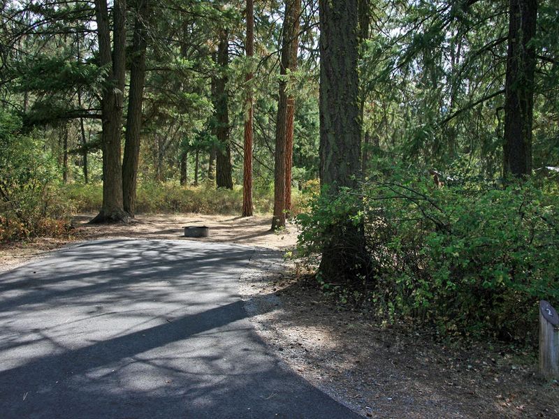
Kamloops Campground. Trees and lake in the background.
Open

Open year-round for reservations. No potable water available; bring your own drinking water. Limited trash services; pack it in, pack it out. Winter access may be limited as sites are not plowed. Fires permitted in fire rings only when no fire restrictions are in effect.

Red Flag Warning issued August 11 at 11:02AM PDT until August 12 at 11:00PM PDT by NWS Spokane WA

11:02 AM — August 12th, 12:00 AM

A weather system will move through the area on Wednesday, bringing scattered showers and thunderstorms to the region. These thunderstorms will mainly be focused along the eastern slopes of the Cascades and along the International Border. Lightning strikes will have the potential to start new wildfires, and gusty and erratic outflow winds could cause dangerous conditions around new and existing wildfires. The National Weather Service in Spokane has issued a Red Flag Warning for thunderstorms, which is in effect from 11 AM to 11 PM PDT Wednesday. * Affected Area: Northern and Central Idaho Panhandle (Zone 101), East Washington Central Cascades (Zone 696), East Portion of North Cascades National Park/Lake Chelan National Recreation Area (Zone 697), East Washington North Cascades (Zone 698), Okanogan Highlands and Kettle Mountains (Zone 699), Selkirk Mountains of Northeast Washington (Zone 700), Foothills of Northeast Washington (Zone 701), Colville Reservation (Zone 702), Okanogan Valley (Zone 703), Methow Valley (Zone 704), Foothills of Central Washington Cascades (Zone 705) and Waterville Plateau (Zone 706). * Thunderstorms: Scattered showers and thunderstorms will be possible late morning through late evening Wednesday. * Outflow Winds: Gusty and erratic outflow winds up to 40 mph will be possible. * Impacts: Lightning strikes will have the potential to start new fires, and gusty and erratic outflow winds could cause dangerous conditions around new and existing wildfires.

Air Quality Alert issued August 11 at 11:25AM PDT by NWS Spokane WA

11:25 AM — August 12th, 4:00 PM

An Air Quality Alert has been issued by the following agencies: Washington Department of Ecology Colville Confederated Tribes Environmental Protection Agency Spokane Regional Clean Air Agency An Air Quality Alert has been issued for Adams, Asotin, Chelan, Douglas, Ferry, Garfield, Grant, Lincoln, Okanogan, Pend Oreille, Spokane, Stevens, and Whitman Counties until further notice due to current and expected smoke from regional fires. Particulate matter (PM2.5) may reach Very Unhealthy levels for areas directly downwind from active wildfires. Other areas may reach Unhealthy for Sensitive Groups or worse. Intermittent clearing may occur due to windy conditions, but smoke production continues to be significant. When air quality is Unhealthy, everyone should reduce exposure. Limit time outside, avoid strenuous outdoor activity, and follow tips for cleaner indoor air. When air quality is Very Unhealthy, everyone should reduce exposure. Stay inside and filter indoor air to keep it cleaner. Go elsewhere for cleaner air, if needed.

Air Quality Alert issued August 11 at 11:25AM PDT by NWS Spokane WA

11:25 AM — August 12th, 4:00 PM

An Air Quality Alert has been issued by the following agencies: Washington Department of Ecology Colville Confederated Tribes Environmental Protection Agency Spokane Regional Clean Air Agency An Air Quality Alert has been issued for Adams, Asotin, Chelan, Douglas, Ferry, Garfield, Grant, Lincoln, Okanogan, Pend Oreille, Spokane, Stevens, and Whitman Counties until further notice due to current and expected smoke from regional fires. Particulate matter (PM2.5) may reach Very Unhealthy levels for areas directly downwind from active wildfires. Other areas may reach Unhealthy for Sensitive Groups or worse. Intermittent clearing may occur due to windy conditions, but smoke production continues to be significant. When air quality is Unhealthy, everyone should reduce exposure. Limit time outside, avoid strenuous outdoor activity, and follow tips for cleaner indoor air. When air quality is Very Unhealthy, everyone should reduce exposure. Stay inside and filter indoor air to keep it cleaner. Go elsewhere for cleaner air, if needed.

About

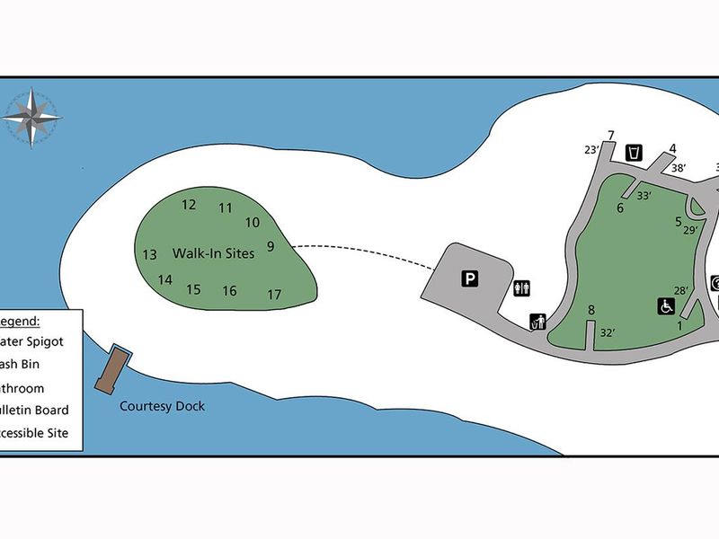
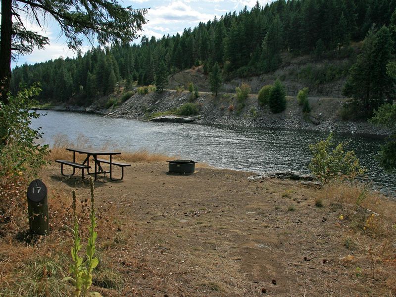
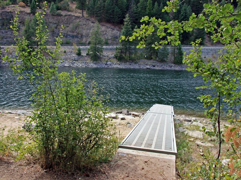
Kamloops Island Campground sits at the scenic confluence of the Kettle River and Lake Roosevelt on the Columbia River. Thick forests of ponderosa pine and Douglas fir provide ample shade throughout the campground. Loop 1 contains 8 standard sites that accommodate tents and RVs, while Loop 2 features 9 walk-in tent sites spread across a pine-covered hillside with river and lake views. The area is rich with wildlife including moose, elk, deer, and bald eagles. Fishing is a major draw, with walleye, bass, rainbow trout, salmon, and sturgeon available in the waters. A courtesy dock allows boat tie-up but there is no boat launch on site. Nearby attractions include the historic St. Paul's Mission (4.5 miles south in Kettle Falls), Fort Colville, the Hudson Bay Company Post, and the scenic Sherman Drive loop. The campground is unstaffed but managed by Lake Roosevelt National Recreation Area.

Directions

From Kettle Falls, drive north on US 395 and cross Lake Roosevelt on Barneys Bridge. Continue on Hwy 395 for approximately 3 miles, then turn right onto Northport Flat Creek Road/River Bridge Road (signed for Kamloops Island Campground). Cross the bridge over Kettle River and turn left at the second campground sign.

Amenities

Water No
Fires Allowed Yes
Toilets Yes
Dump Station No
Wifi
Pets Allowed Yes
Showers No
Electric Hookups
Water Hookups
Sewer Hookups
Camp Store
Price $23

Vehicle

Max RV Length
Max Trailer Length
Big Rig Friendly No
Pull Through Sites No

Contact

Phone +1 (509) 754-7889

Cell Service

AT&T Yes
Verizon Yes
T-Mobile Yes

Availability

Photos

Kamloops Campground. Trees and lake in the background.
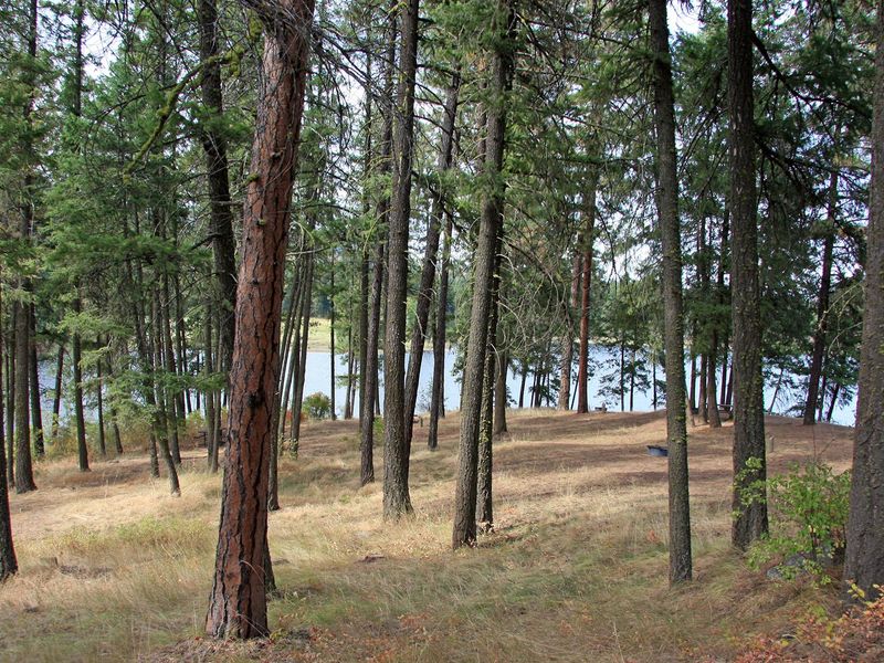
Kamloops Campground. Trees in the background.
Half of Kamloop's campsites are walk-in only.
The first eight campsites can fit tents or RVS and have paved parking areas.
Most of the walk-in sites have nice views of Kettle River.
The courtesy dock is located below the walk-in sites at the bottom of the hill.
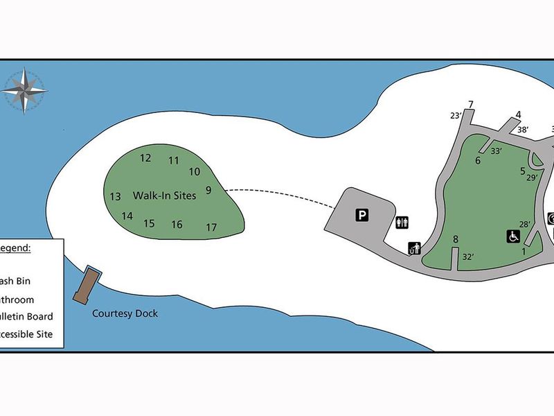
Campsite map of Kamloops Island

Community Posts

No posts yet. Be the first to share your experience!